Contact: Rich Kurz Page content last updated June 29, 2023
Contact: Rich Kurz Page content last updated June 29, 2023
You can understand my surprise and excitement upon discovering a set of small, black and white prints that my grandfather took on a trip out west in 1924.
I know the dates because he annotated the photos on the back.
I was doubly excited because I now live in Colorado and recognize some of the locales.
The prints were all more than half faded, but modern scanners can pull out a lot of detail.
And there is a surprising amount of detail and sharpness on those old, small prints.
You can see the cameras they are carrying in some of the photos.
My grandfather used a Brownie Camera No. 2A, as seen carried by him in a case in some of the photos.
It used 116 film that made 2-1/2" x 4-14" negatives, which were then contact-printed directly onto the photo paper.
And of course, they had the problem of lag time between clicking the shutter and getting back a print . . .
only to discover that a finger or a camera strap got in front of the lens.
The photos recount a trip he made in high school with two friends and a chaperone, a coach name Marquardt.
The only four people we ever see in their party are my grandfather (as a 16 year old), what looks like two classmates he called Rob "Dutch" Sterbruch and Ted Bosler, and an adult called "Coach Marquardt", possibly Willard H. (Bill) Marquardt (1890-1936).
So my grandfather's dad, C.A. Kurz, must have hired the high school (I am guessing) coach to chaperone the boys on this fabulous tour out west that summer of '24.
They traveled from Dayton, Ohio out to Colorado, to Yellowstone, to the Grand Canyon, to L.A., to San Francisco, and up to Mt. Rainier, then over to Glacier, and finally to Minnesota, and back home.
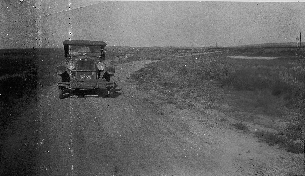
It's amusing to see an old Ohio-plated car on the Fall River Road near the Continental Divide.
BTW... I have kept the occasional misspellings in the captions.
And my comments are in parantheses.
Oh - by the way... the car they drove is a 1923 Cadillac, either a 4-passenger Phaeton or a 7 passenger Touring.
The S.S. Catalina entered service just a month before they took her to Catalina Island.
There on the island they took a glass-bottomed boat, the S.S. Emporer, around the island.
Later, they took the S.S. Admiral Fiske from San Francisco to Portland OR. The Fiske was originally named the SS. Senator. Her cruising speed was 10.8 knots.
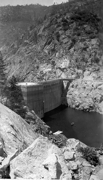
The Hetch Hetchy dam had only been in operation for a year and was the second tallest built at the time.
Hetch Hetchy is the name of the valley and the reservoir, and the dam is named the O'Shaughnessy Dam.
It is 900 feet wide and is within Yosemite N.P.
June 22, 1924 - On Top of Pikes Peak

1922 highway map showing their probable route plus dates from the photos.
This shows a deep snow drift on the way up Pike's Peak
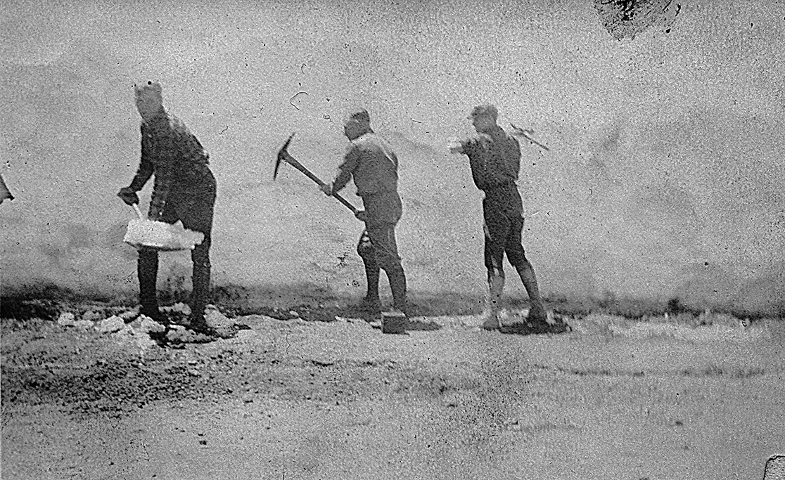
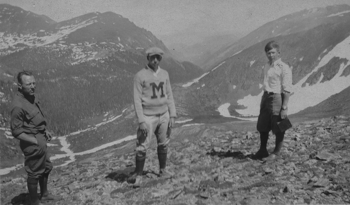
This is a view of Coach Marquart, Ted Bosler, and myself on top of Pike's Peak. Over to the right is the observation tower.
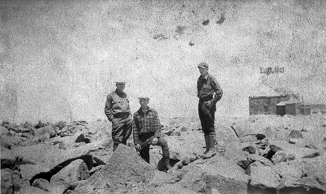
June 25, 1924 - The Hike Up Longs Peak
This 1915 USGS map identifies the approximate locations of the photos taken on the 25th and 27th.
They were staying at Enos Mills' Longs Peak Inn, which was run by his widow at that time.
It is the beginning point of each days journeys.
The photos on the 25th up Longs Peak are lettered sequentially on the map from A to I with a carat indicating the direction of view.
Using horses, they were able to do it all in daylight.
Likewise, those of the 27th up Fall River Road are numbered from 1 to 10 with a carat indicating the direction of view on the map.
The question marks indicate my uncertainty about the location.
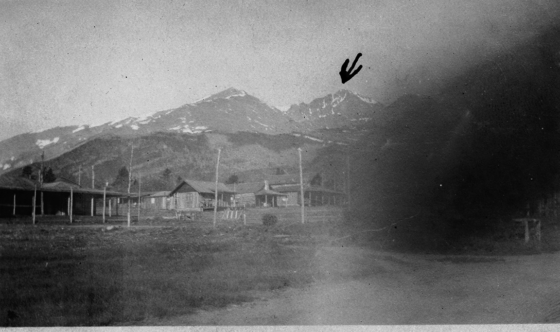
(A) "This is a view of Long's Peak Inn at the foot fo the mountain. I have marked Long's Peak. It looks as tho the peak to the left is highter, but it isn't near as high, as it is closer."
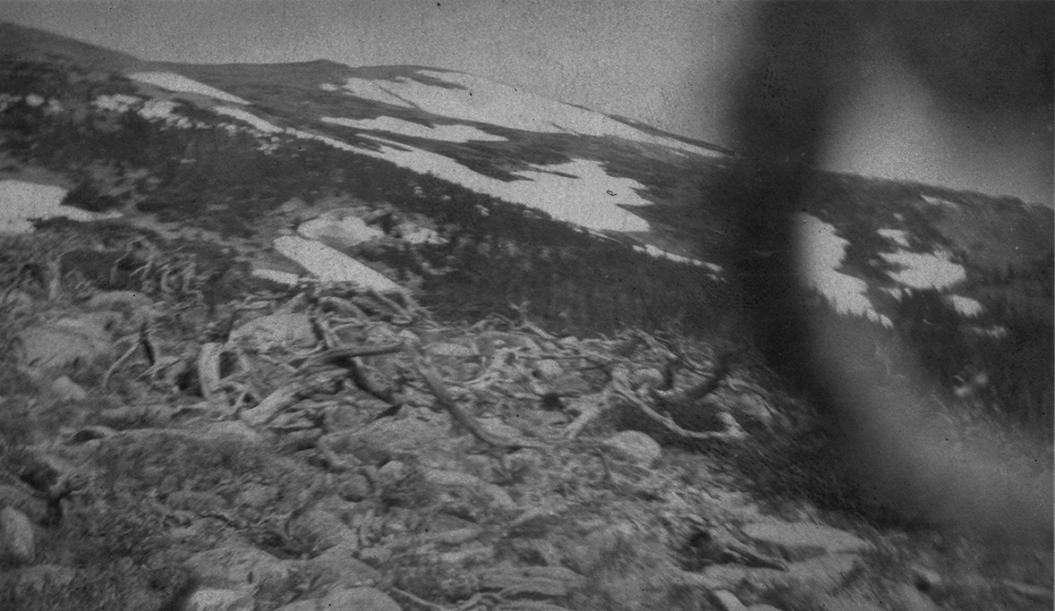
(B) "This picture shows a typical scene around the timber line."
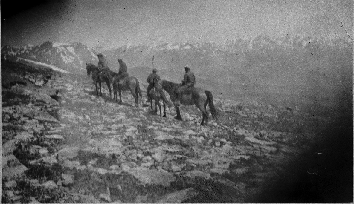
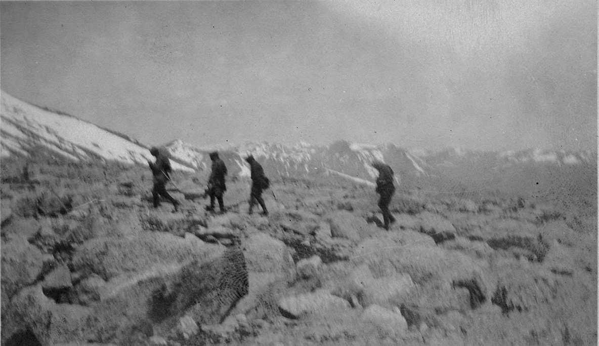
(C) "This is a picture of the guide in front, bosler, then Herbruck, and Coach Marquart on horses nearing boulder field. My horse is in the rear."
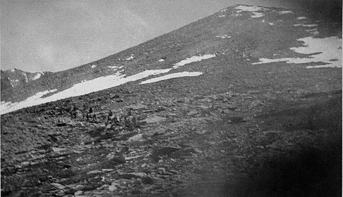
(D) "If you will look carefully you can see the horses on boulder field."
"If you will look carefully you can see the horses on boulder field."
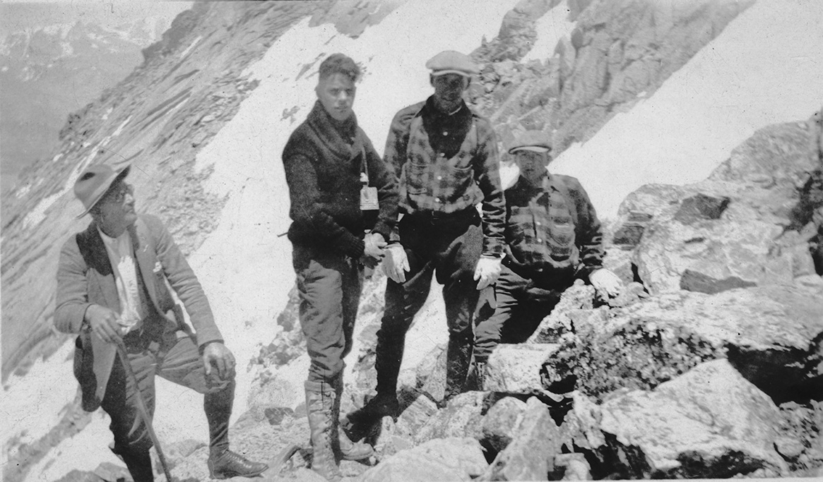
(E) "This picture shows Coach Marquart and Rob Herbruch on boulder field. You can see the peak in the distance."
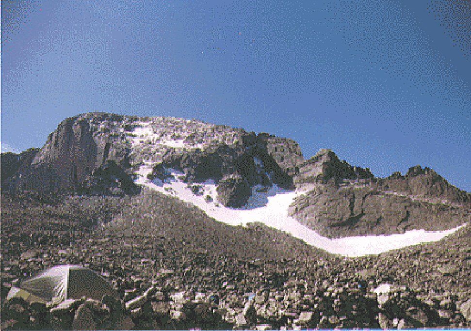
Here is what this looks like 80 years later.
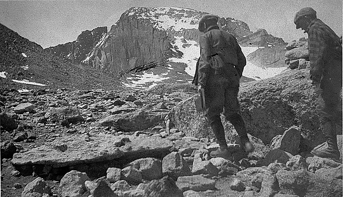
"On snow drift across boulder field while climbing Long's Peak."
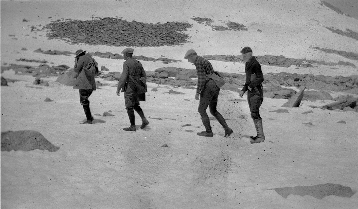
(There is a lot of snow on the mountains for late June. It was a wet winter.)
(That same year, the Colorado River pact established how much water each state along it could take.)
(The river watershed could not produce that much normally. 100 years later, we now have a water crisis.)
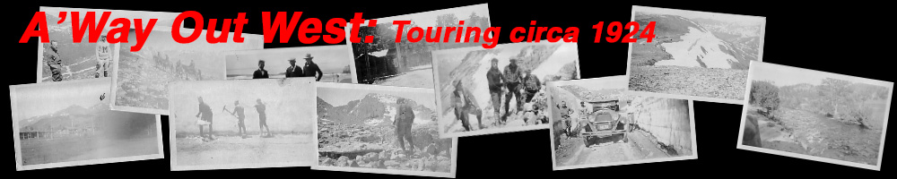
(F) "This shows our guide on the left, Shep Husted. And had made more trips to the top than any one else. Notice we are resting at the foot of a snow trough."
(G) "This shows our guide on the left, Shep Husted. And had made more trips to the top than any one else. Notice we are resting at the foot of a snow trough."
(H) "This is a view of the snow trough a hard climb up to the narrows."
"This is a view of the snow trough a hard climb up to the narrows."
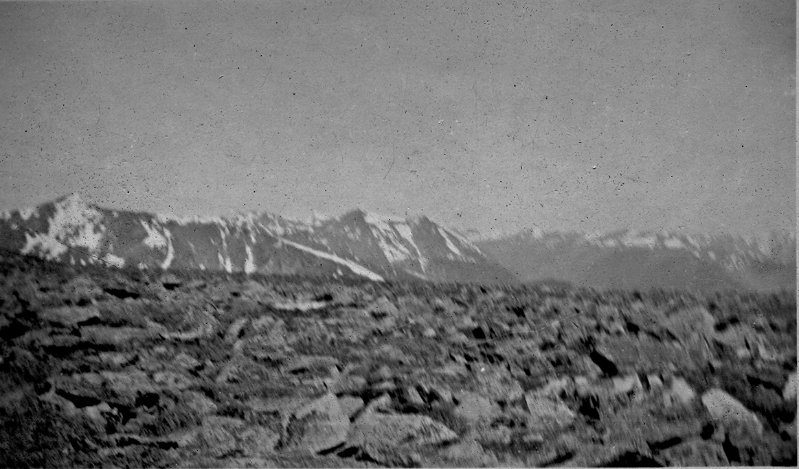
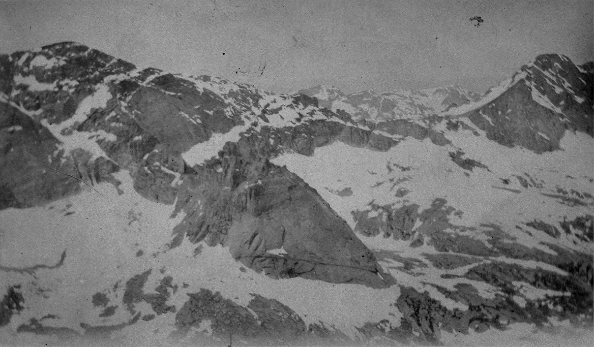
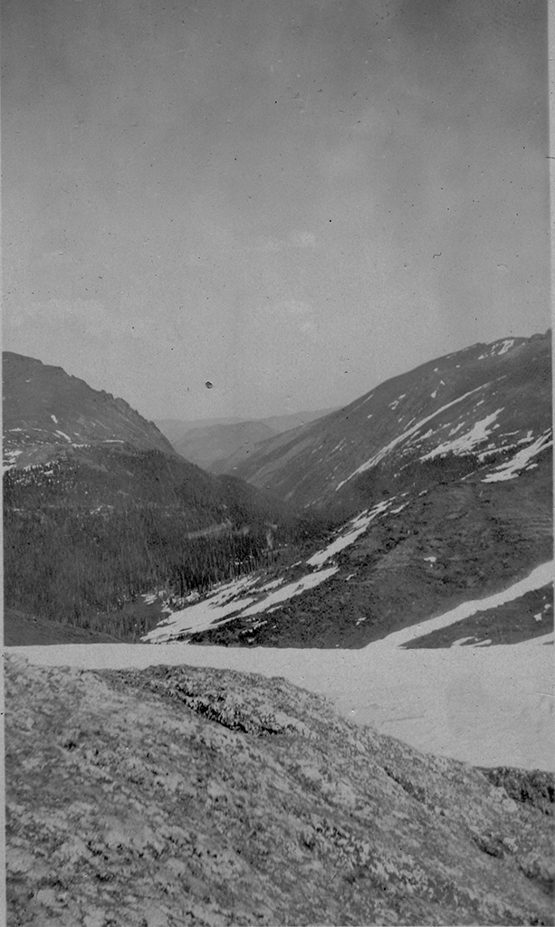
(I) "This was taken from side of Longs Peak showing western side of the Continental Divide. You can see a dim outline of another range, which is more than fifty miles away."
June 27, 1924 - Up Fall River Road to the Continental Divide
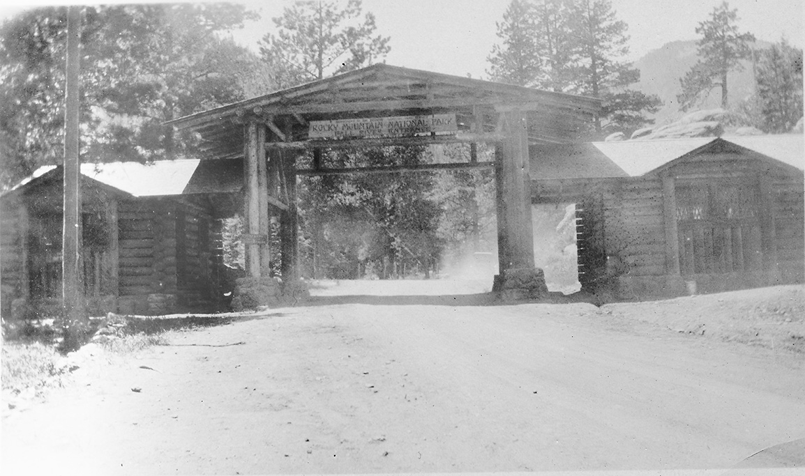
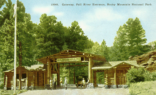
(1) "This shows the entrance to Rockey National Park"
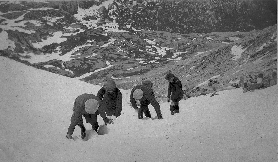
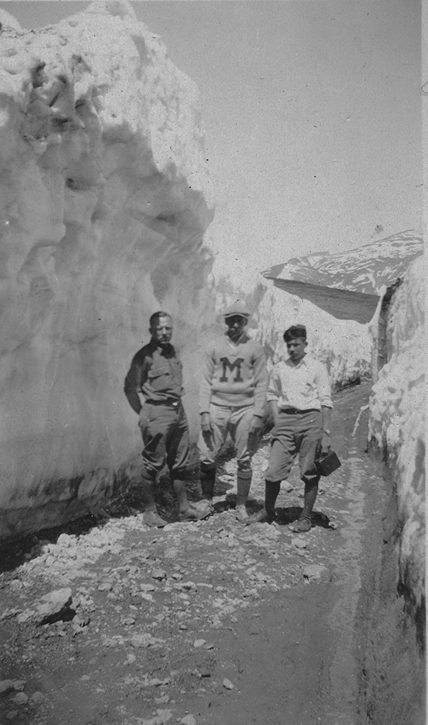
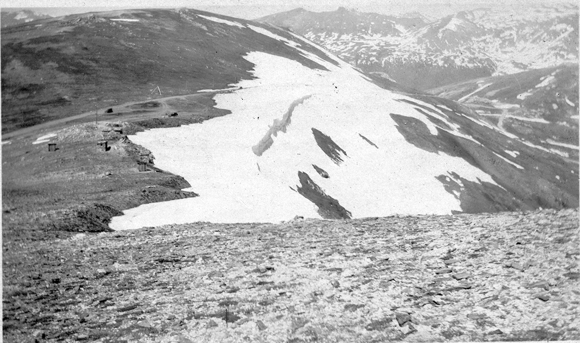
(2) "This is a picture showing the high snow drifts in comparison with the size of the fellows. On the way up to the top of Divide."
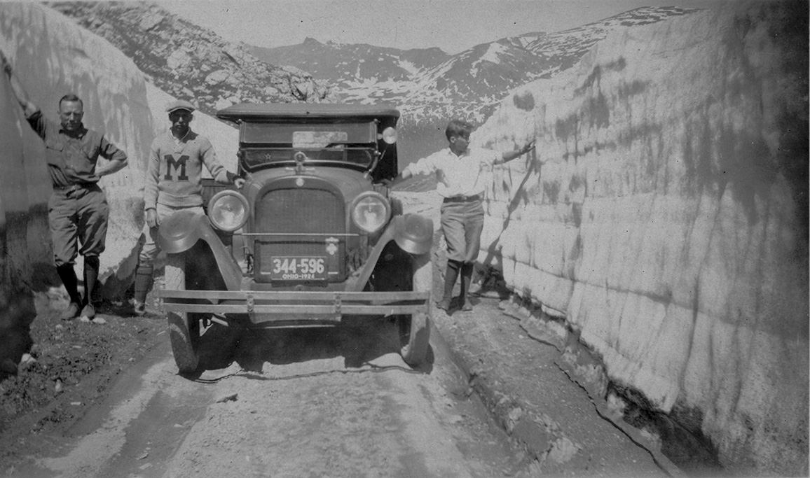
(3) "Another view showing the fellows and machine."
(4) "A picture of the Atlantic side of Divide. Note how distinctly the timber line shows on mountain to the left."
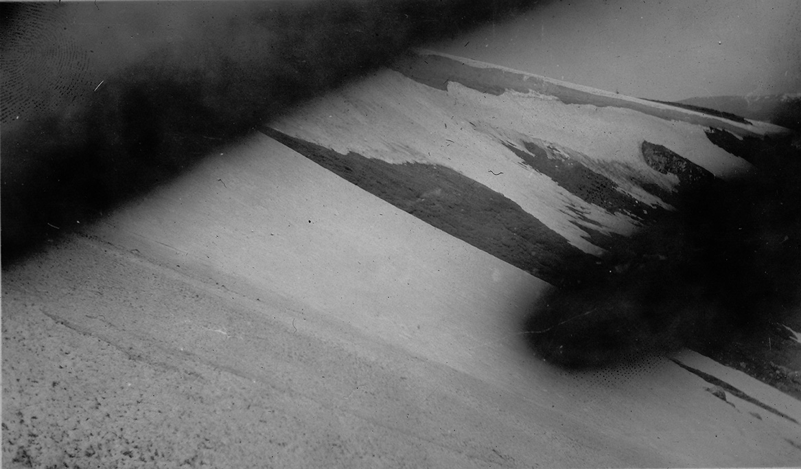
(5) "I foged this picture accidently, but you can see deep snow banks on Atlantic side of Divide."
(6) "This is a view of the Atlantic side of the Divide showing Coach Marquardt, Bosler, and Herbruch."
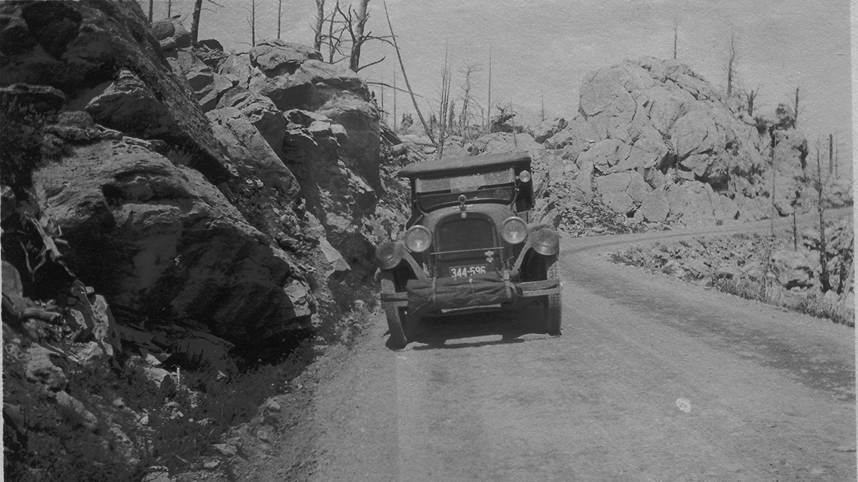
(7) "We took a ride up Fall River Road into Rockey National Park. This is a view on continental Divide. Note snow banks and the "Dodge" in the distance."
(John calls the car a Dodge, but it matches the appearance of a '23 Cadillac. Note the radiator and front fenders.)
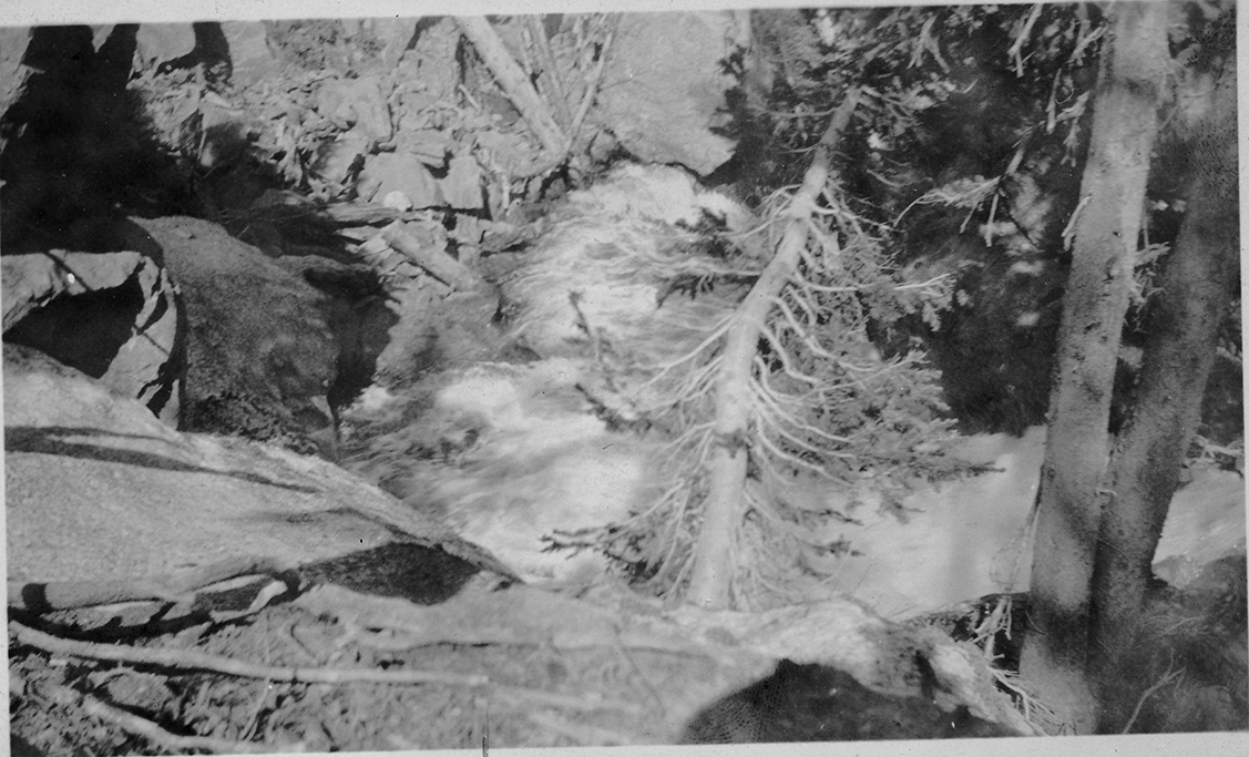
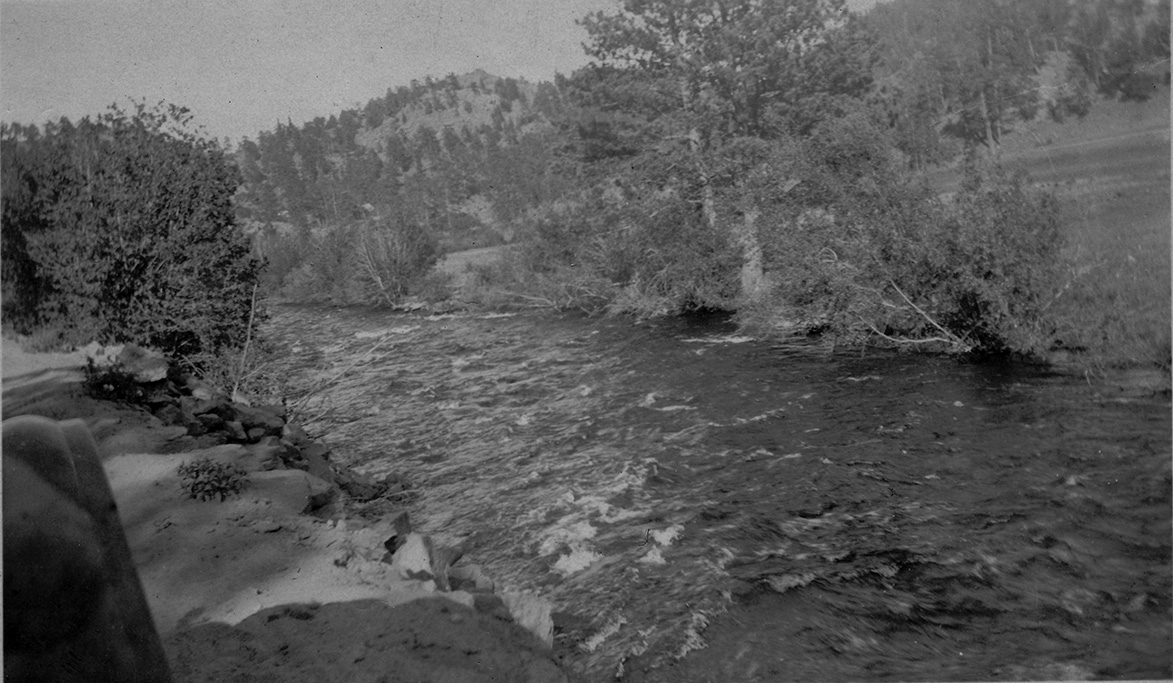
(8) "This is a scene from the road showing Fall River, took this picture coming down the Divide."
(9) "The picture here shown is a view of Fall River on our way down from the Divide to Estes Park."
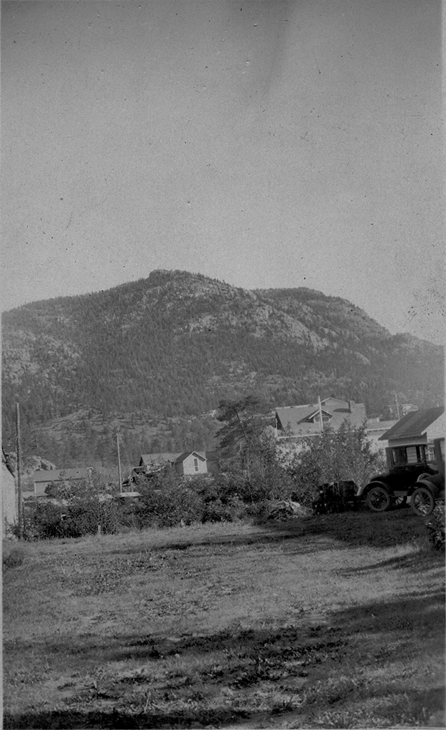
(10) "This picture taken showing part of Estes Park in foreground and mountain in rear."
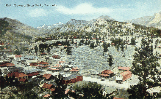
(Postcard from about the same time showing Estes Park, from the south looking north.)
(The original entrance to Rocky was located outside the Park, about 1-1/2 miles from downtown Estes Park.)
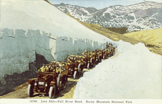
(The snow cut on Fall River Road and a party of Stanley Steamers full of tourists.)
July 1, 1924 - Yellowstone National Park
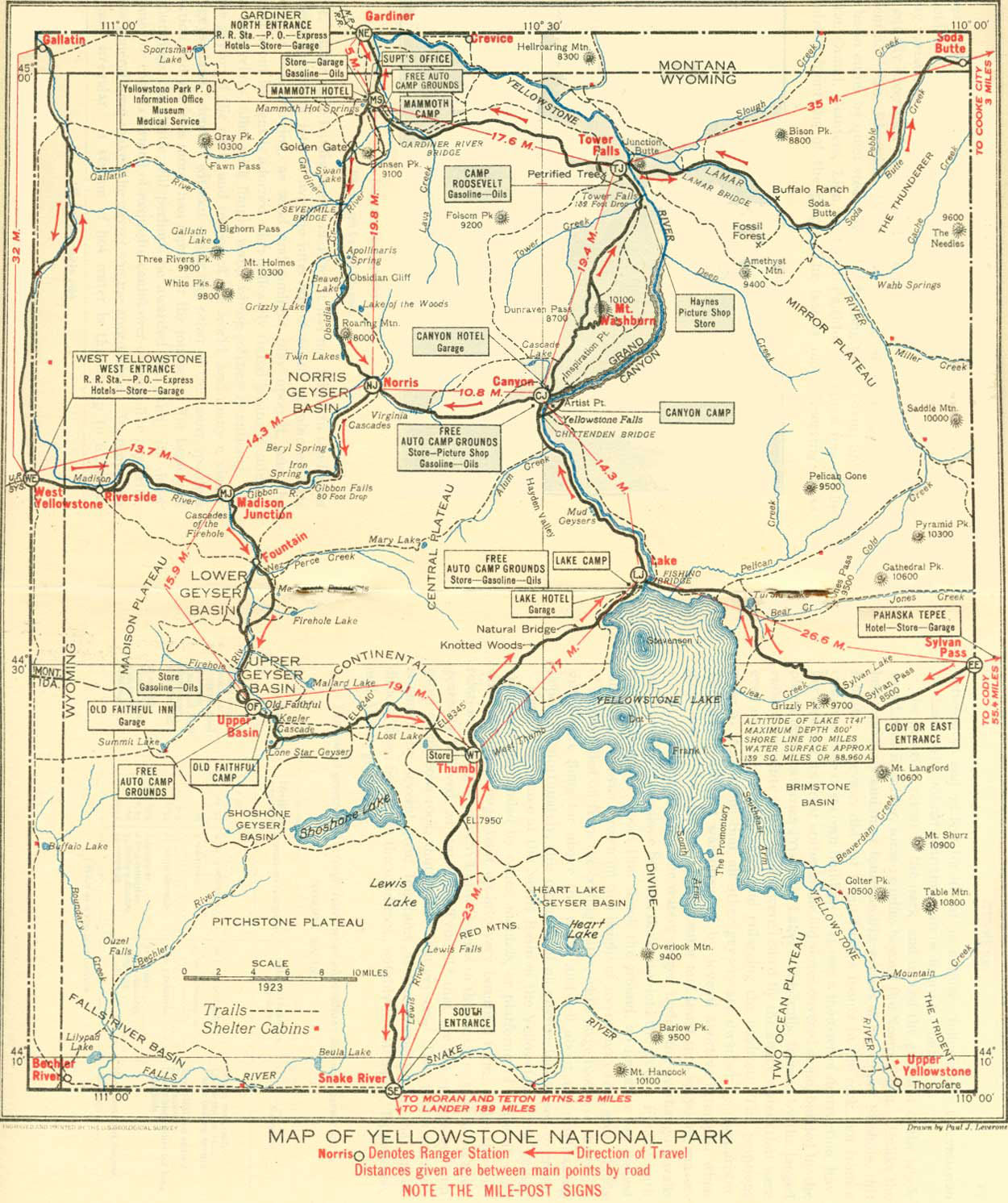
A 1921 map of Yellowstone N.P. Note that most roads in the park are one-way.
"A picture showing a bend in Yellowstone River, much trout fishing is done in the river."
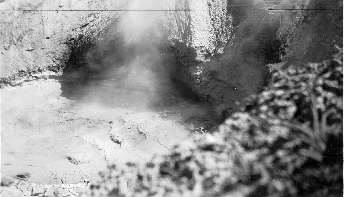
"A picture showing a geyser hole in lower Norris basin."
"A picture of Dragon's Mouth in lower Norris Basin, Yellowstone Park."
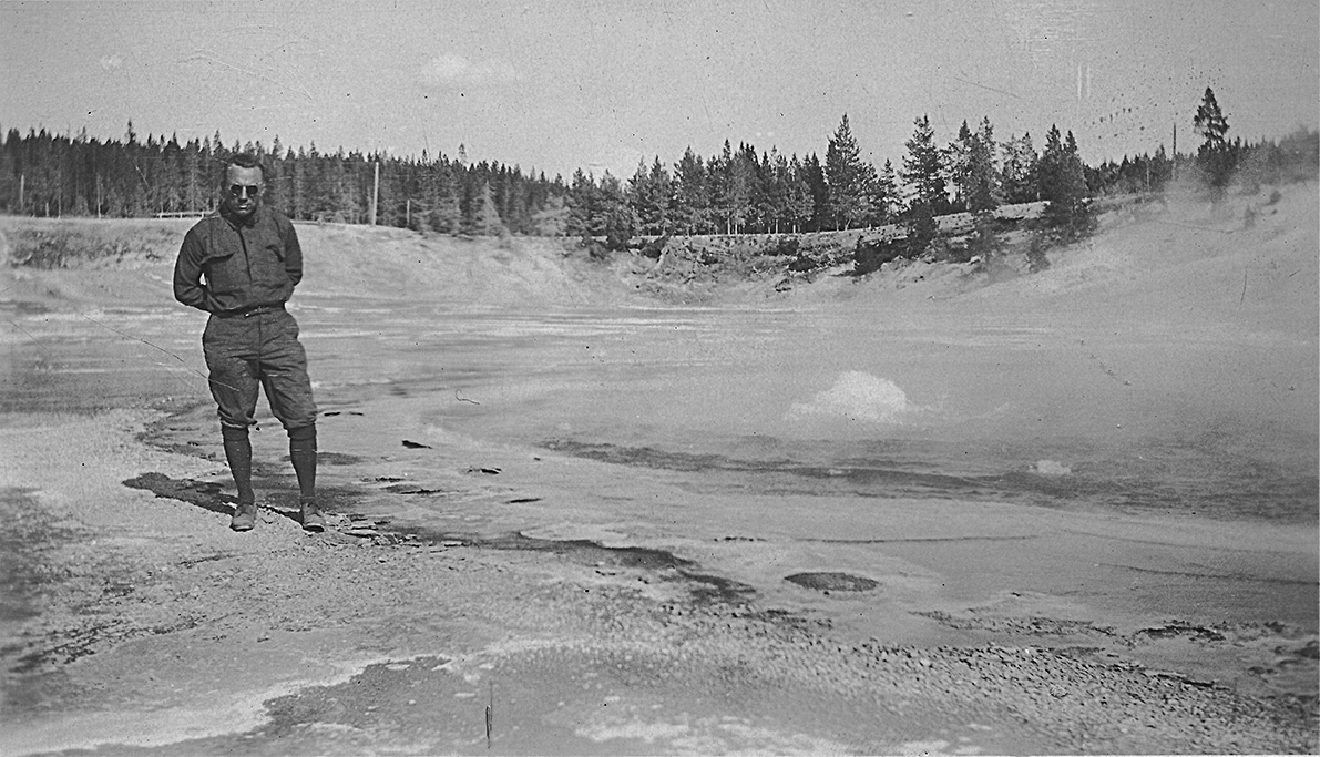
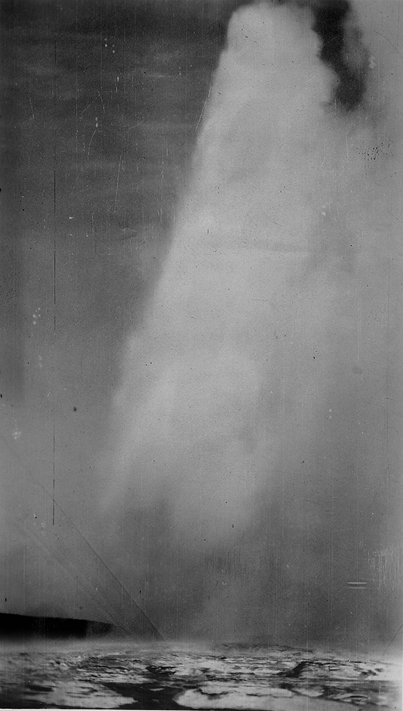
"This is a closeup of Old Faithful crater between plays. It was taken within several feet of the big hole."
July 2, 1924

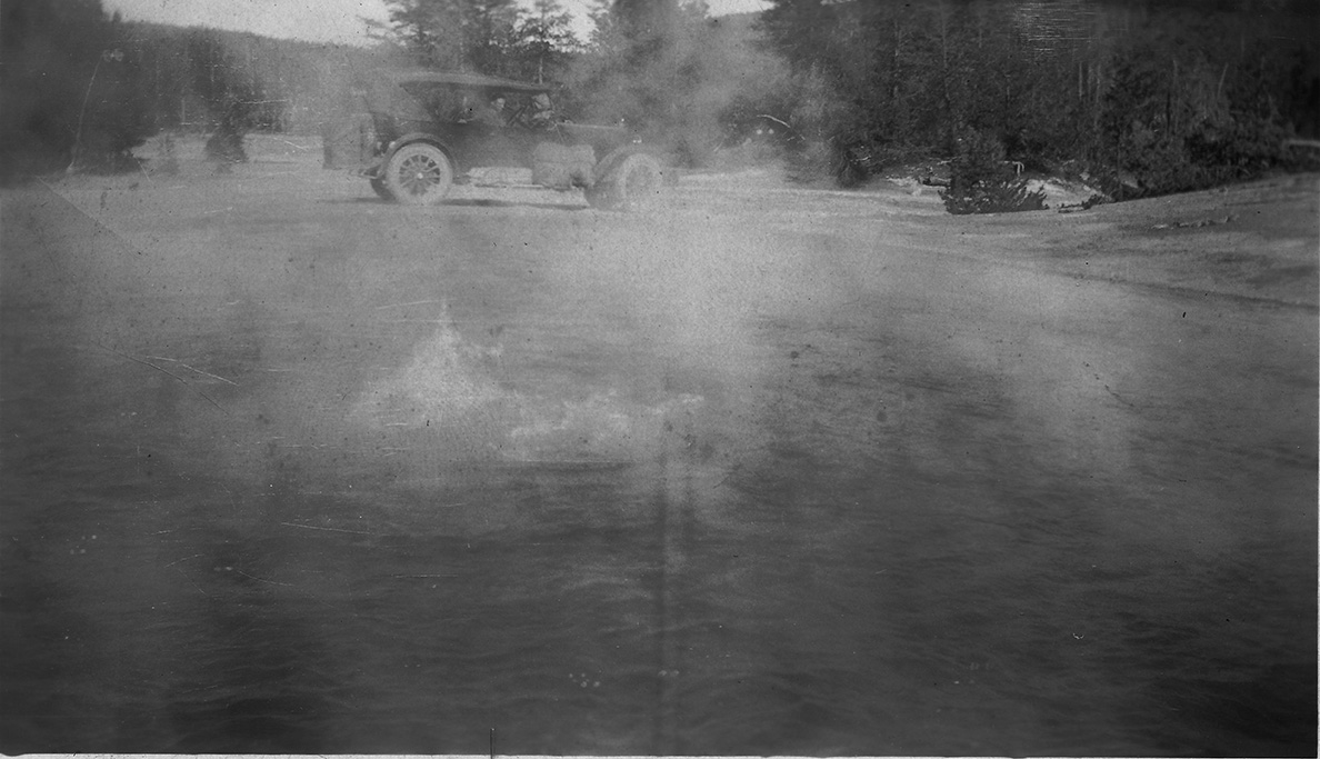
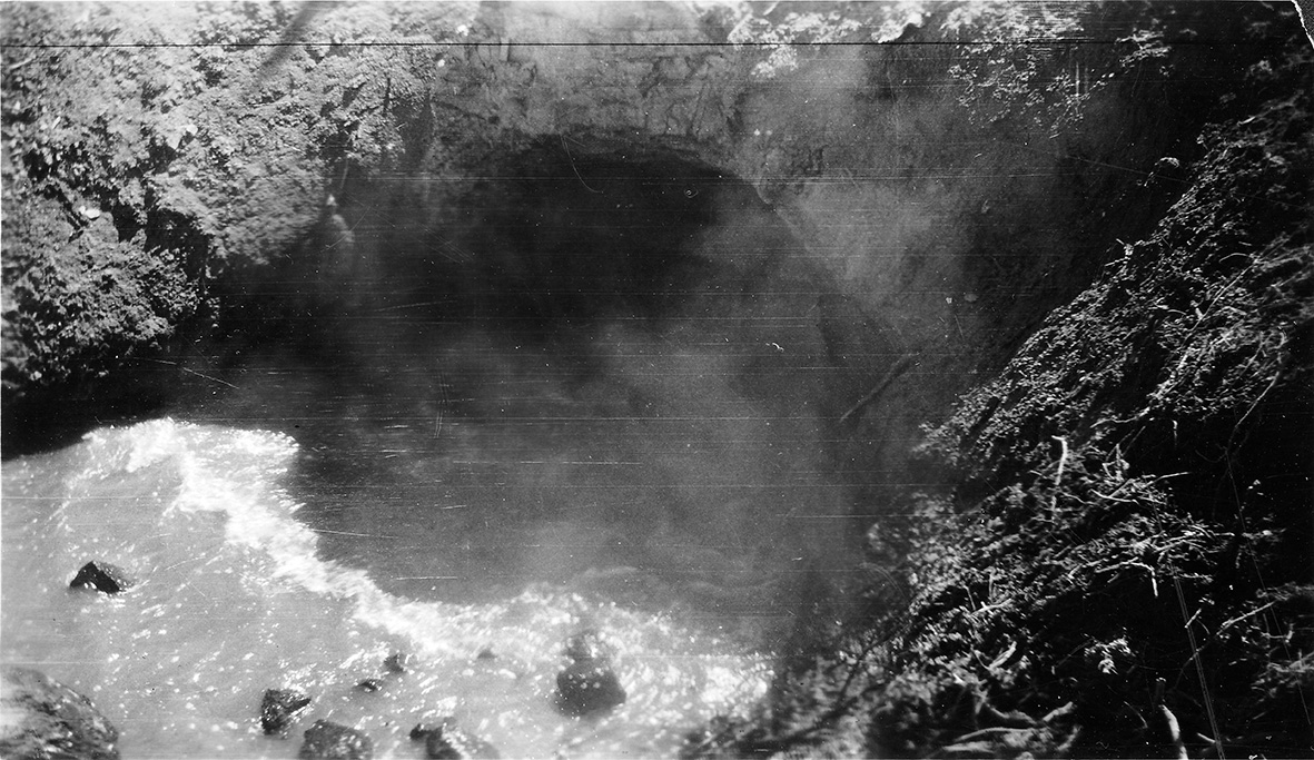
"A picture of Coach besides a pool of boiling sulphur water. Taken in Norris Basin."
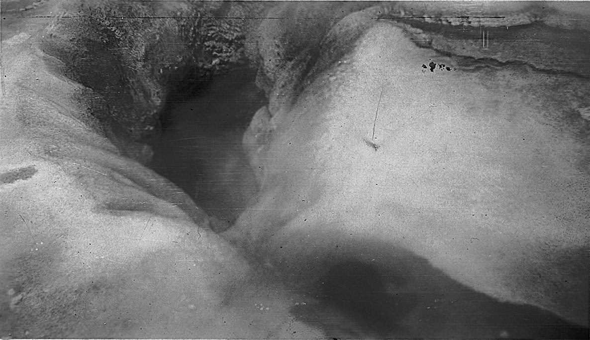
"Showing mammouth paint pots on the road to Old Faithful."
"I got a snapshot of the car from the other side of Crescent Lake a boiling pool of sulphur water. Taken a few miles from Old Faithful."
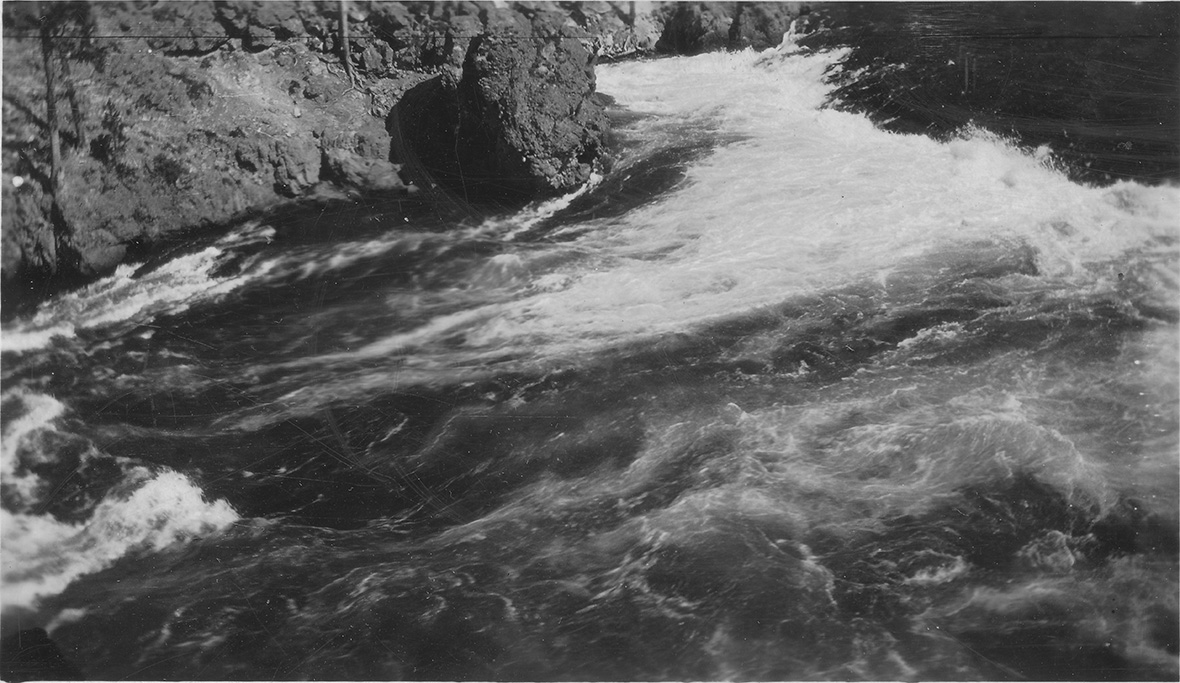
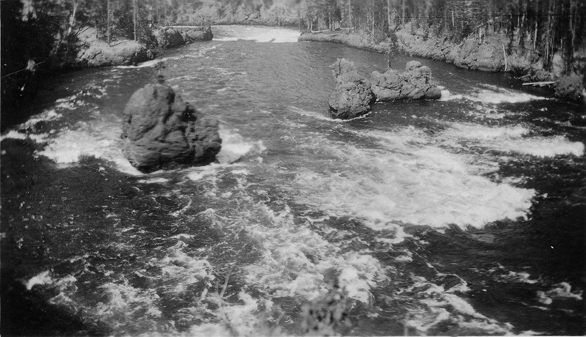
"The rapids of Yellowstone River"
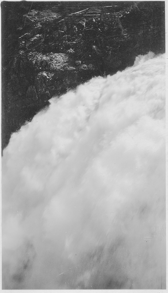
"A picture of Upper Falls of the Yellowstone River which is a hundred and nine foot drop."
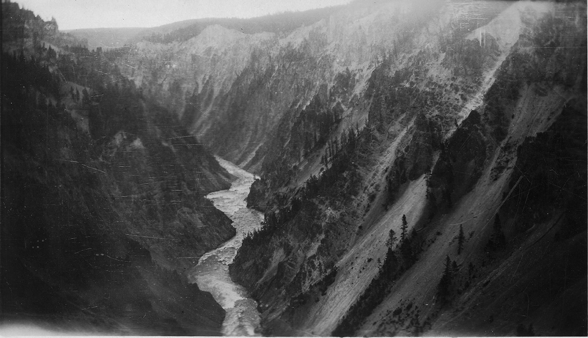
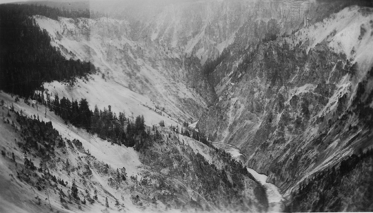
"This is a view of the Grand Canyon of the Yellowstone. The picture was taken on a cloudy day which accounts for a dark picture. The river is the Yellowstone."
"A better view of the Grand Canyon of the Yellowstone."
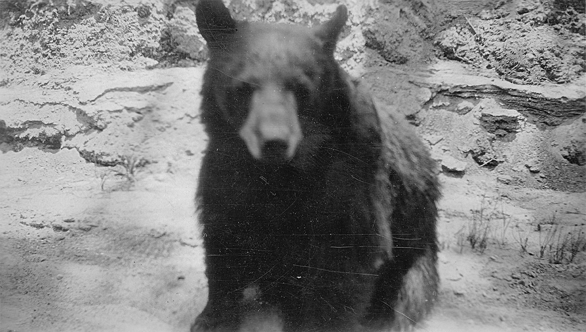
"This picture shows that first black bear we saw in Yellowstone Park. We were coming around a bned and we came to this bear and her two cubs comingacross the road.
We had some sandwiches in the car so we gave her these thus enabling use to get a close up picture of her."
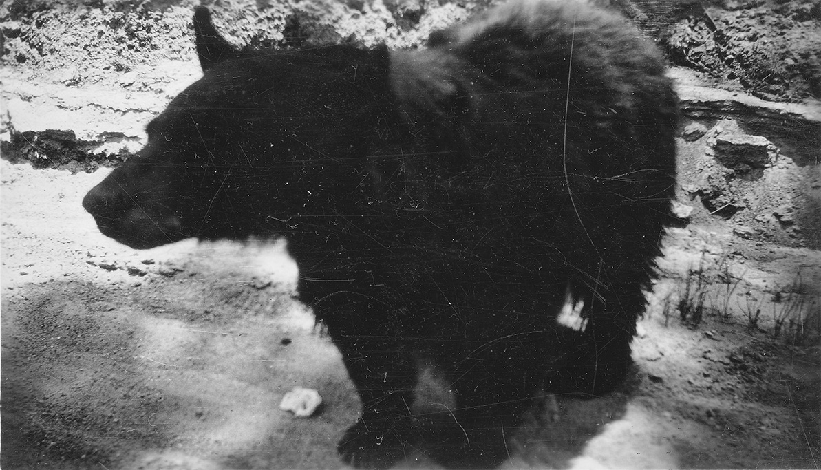
"A little farther on the road we came to this black bear. We gave him a sandwich also."
"A picture of another black bear. We saw dozens of grizzleys, brown and black bears during our two and a half days stay in Yellowstone."
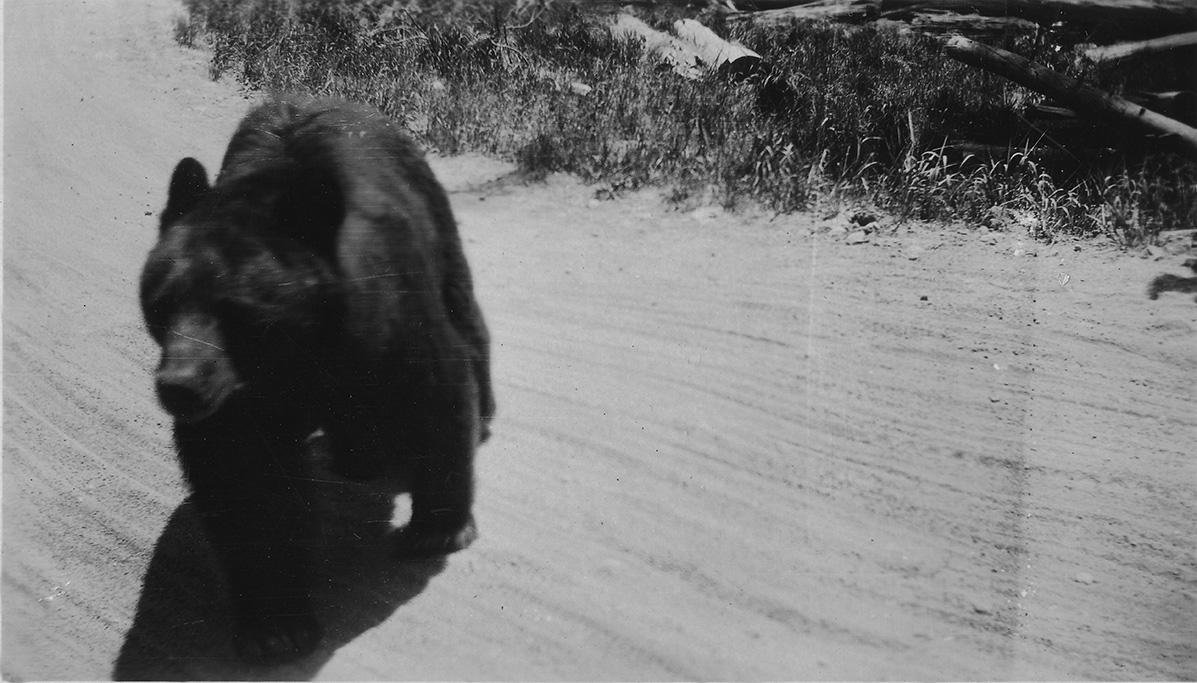
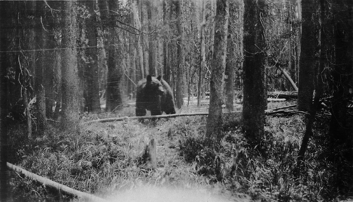
"A picture taken of a giant black bear in the pine forests, comming towards us."
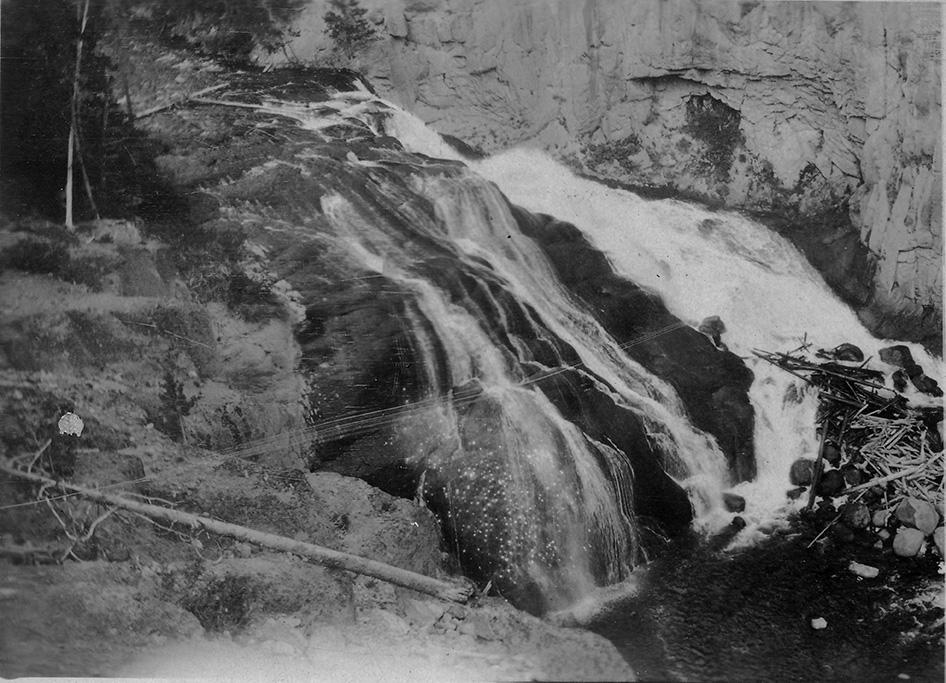
"A picture of Gibbon Falls eighty feet tho it doesn't look it."
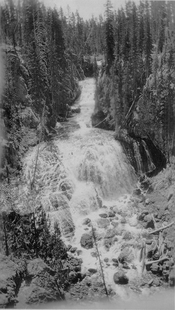
"This is Cepler Falls on Cascade three miles from Old Faithful."
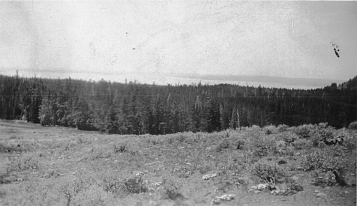
"A view of Yellowstone Lake from the road showing pines bordering lake."
"This shows Old Faithful geyser in full play. You can see that I managed to get all of the geyser in the picture."
July 3, 1924
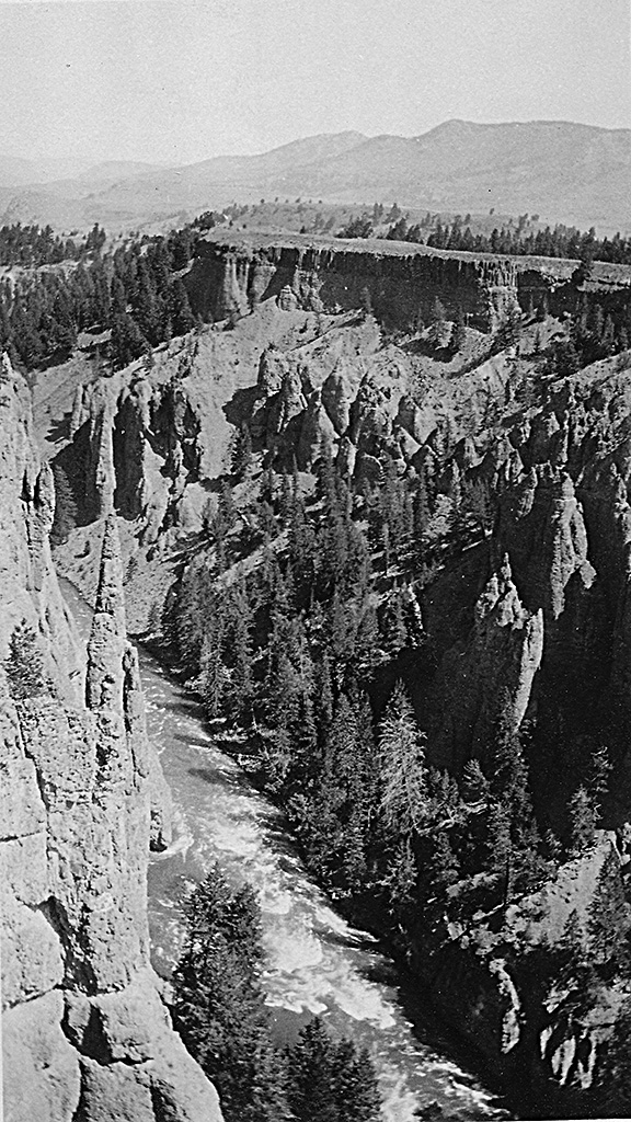
"This shows needles part of the Grand Canyon at Yellowstone Park."
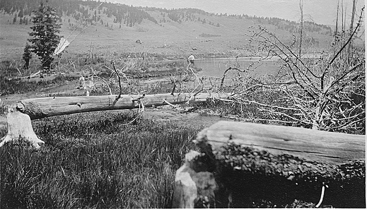
"A picture of a beaver dam Yellowstone Park you can see Herbruch and Bosler in the distance."
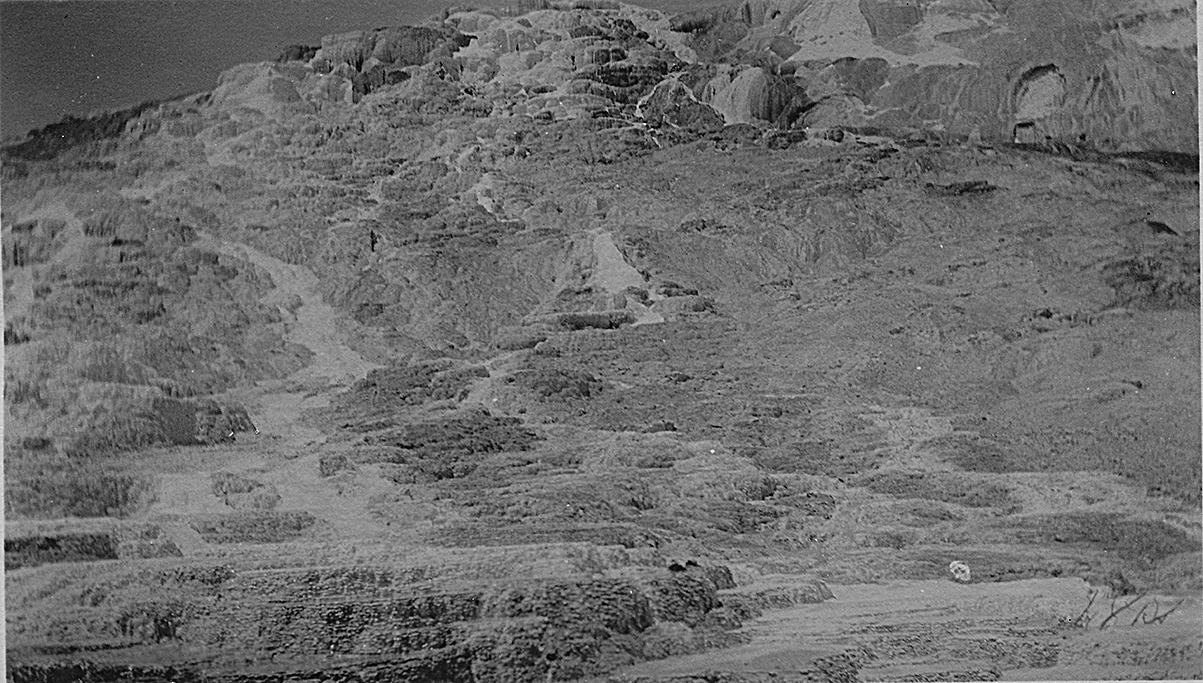
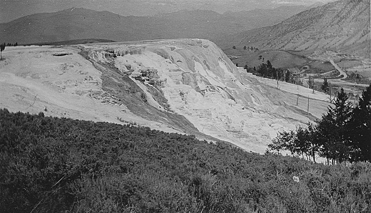
"A picture of Mamoth Hot Springs, the colors were so bright that the camera took a dark picture of it."
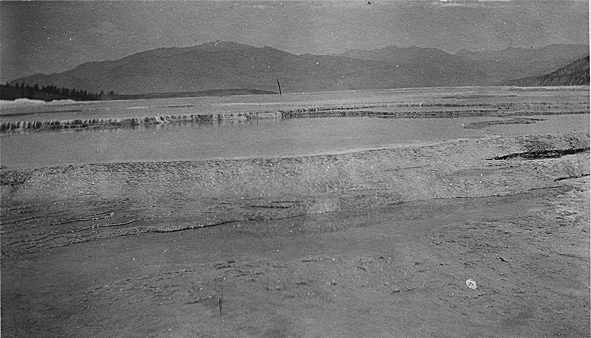
"A picture of Mamoth Terrace at Yellowstone Park"
"Showing another picture of the terraces at Yellowstone Park."
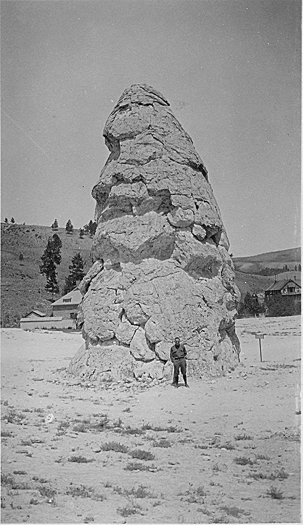
"A picture of Coach Marquardt and Liberty Cap in the rear, Yellowstone Park."
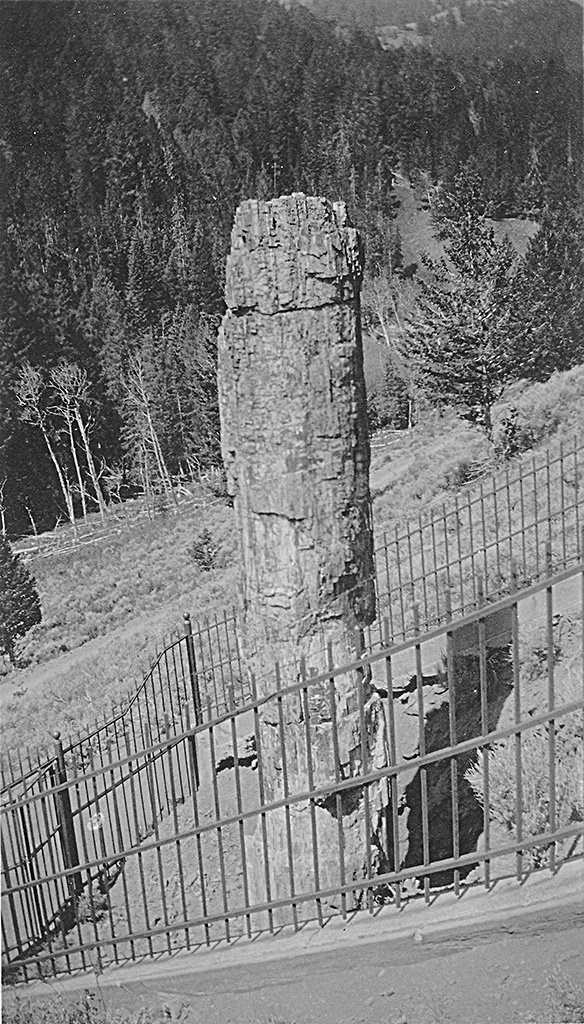
"This shows a petrified tree on the road to western gate Yellowstone Park."
"Showing Silver Gate Pass and machine on our way to western gate of Yellowstone Park."
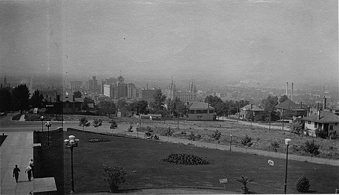
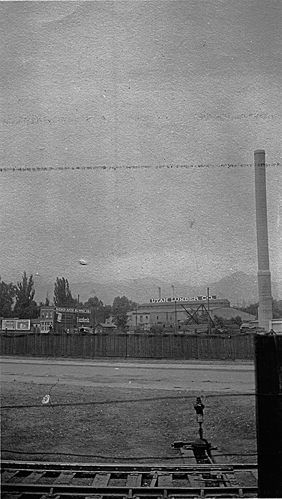
July 5-6, 1924 - Salt Lake City
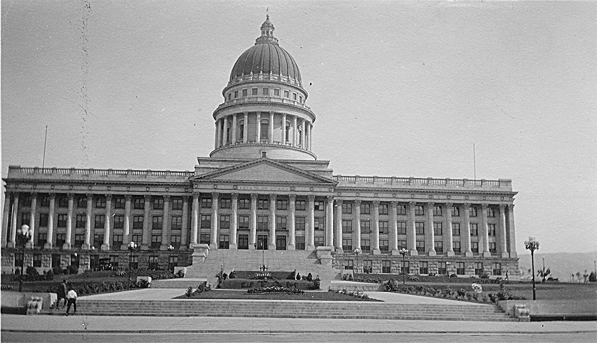
"A picture of the Utah Capitol at Salt Lake City."
"A view of Salt Lake City from the State Capitol, See the Mormon Temple in the distance."
"A picture taken of tracks and Utah Lumber Company just as we were leaving Salt Lake City for Saltair on train."
July 7, 1924 - Bryce
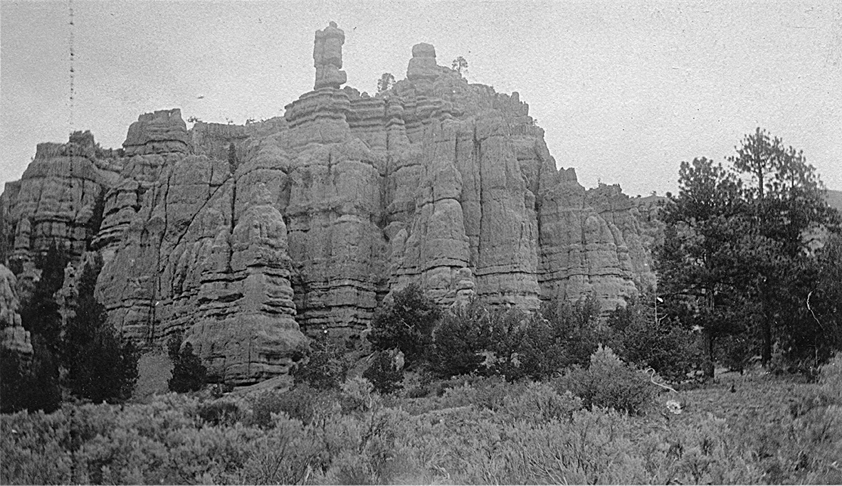
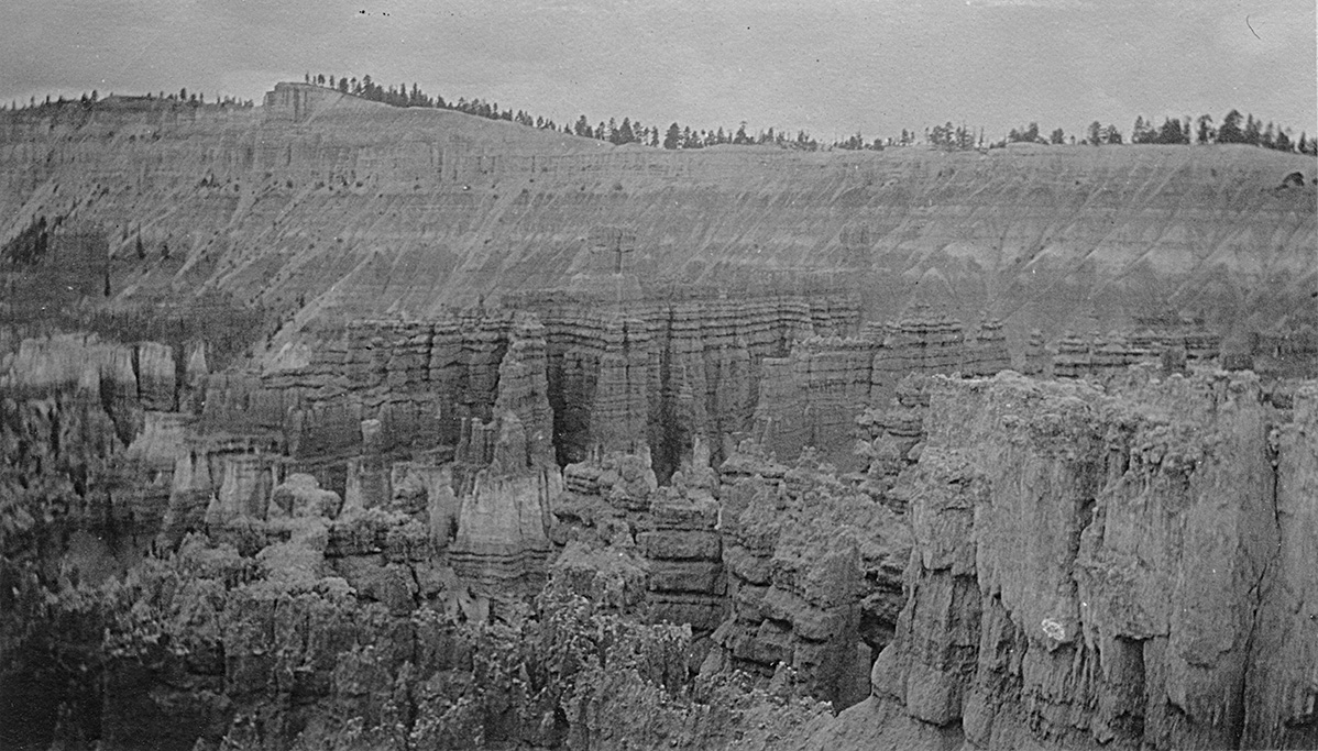
"Beautiful formations on the road to Bryce's Canyon."
"A view of Bryce's Canyon a canyon in Utah which we saw on our way to Grand Canyon."
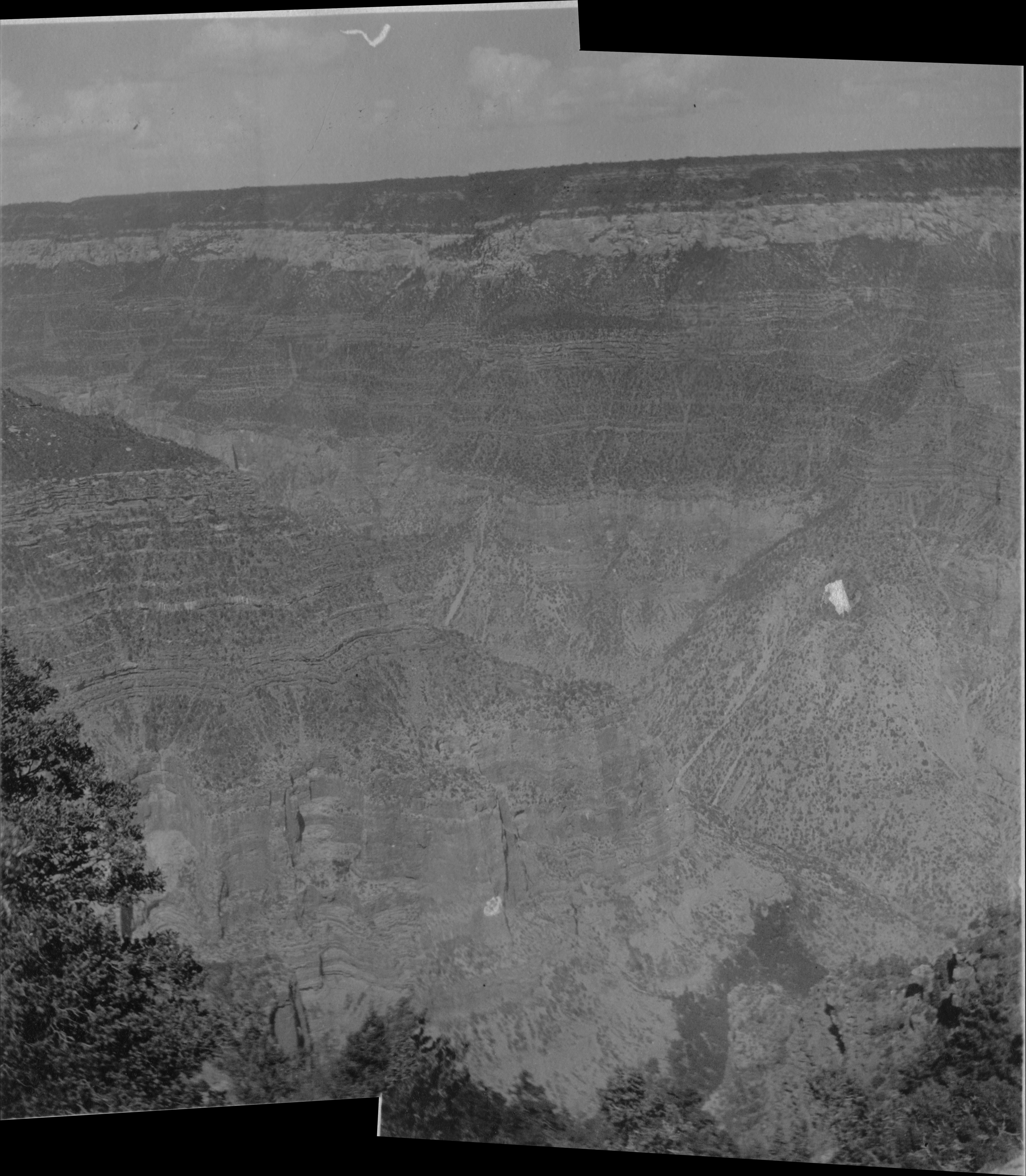
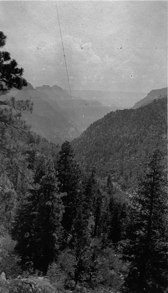
July 10, 1924 - Grand Canyon
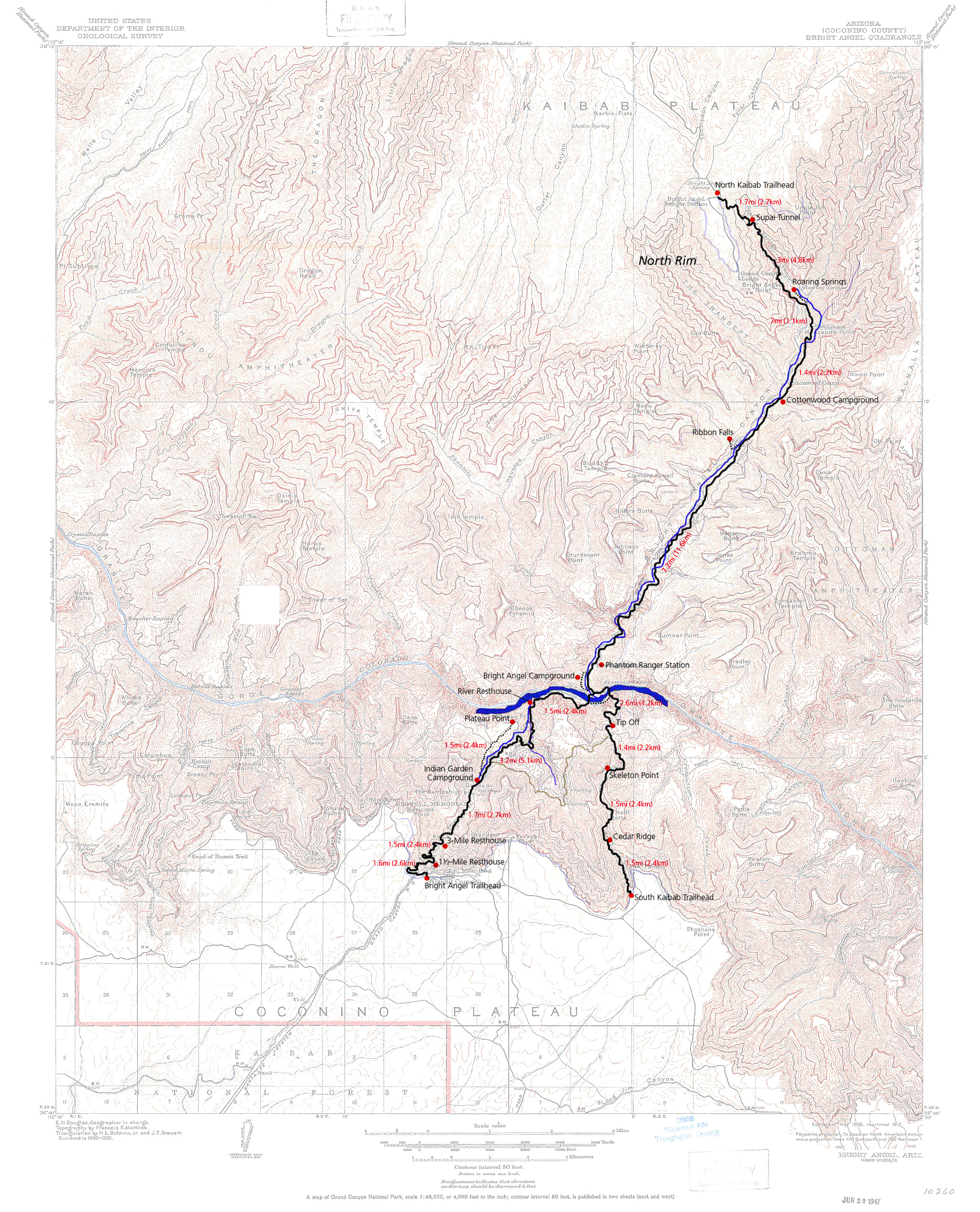
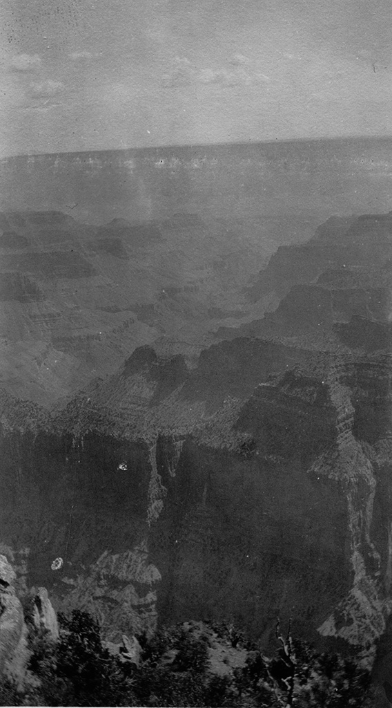
A 1915 map of the Bright Angel section of the park. A modern map of the Bright Angel Trail is overlaid on the 1915 topo map.
(a recent digital panorama made from two photos)
"Starting down the Canyon showing the other side." "Another view showing Canyon from Bright Angel Point."
"A view of the Canyon showing south rim in the distance, taken from Bright Angel Point north rim."
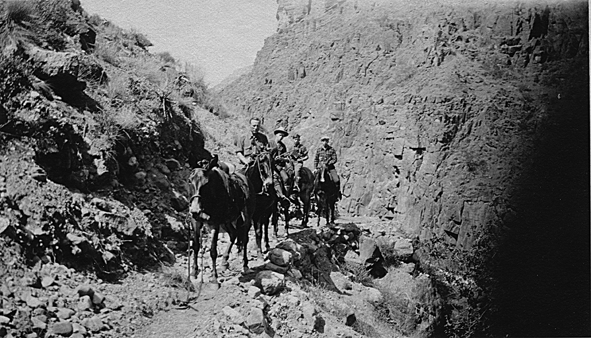
"A closeup of us along Bright Angel Trail our guide took this one."
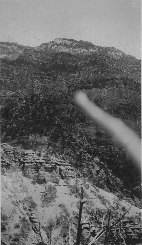
"Showing a side of the Canyon going up."
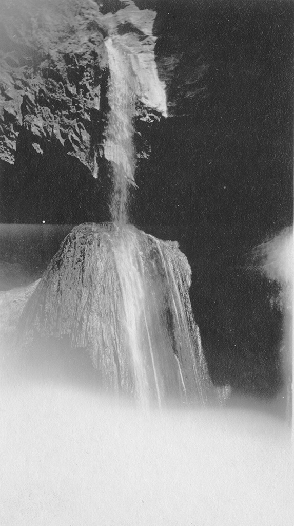
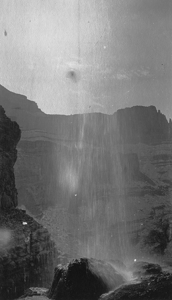
"This shows Ribbon Falls approaching it."
"This picture was taken from behind Ribbon Falls, Grand Canyon."
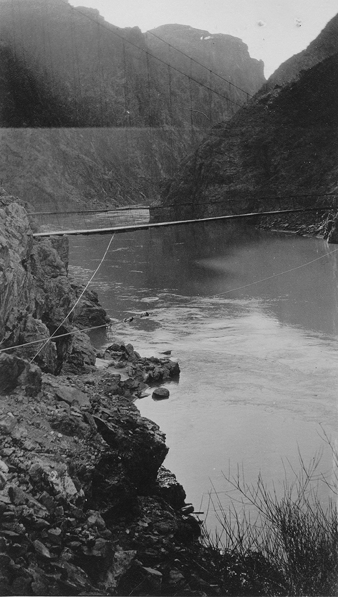
"In the Canyon showing the Colorado River and extension bridge above it."
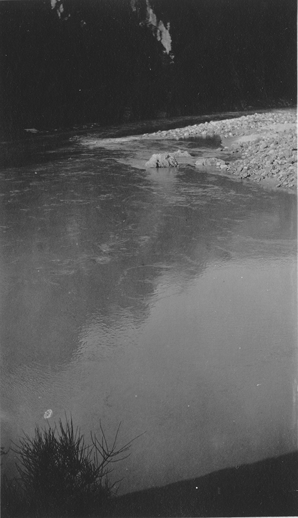

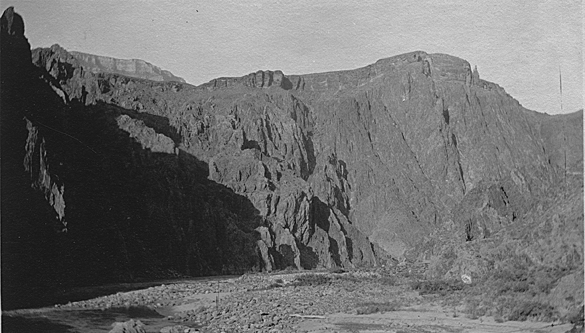
"A picture of the Colorado River."
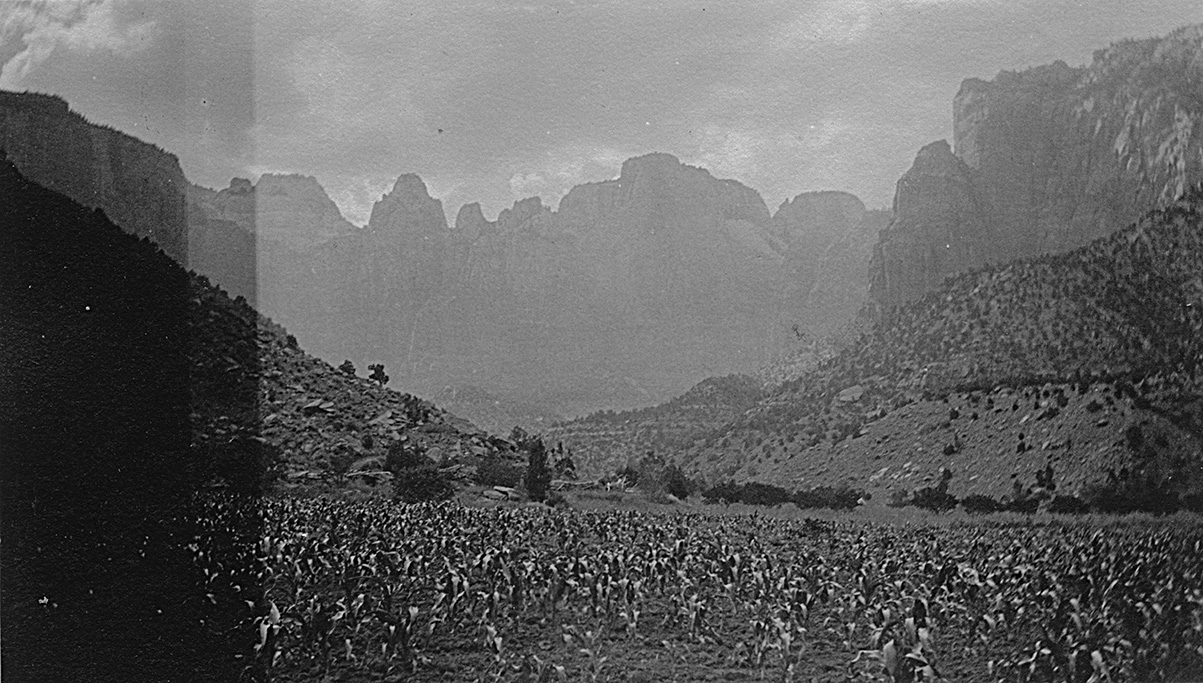
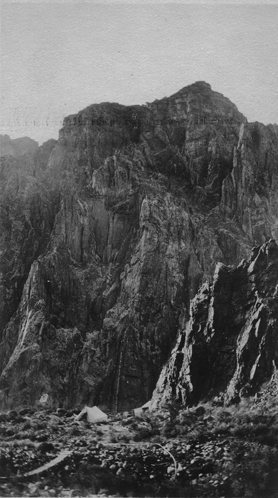
"Down in the Canyon showing corn field at Phantom Ranch."
"At Phantom Ranch showing our mules and southern cliffs in the distance."
"A view of the south cliffs. Note how high they are in comparison with the tent."
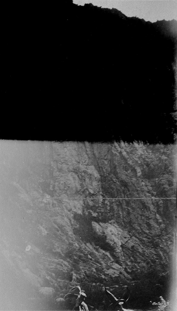
"A foged picture showing side of Canyon."
"Another picture of the south side of Canyon."
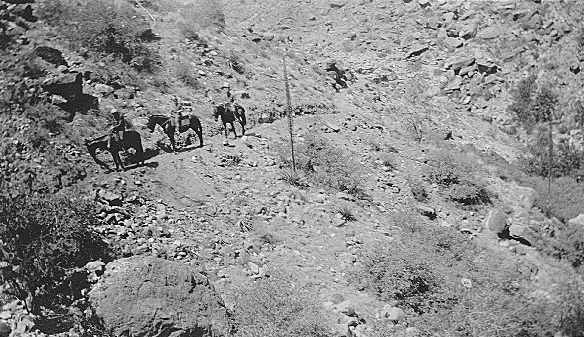
"This is a picture showing Bosler, Herbruch, and Coach Marquardt on mules going up Bright Angel Trail."
"Taken from the Bright Angel Trail going up. Showing part of Canyon and south rim about fifteen miles away."
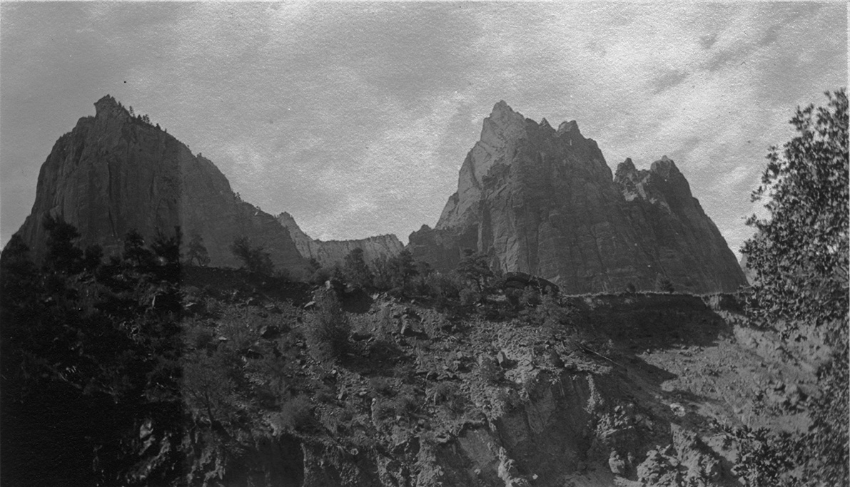
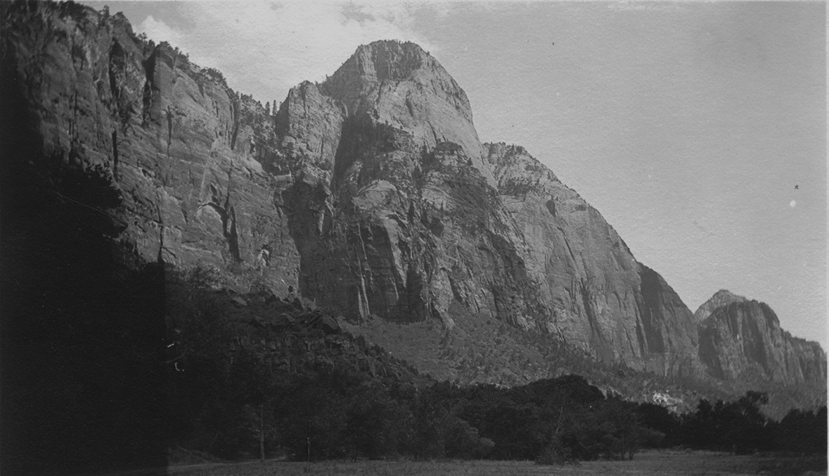
July 11, 1924 - Zion National Park
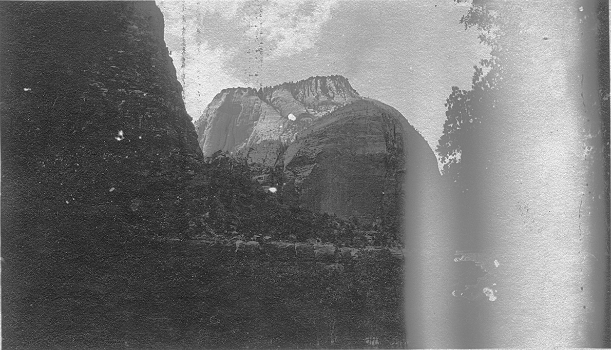
"A picture of rocks and ledges at Zion Nat Park in Nevada."
"A picture of the altar of sacrifice Zion Nat. Park, Nevada"
"Another view of a high mountain Zion Nat. Park."
July 12, 1924 - Nevada desert
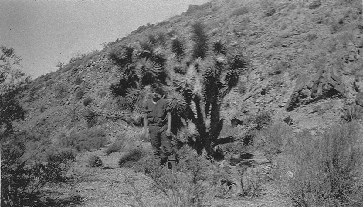
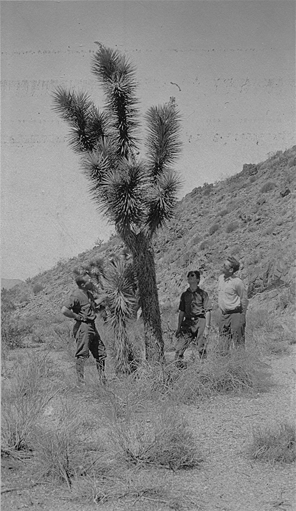
"A picture of the cactus trees on the deserts of Nevada."
"Another picture of a giant cactus, on the deserts of Nevada"
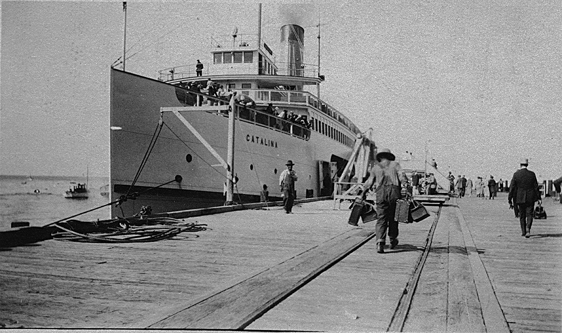
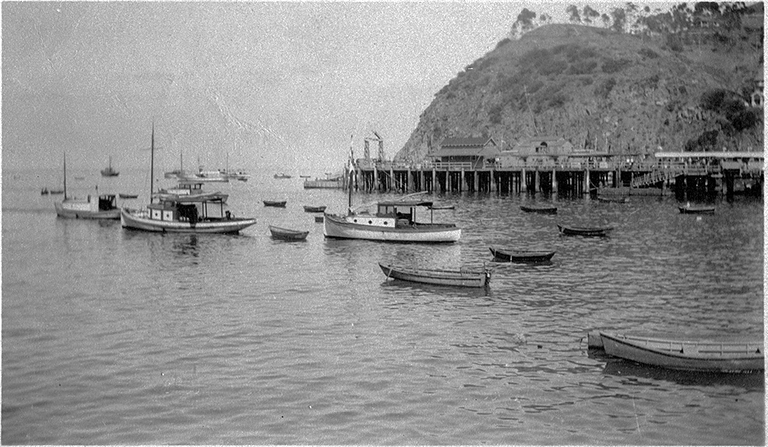
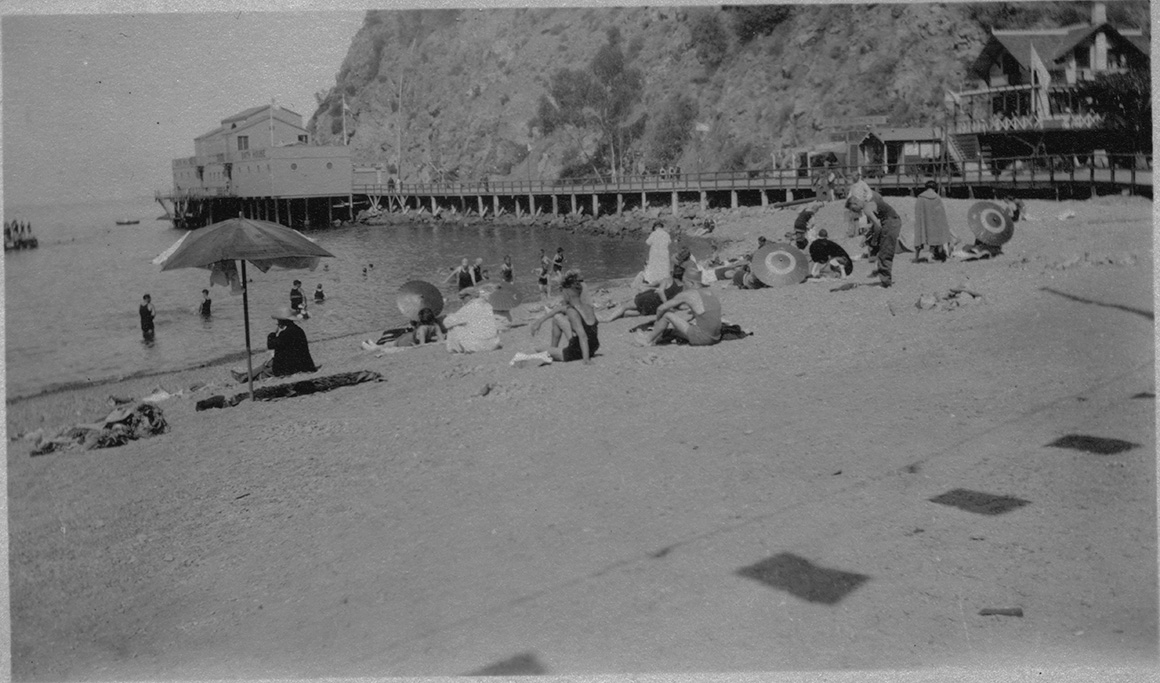
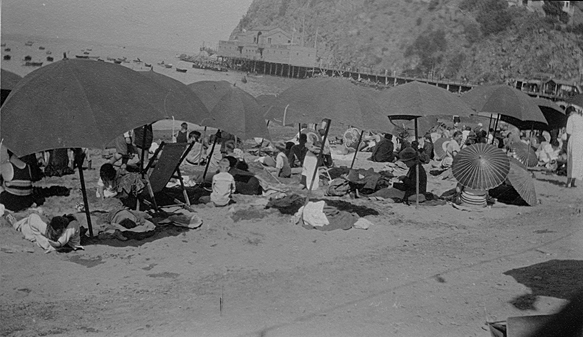
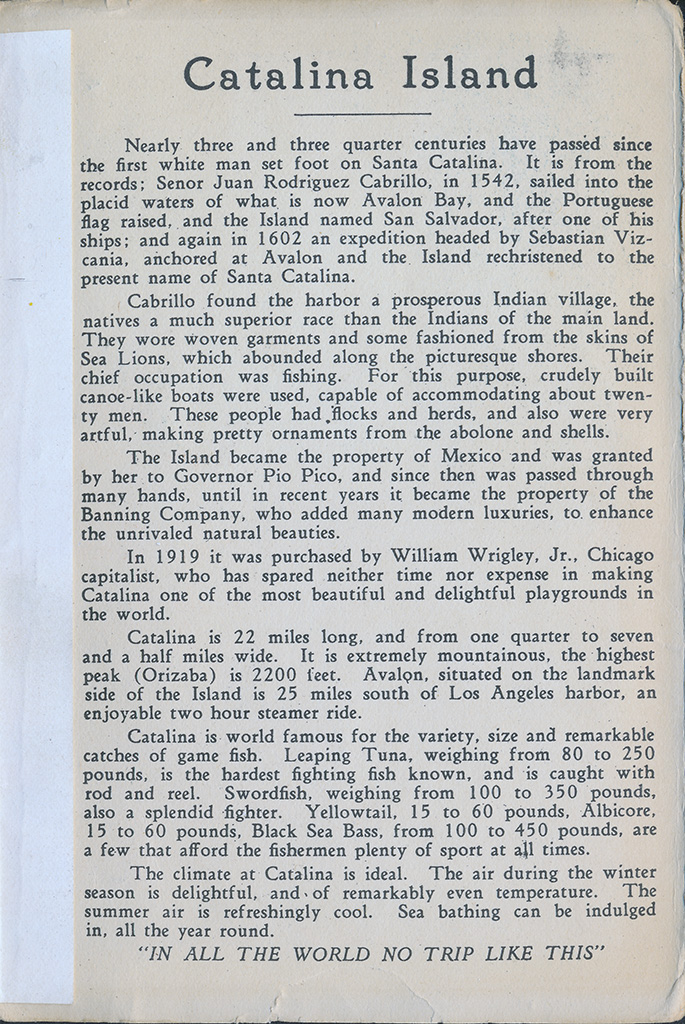
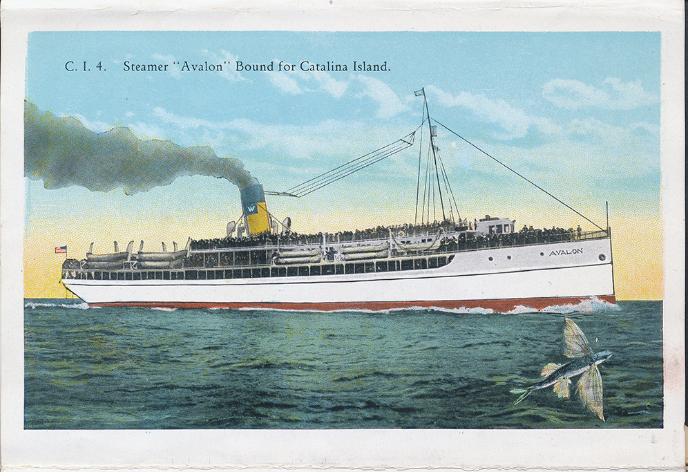
July 15, 1924 - Catalina Island
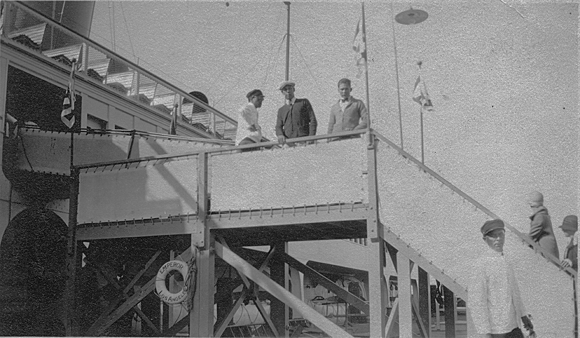
"This shows Herbruch, Bosler, and the first mate on the Emperor going to the Seal Islands"
"Our steamer the SS. Catalina in the dock at Catilina Islands."
The S.S. Catalina was new and had just entered service the month before.
"This shows the harbor at CatilinaIslands. Great swimming in the ocean here."
"This is a picture of the beach on Catilinia Islands off the coast of Southern California."
"Another picture of the beach Catilina Islands."
Postcards of Catalina
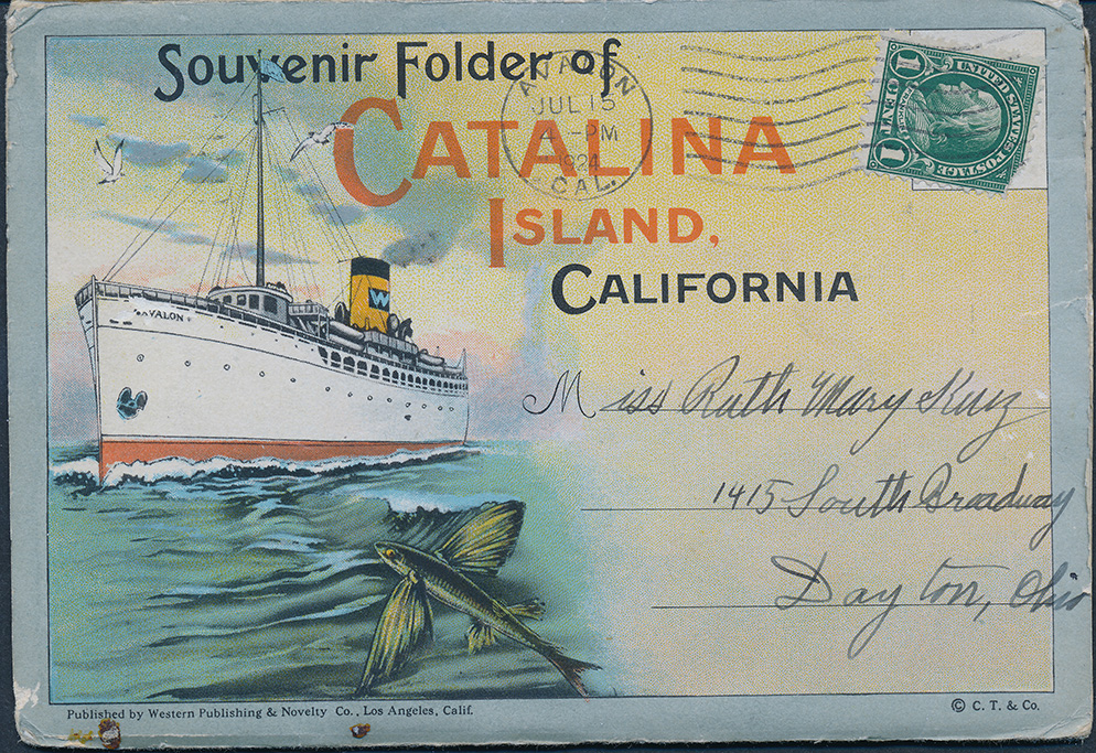

FRONT COVER OF PACKET:
This packet of postcards folds out like an accordion. The views were printed on both sides of the fold-out, nine per side.
INSIDE FRONT COVER:
Promotional intro text
INSIDE BACK COVER:
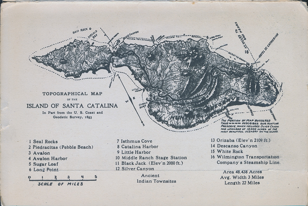
Illustrated and numbered map of Santa Catalina Island.
FRONT SIDE OF FOLDOUT:
"Main View, Avalon Bay, Catalina Island, California."
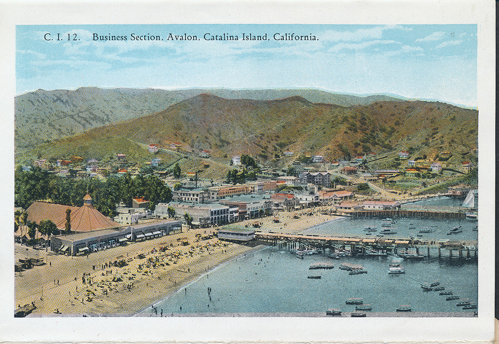
"Business Section, Avalon, Catalina Island, California."
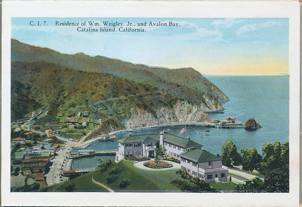
"Residence of Wm. Wrigley, Jr., and Avalon Bay, Catalina Island, California."
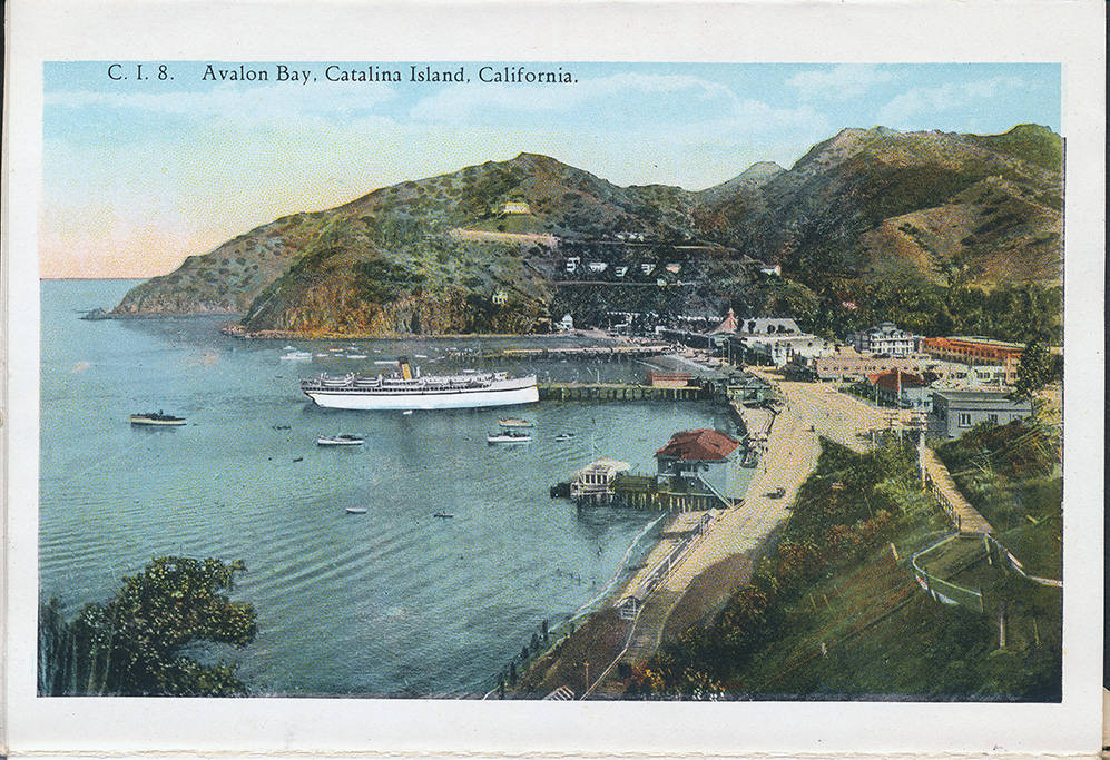
"Avalon Bay, Catalina Island, California."
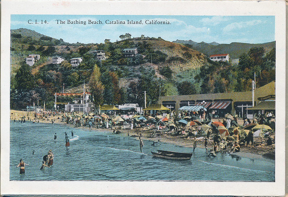
"The bathing Beach, Catalina Island, California."
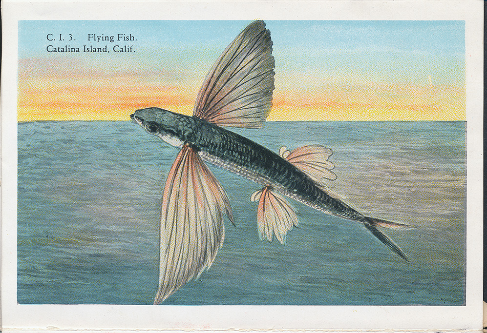
"Flying Fish, Catalina Island, California."
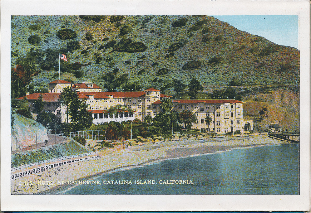
"Hotel St. Catherine, Catalina Island, California."
"Steamer "Avalon" Bound for Catalina Island."
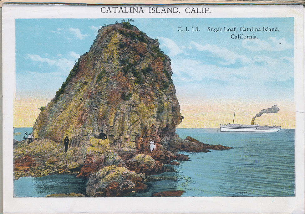
"Sugar Loaf, Catalina Island, California."
BACK SIDE OF FOLDOUT:
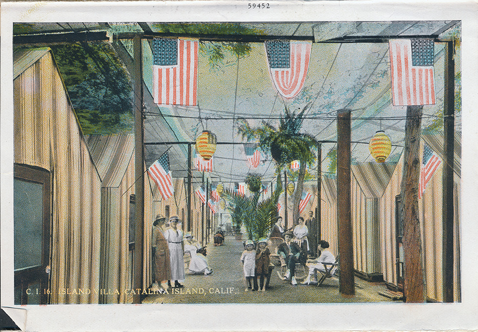
"Island Villa Catalina Island, California."
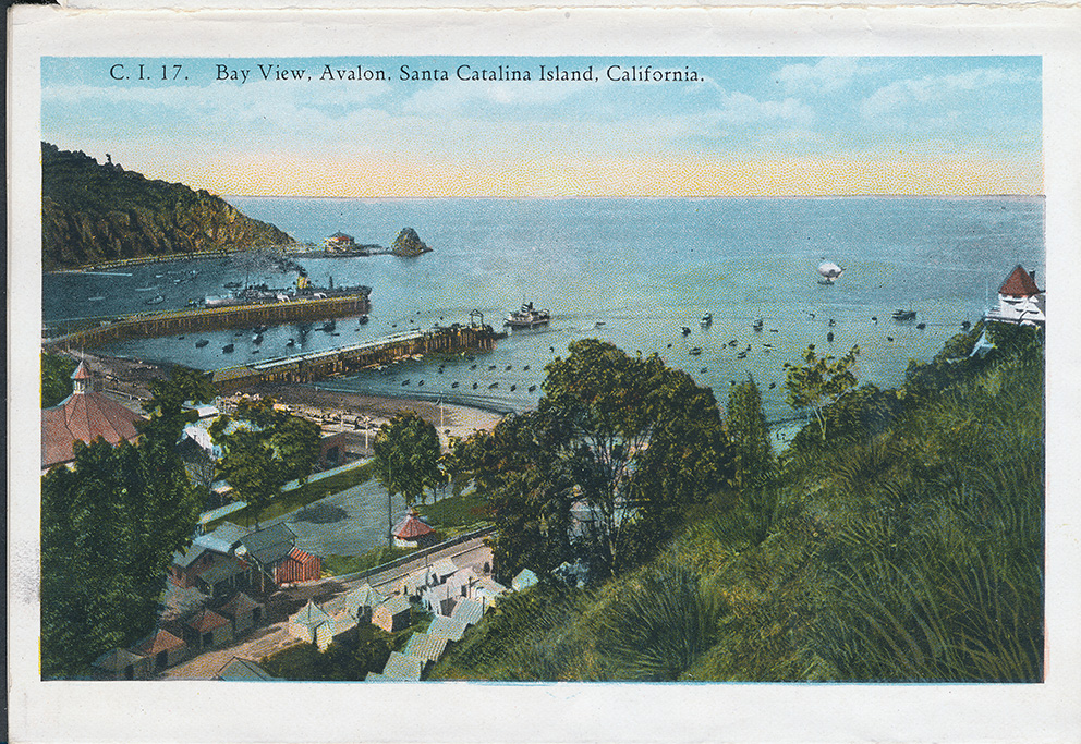
"Bay View, Avalon, Santa Catalina Island, California."
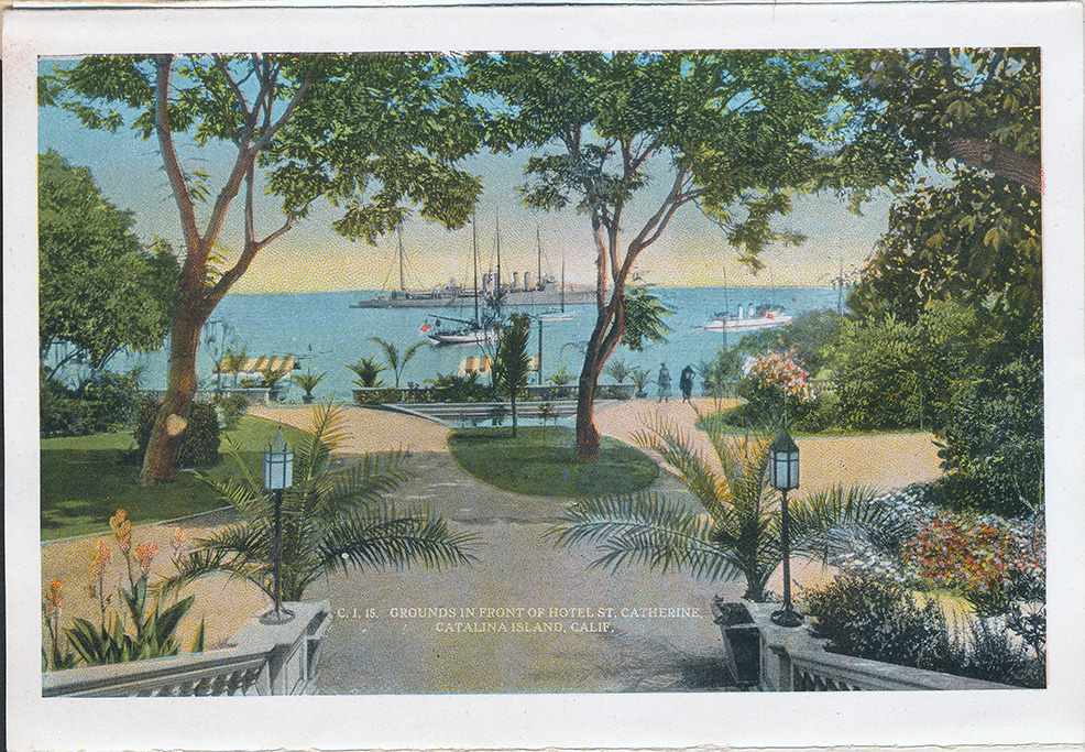
"Grounds In Front Of Hotel St. Catherine, Catalina Island, California."
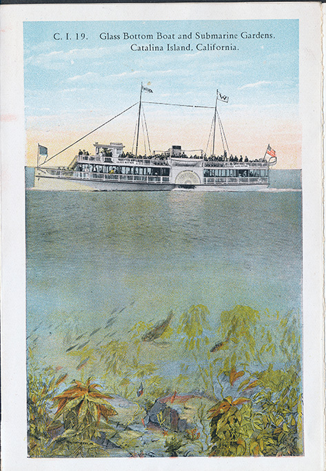
"Glass Bottom Boat and Submarine Gardens, Catalina Island, California."
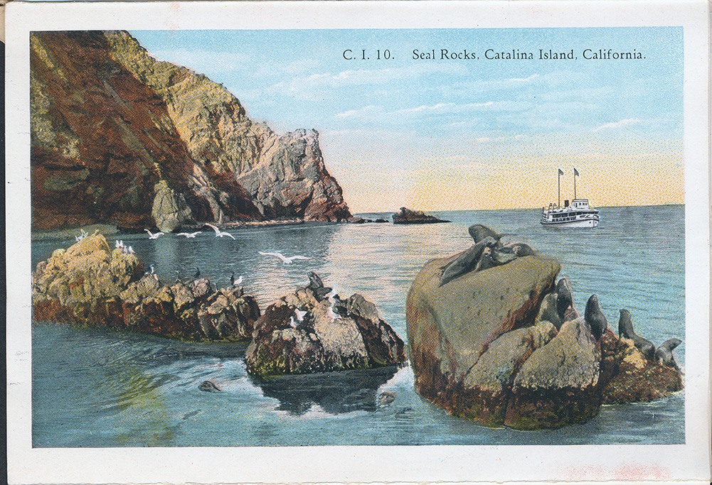
"Seal Rocks, Catalina Island, California."
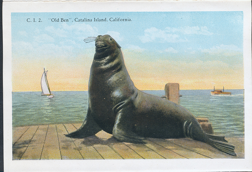
" "Old Ben", Catalina Island, California."
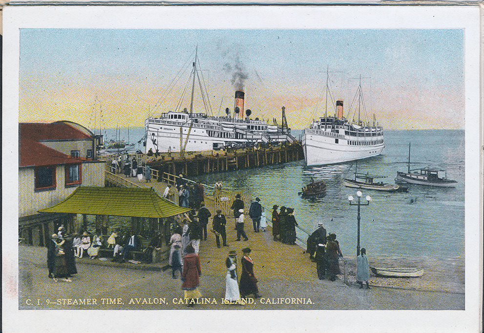
"Steamer Time, Avalon, Catalina Island, California."
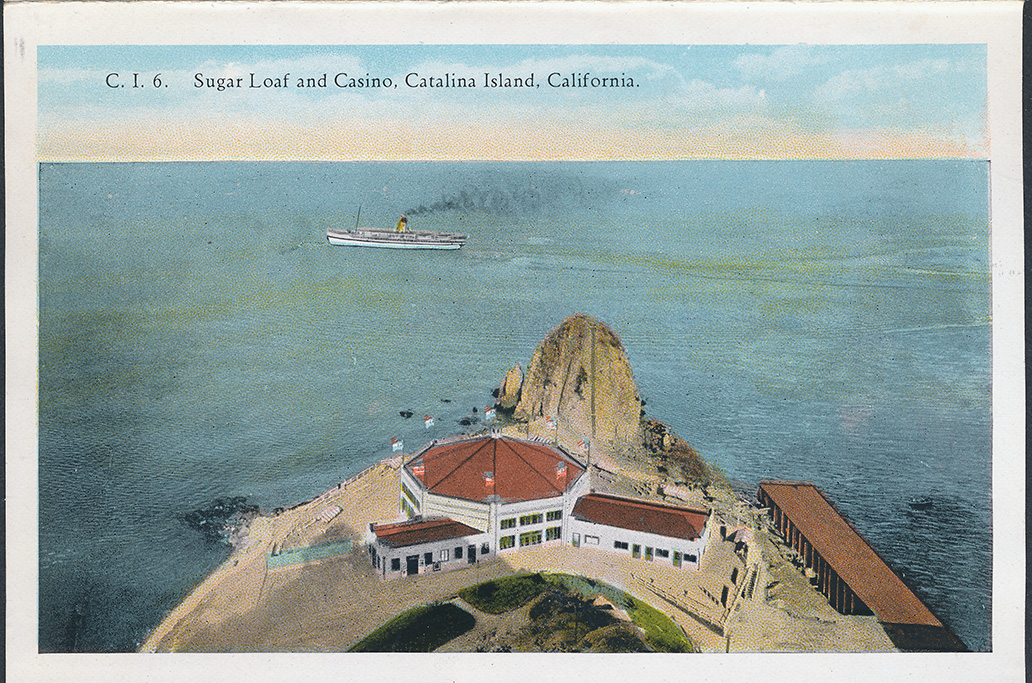
"Sugar Loaf and Casino, Catalina Island, California."
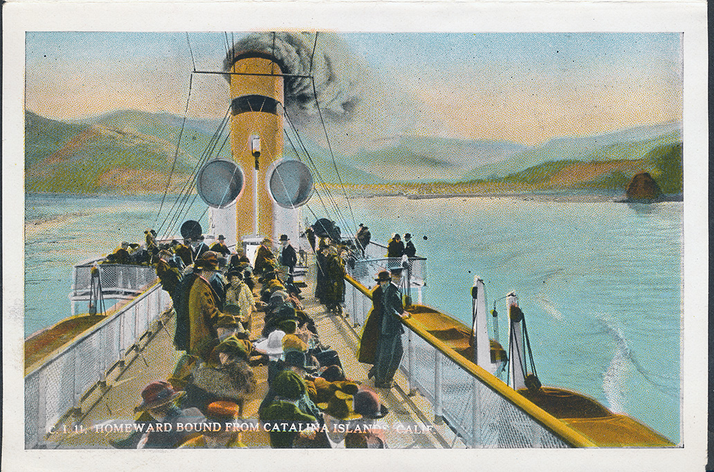
"Homeward Bound From Catalina Island, California."
BACK COVER OF PACKET:
Packet opens from this side.
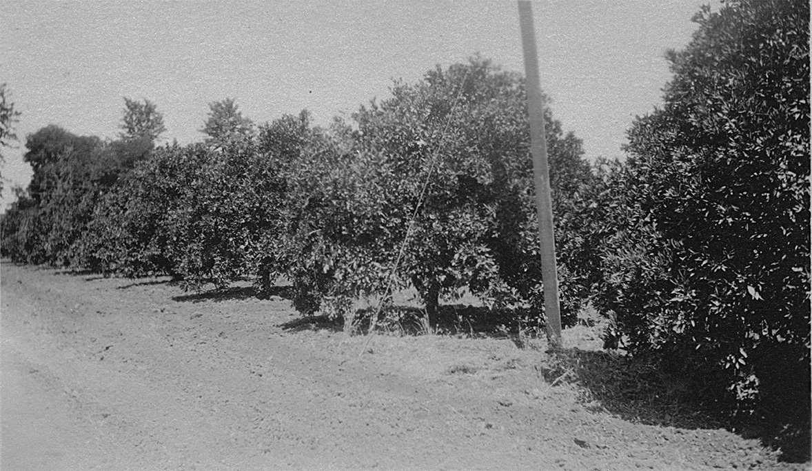
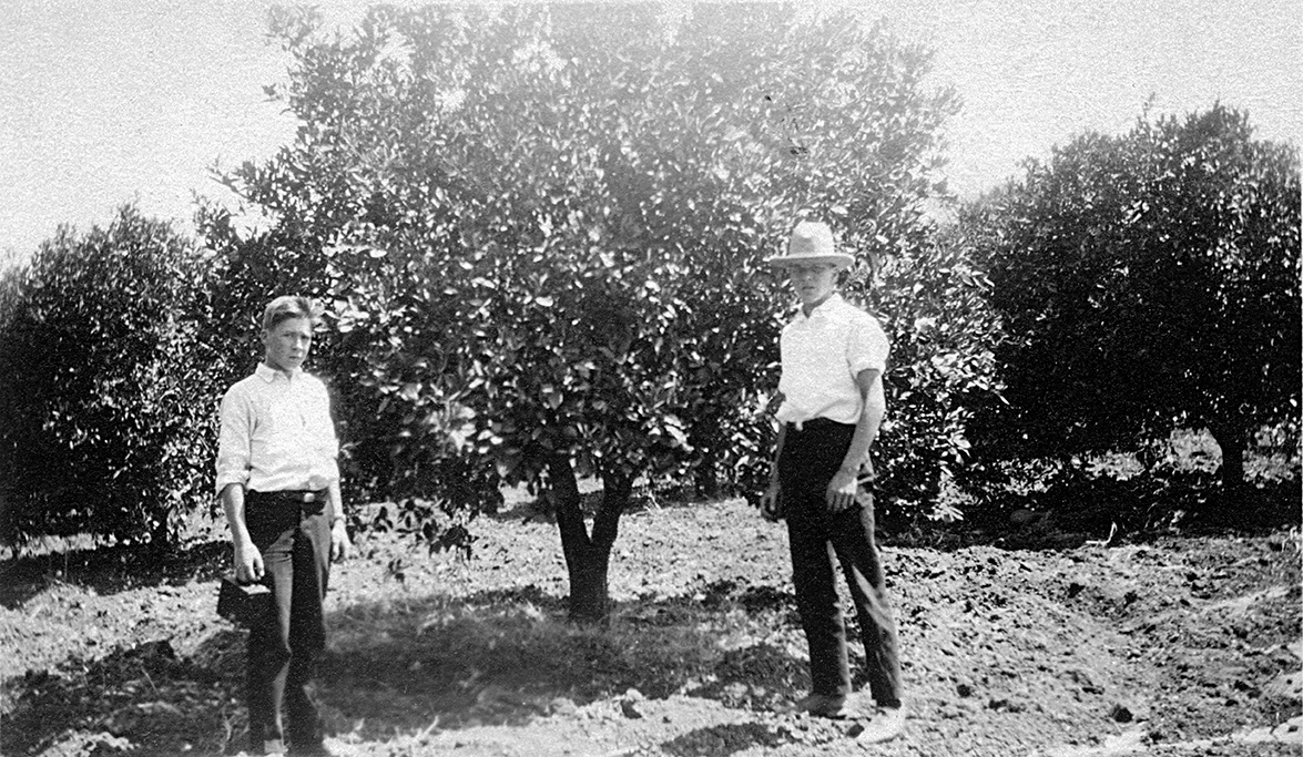
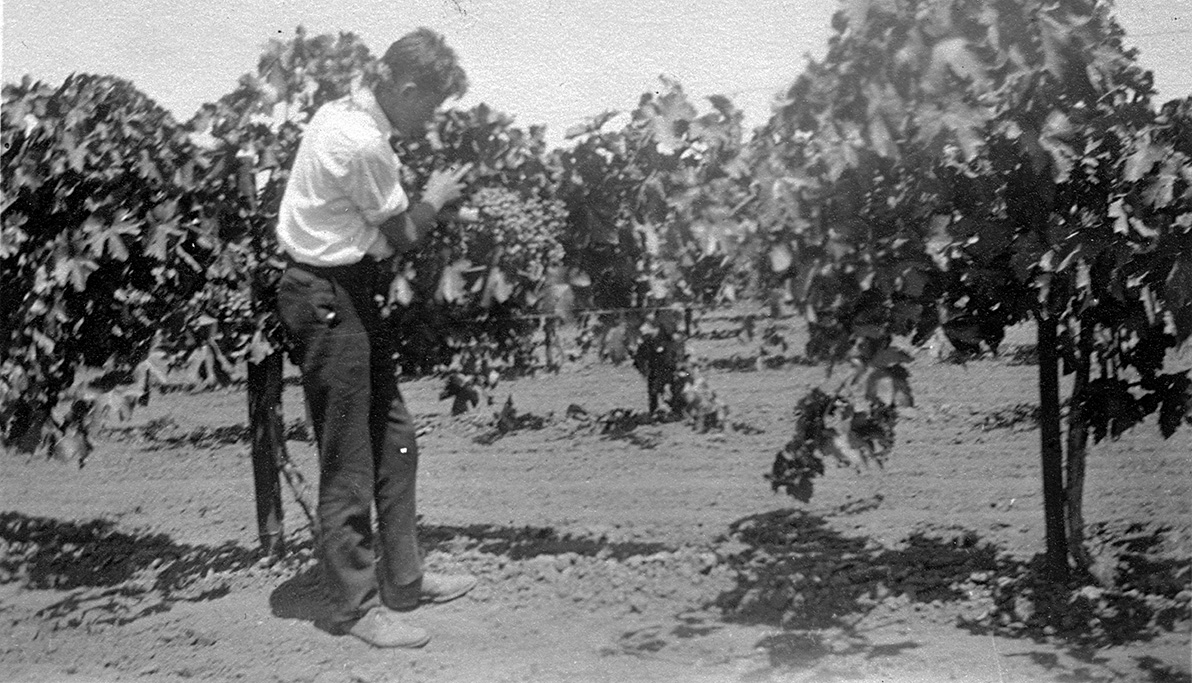
July 16, 1924 - Southern California
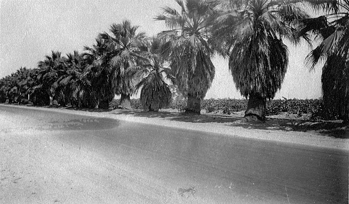
"A row of palms along one of many highways in California."
"A grapefruit orchard, southern California"
"A picture of Herbruch and me in an orange grove in southern California."
"This shows me in a grape vineyard. Note the bunch of grapes. There are miles of grape vineyards also."
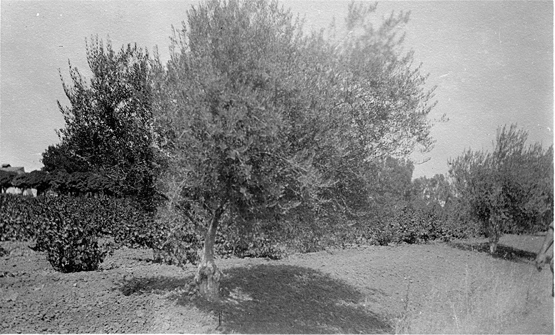
"An olive tree in southern California."
July 19, 1924 - General Grant National Park
(Upper half photo)
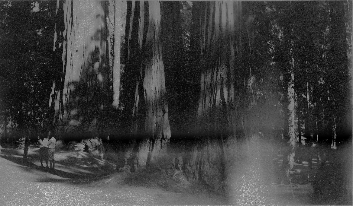
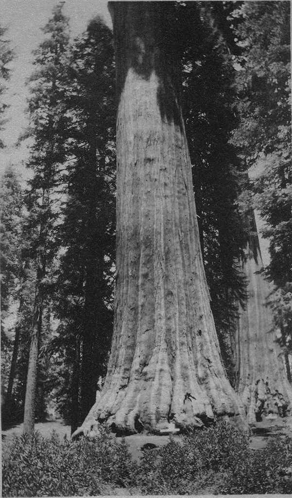
"This is a view of the upper part of General Sherman, largest tree in the world. Place the two pictures together and note the enormous size of tree."
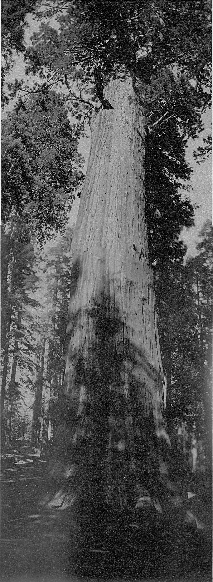
"This shows the giant Sequoias in General Grant National Park."
"This is a picture of General Lee tree, a large Sequoia in General Grant National Park."
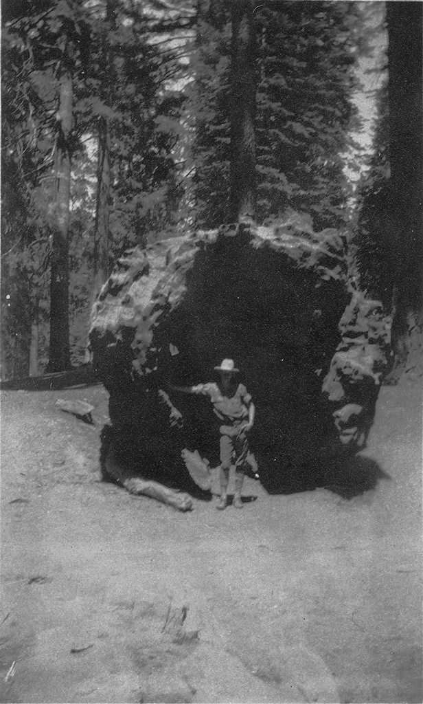
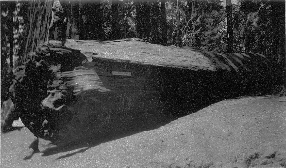
"A picture of me inside of Fallen Monarch. Note huge size of tree."
"Showing side view of Fallen Monarch in General Grant National Park."
"This is the California Tree one of the beautifulest trees in General Grant Park."
(a recent digital panorama made from two photos)
Lower half photo)
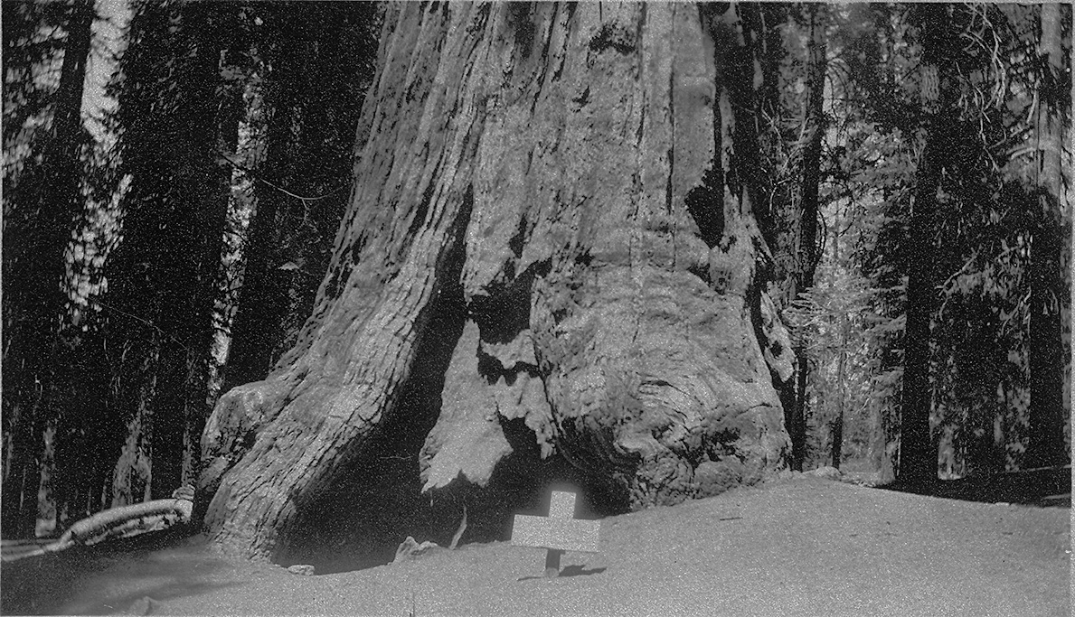
"This is a picture of the trunk of General Sherman the largest tree in the world. Sequoia Nat. Park."
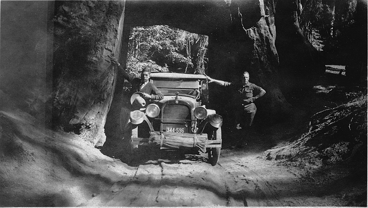
"Dead Giant which we passed thru on our way to Yosemite."
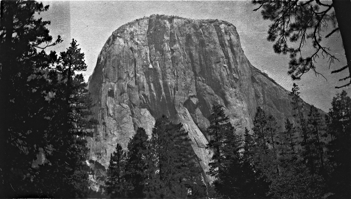
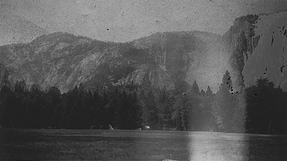
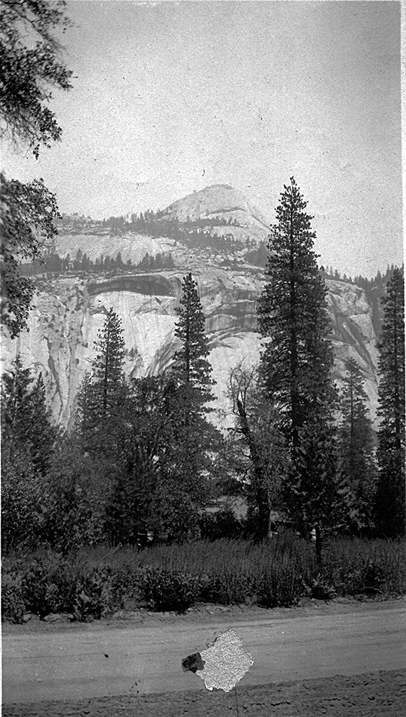
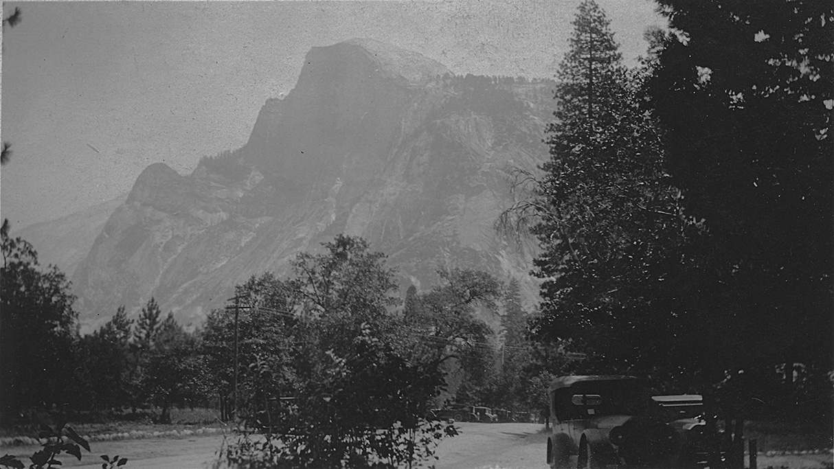
July 20, 1924 - Yosemite National Park
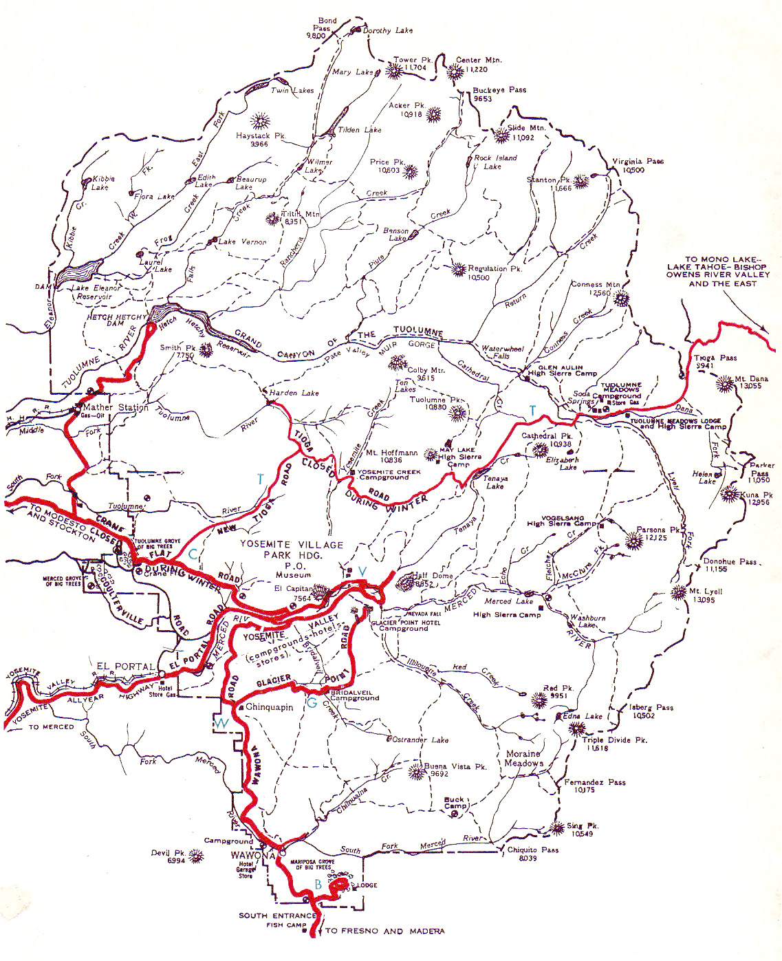
A map of Yosemite from the early part of the 1oth century. Note the location of the Hetch-Hetchy dam and reservoir in the northwest quadrant.
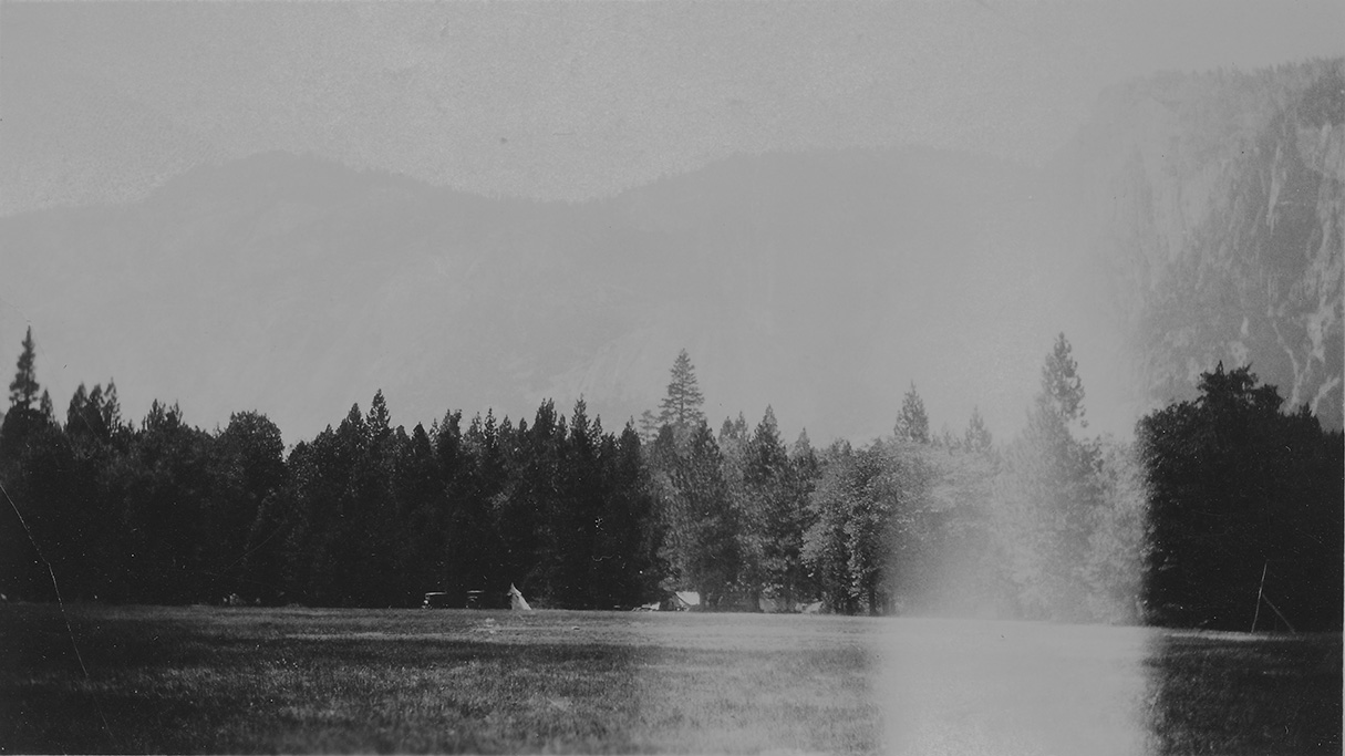
"A view of high mountains from bridge Yosemite Nat. Park."
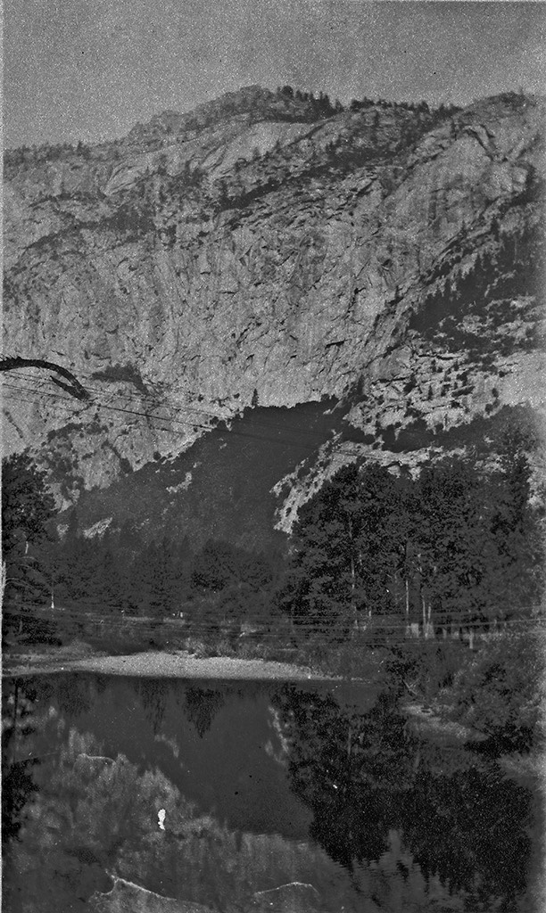
"Shows high cliffs of solid rock. These surround all of Yosemite valley Yosemite Valley"
"Another view of rock cliffs Yosemite Valley;"
"El Capitan a dome of solid rock Yosemite Nat. Park."
"Another picture of rocky cliffs from road Yosemite Valley."
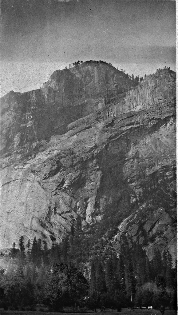
"Glacier Point above Camp Curry Yosemite Valley"
July 22, 1924 - Hetch Hetchy Dam
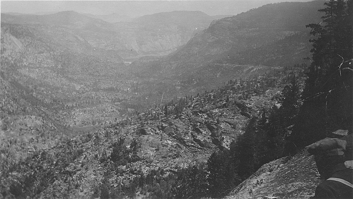
"In the center of the picture is a small white object that is Hetch Hetchy Dam eight miles ore so awaj."
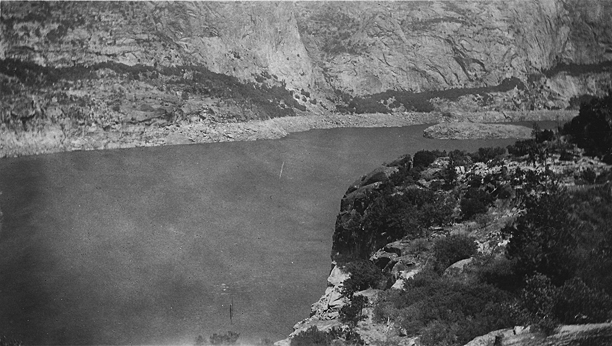
"Hetch Hetchy reservoir."
"A view of the dam in the distance."
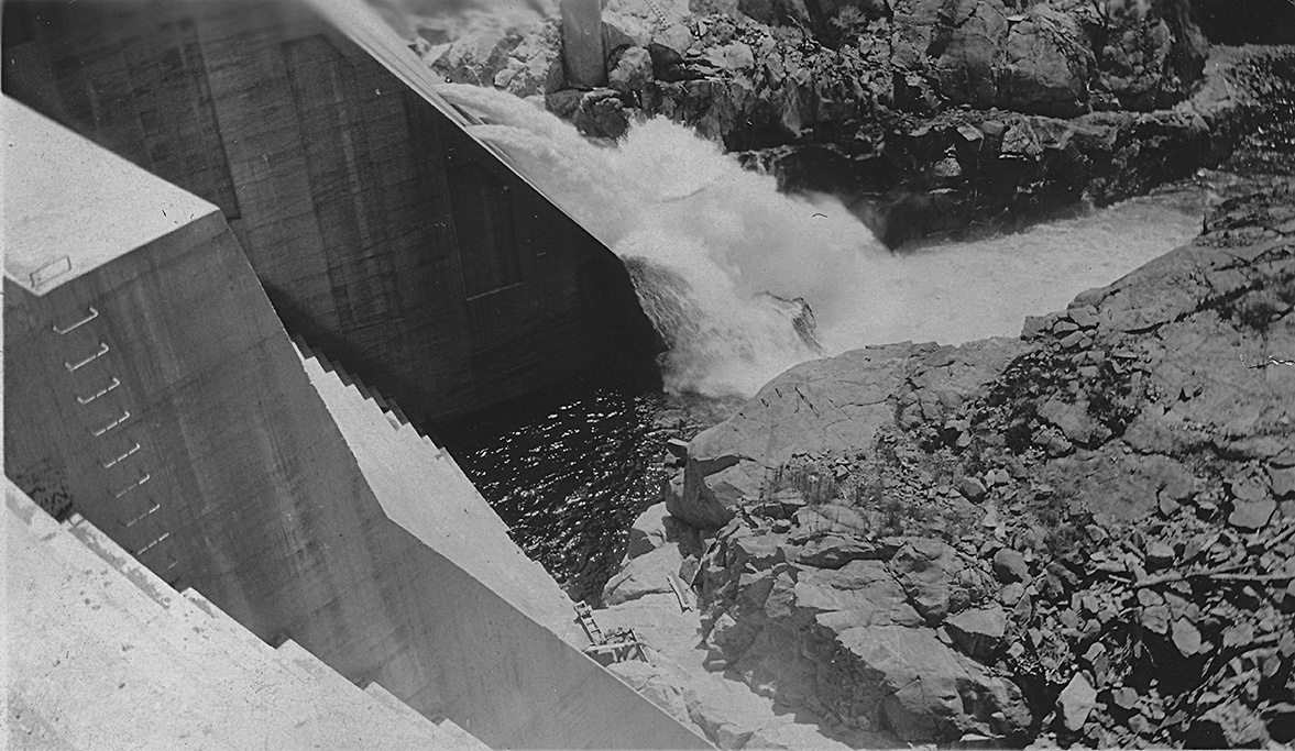
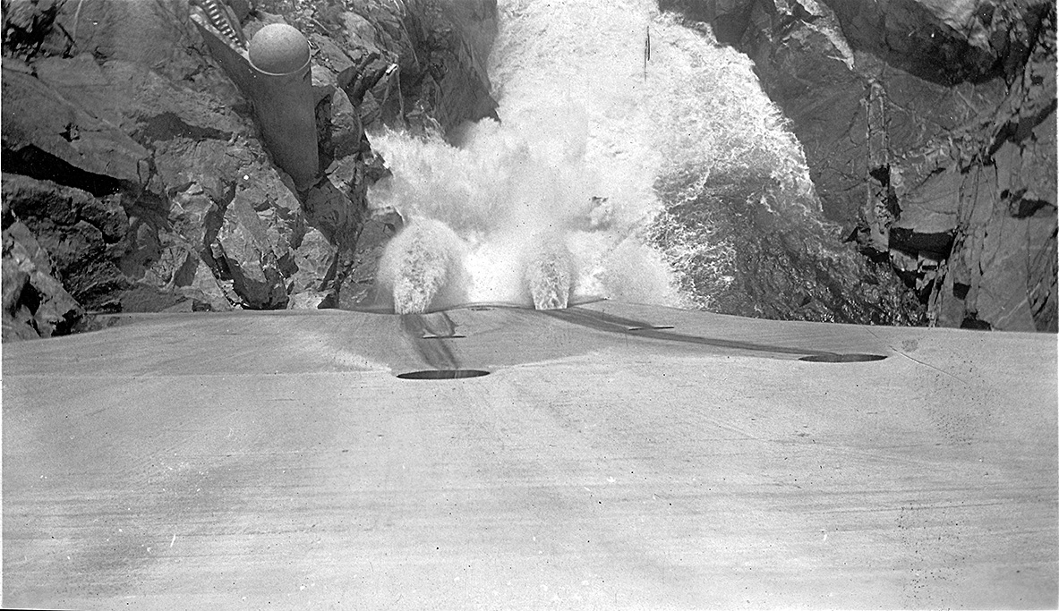
"A view of the Hetch Hetchy Dam and siphon spillways."
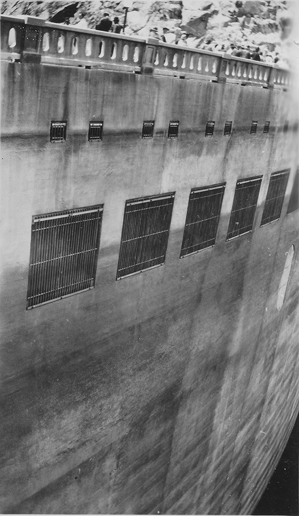
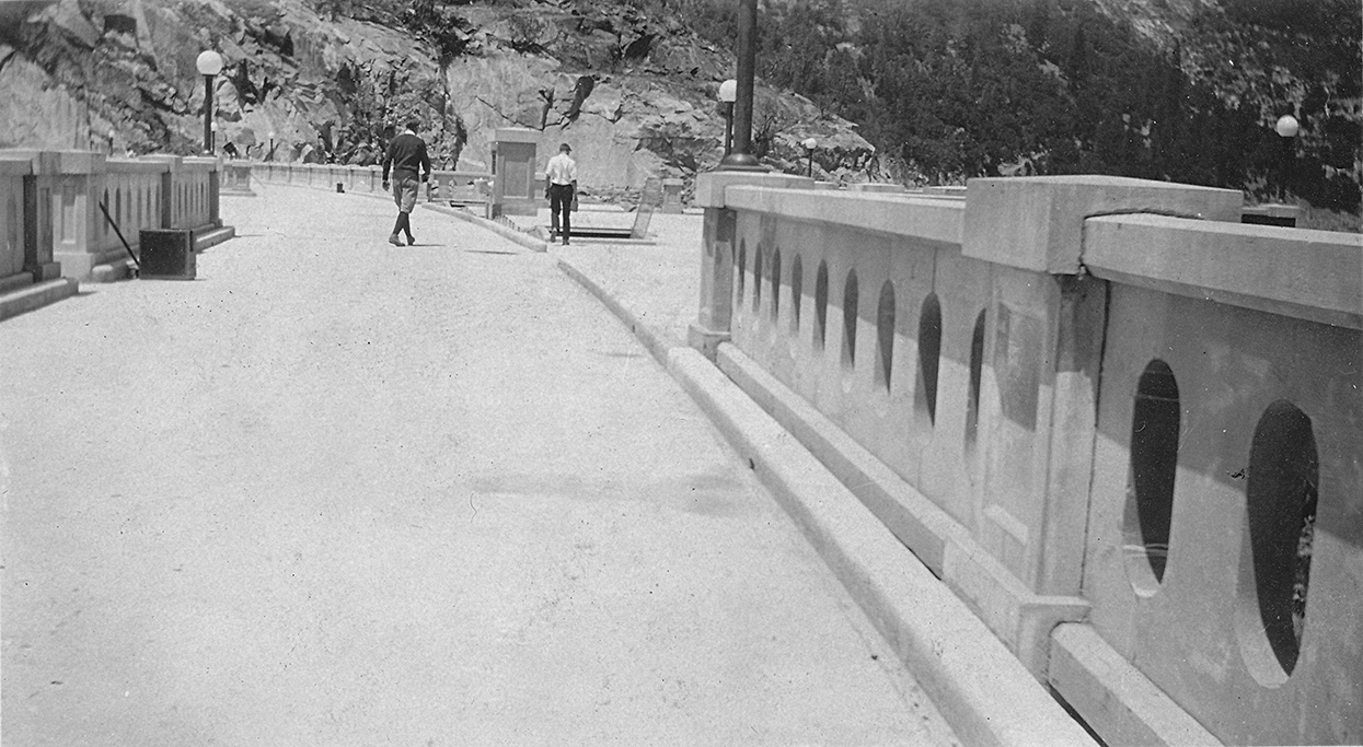
"Along the top of Hetch Hetch Dam."
"A view of Hetch Hetchy Dam, The largest in the world when completed.
Situated near Frisco to be used as water resorvoir for Frisco."
"Looking down the side of Hetch Hetchy Dam."
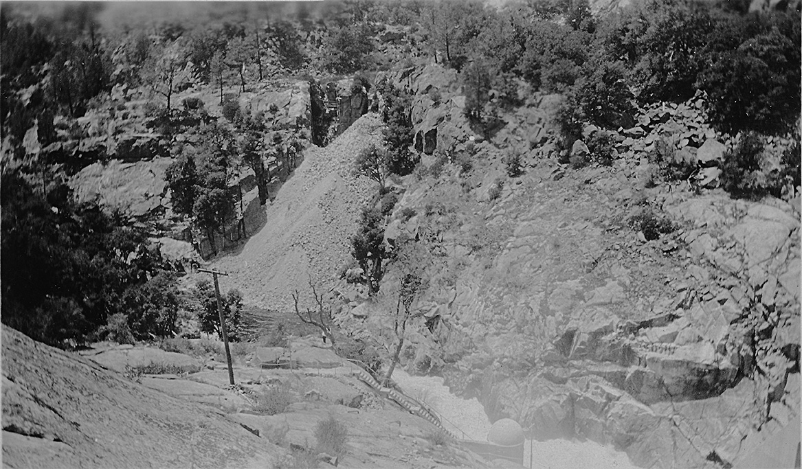
"The valley below Hetch Hetchey Dam."
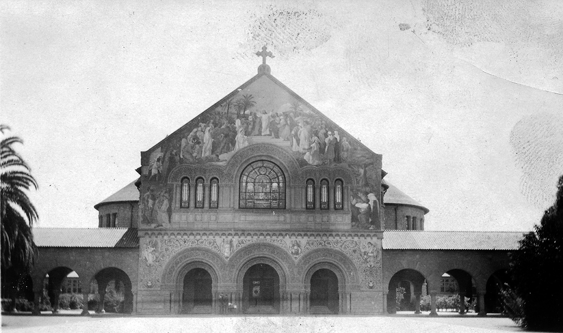
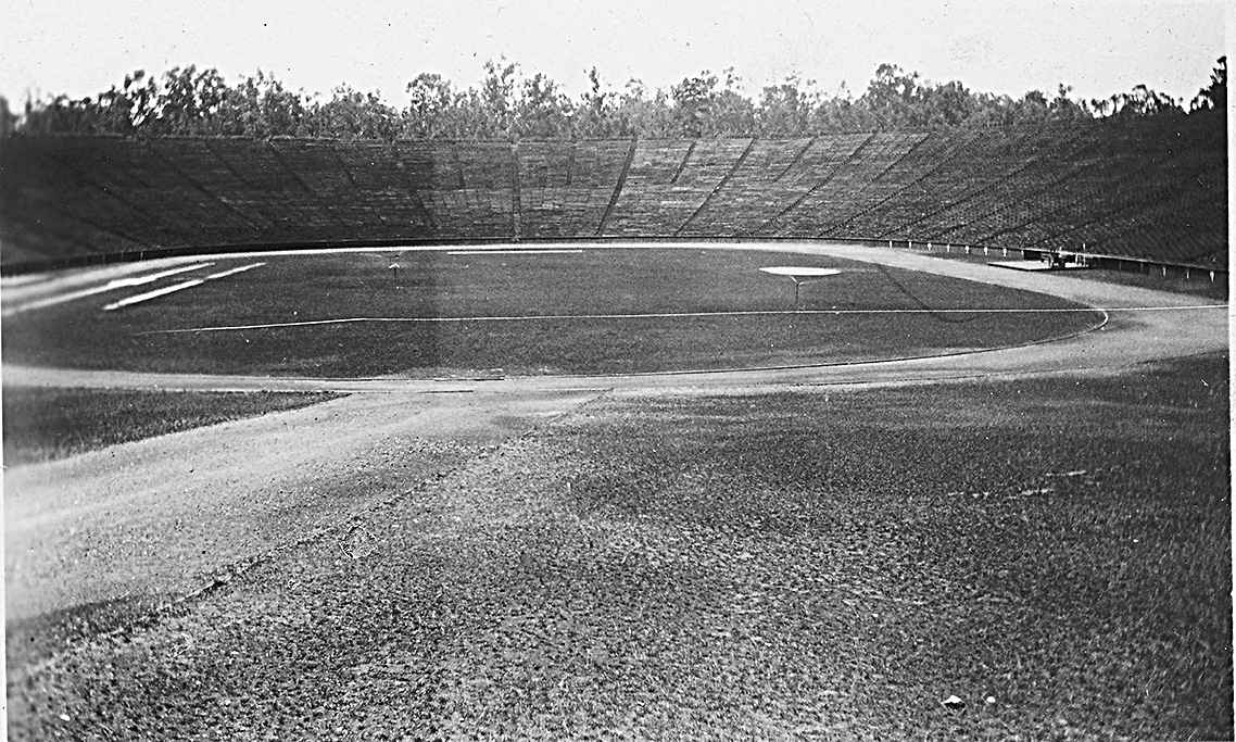
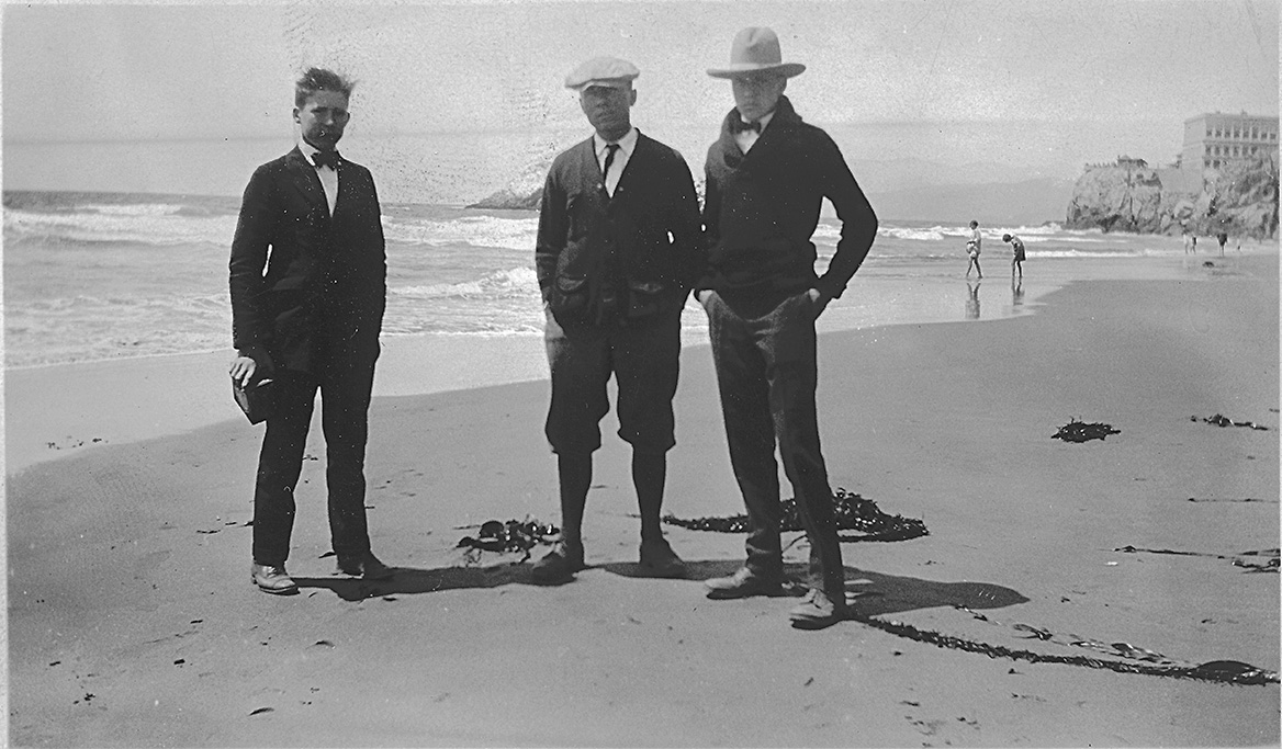
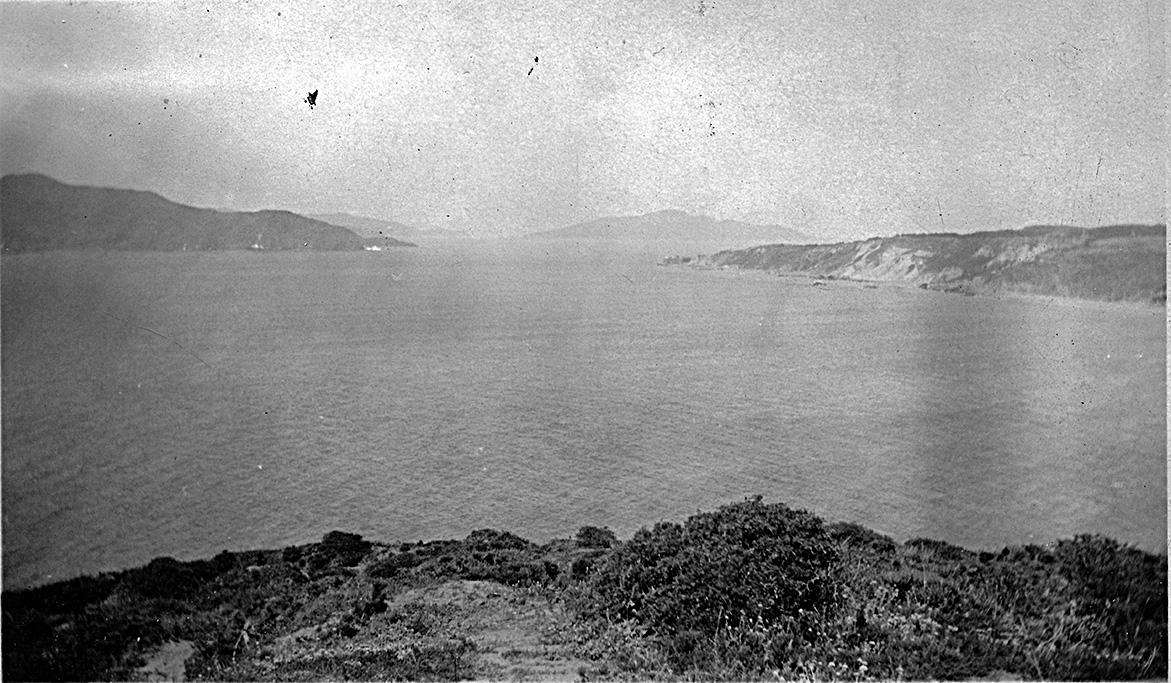
July 24, 1924 - Stanford & Pacific Ocean
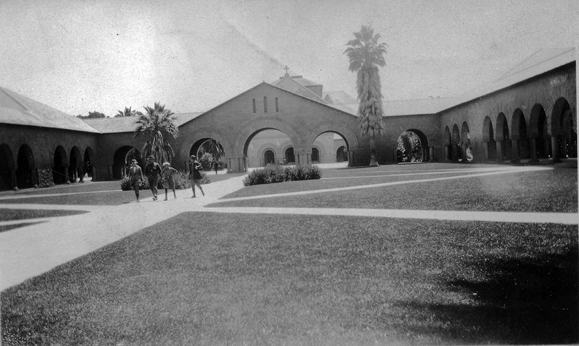
"Entrance to the chapel at Stanford University situated a few miles from San Francisco"
"The church at Stanford University. The designs are mosaic. A beautiful church both inside and outsode."
"Football stadium Stanford University."
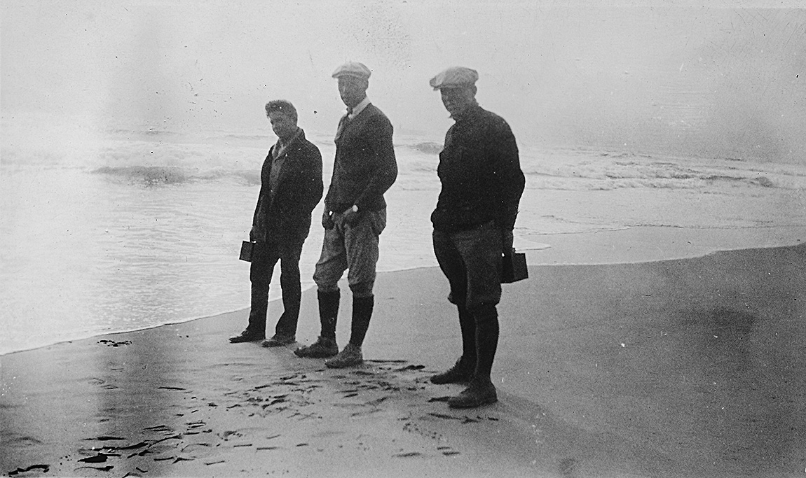
"Herbruch, Coach Marquardt and myself on the beach at San Francisco Cal."
"Herbruch, Bosler, and Coach Marquardt. on the beach at San. Francisco Cal."
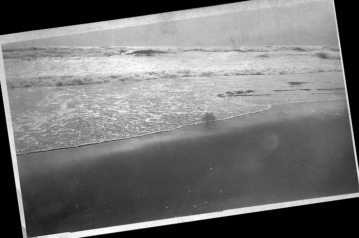
"The beach and ocean San Francisco."
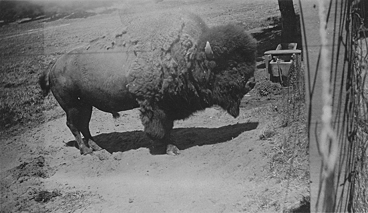
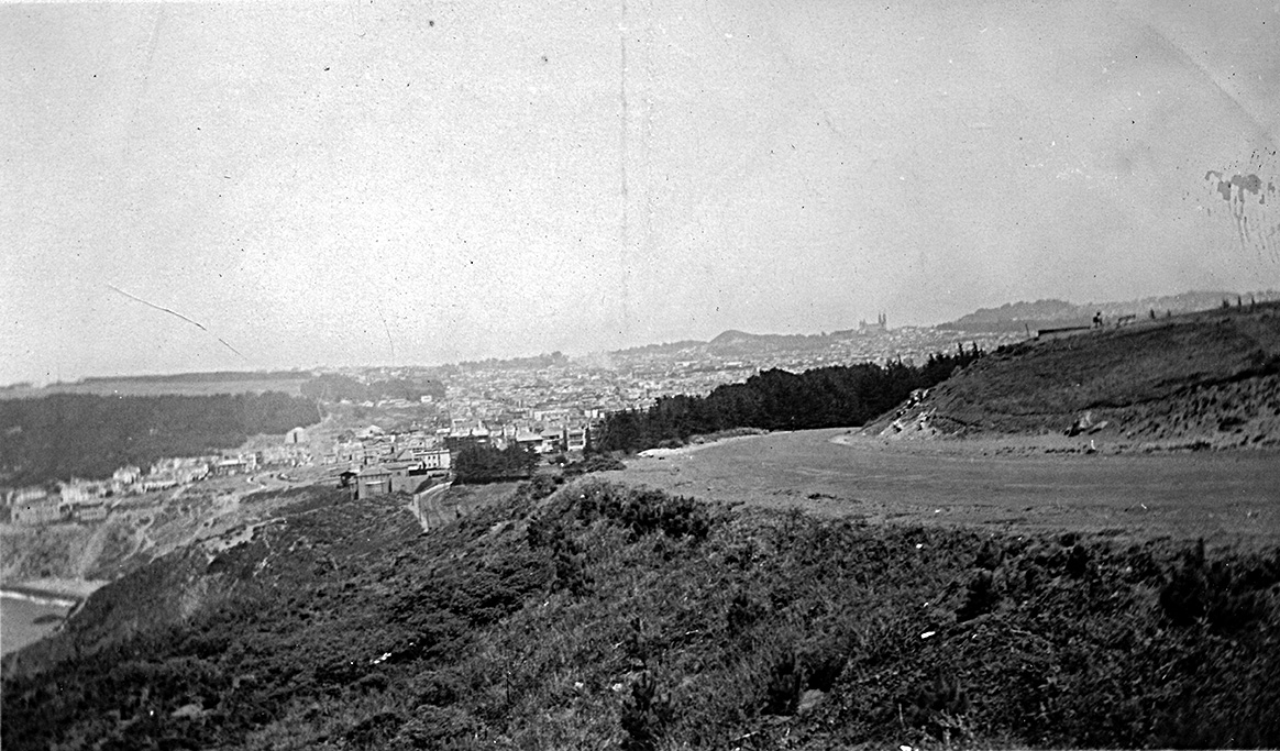
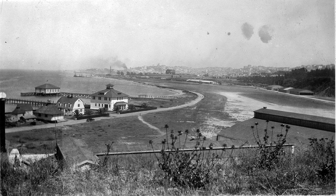
July 25, 1924 - San Francisco
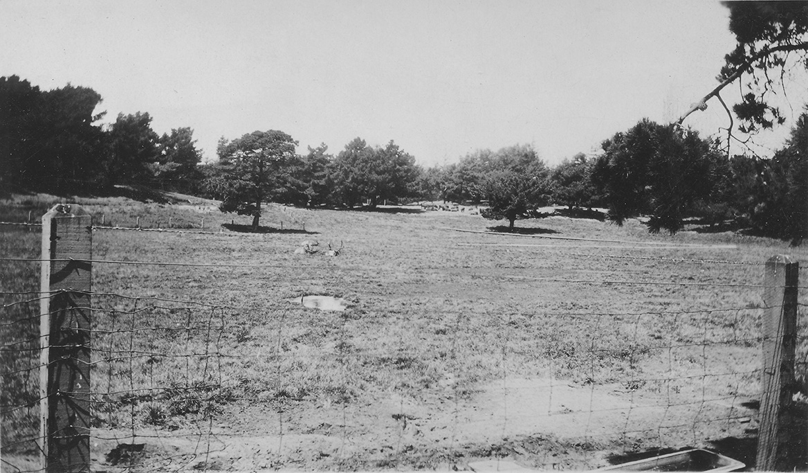
"Some deer Golden Gate Park San. Francisco Cal."
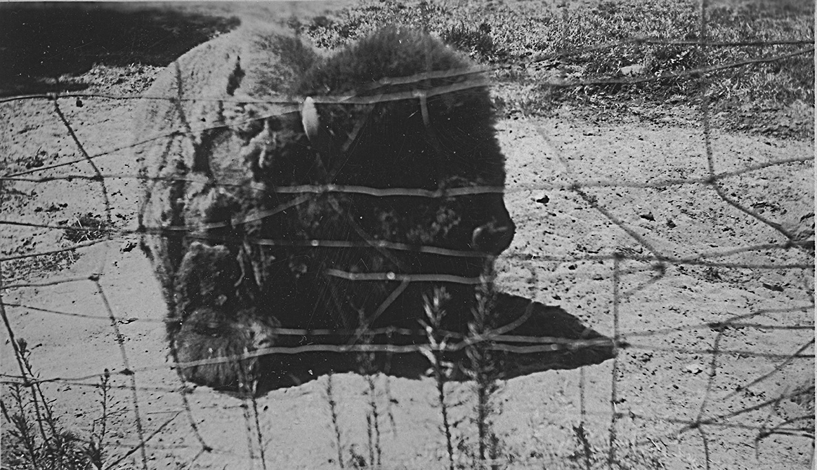
"A picture of the largest buffalo in Golden Gate Park San Francisco."
"A better picture of the buffaloe Golden Gate Park San Francisco Cal."
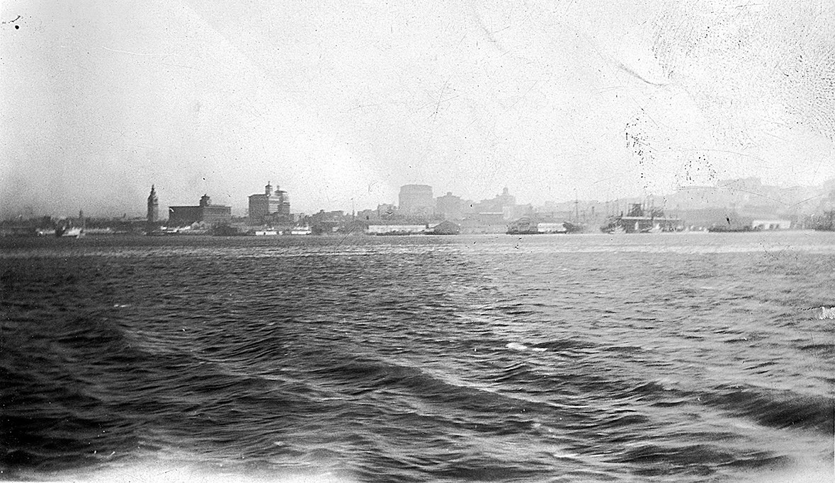
"Shows San. Francisco from the road."
"A view of the Golden Gate from the road San Francisco Cal."
"The harbor and city of San. Francisco."
July 25-27, 1924 - San Francisco to Portland on the S.S. Admiral Fiske
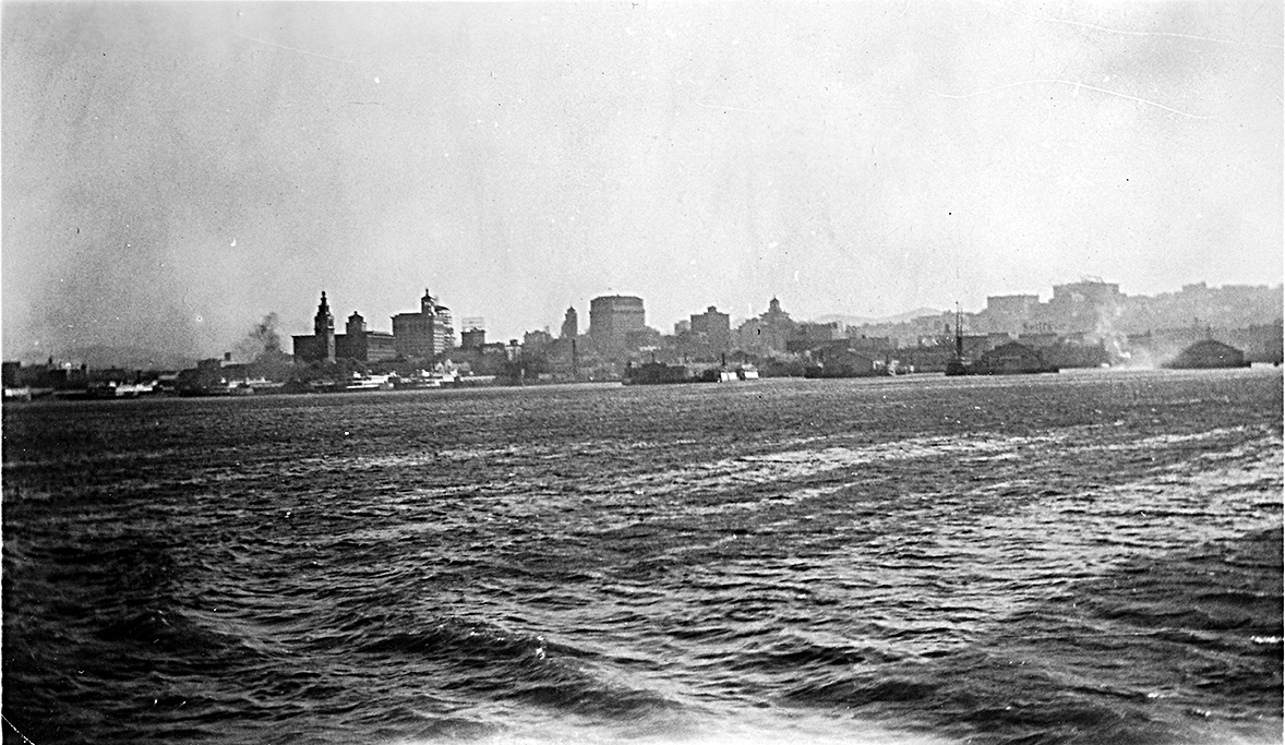
"Leaving Sanfrancisco on the S.S. Admiral Fiske for Portland. Showing docks."
"Another picture of the San Francisco harbor."
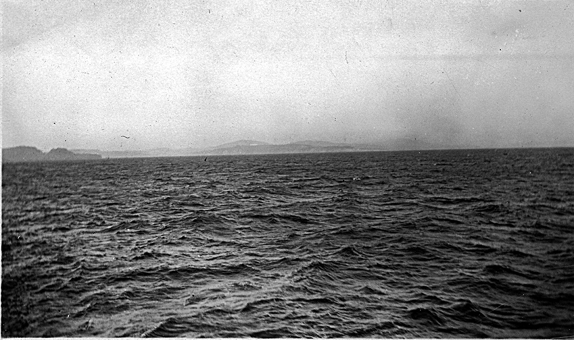
"On the Pacific. Sailing for Portland."
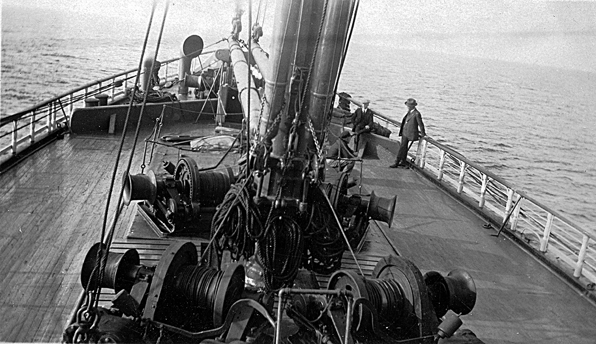
"The bow of the Admiral Fiske"
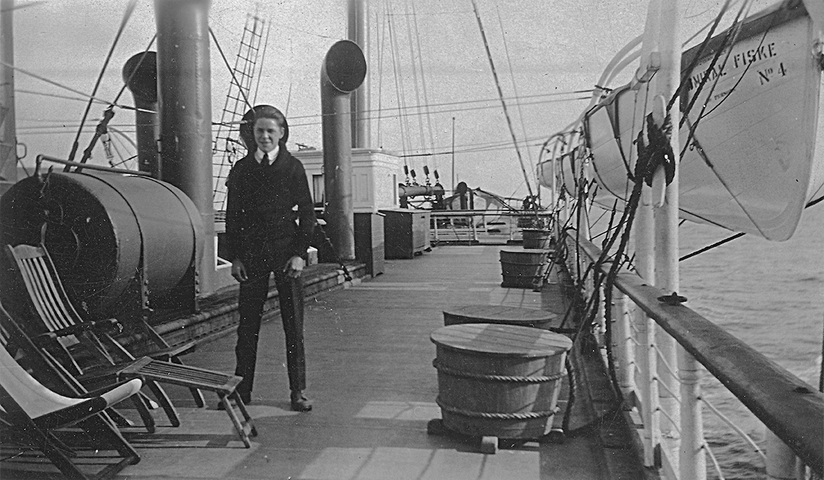
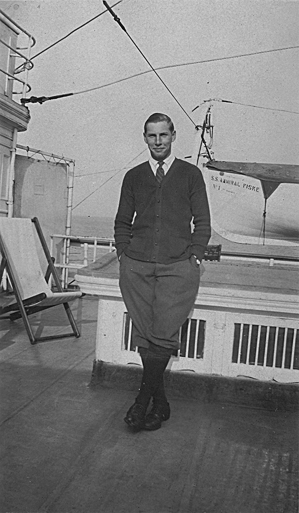
"A view of the lower deck and a picture of myself on the Admiral Fiske"
"Myself on the admiral."
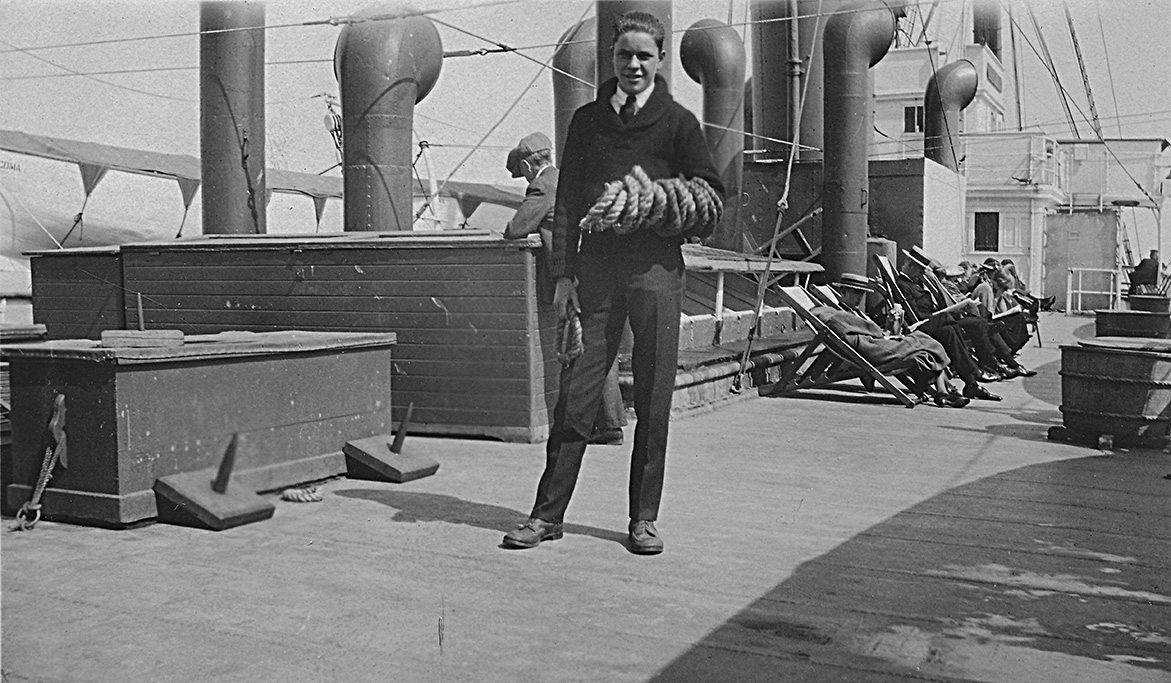
"Dutch on the Admiral"
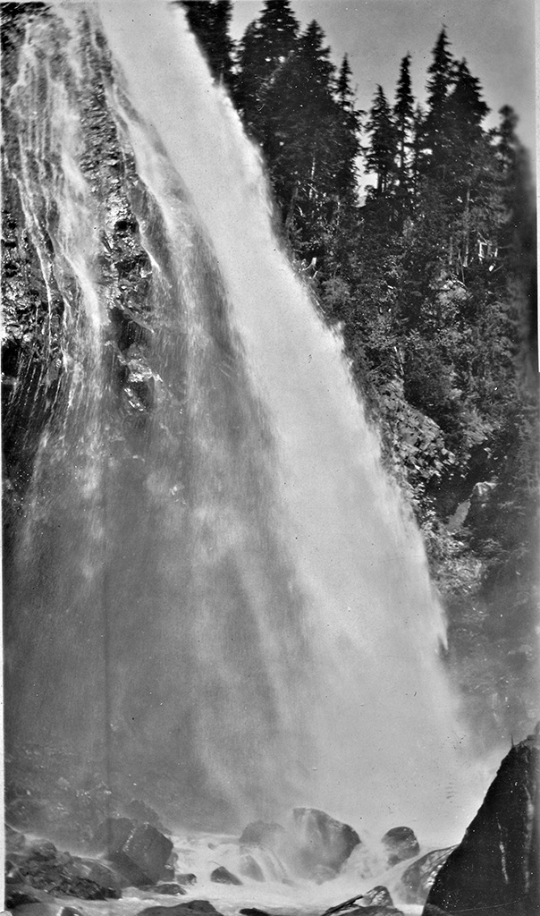
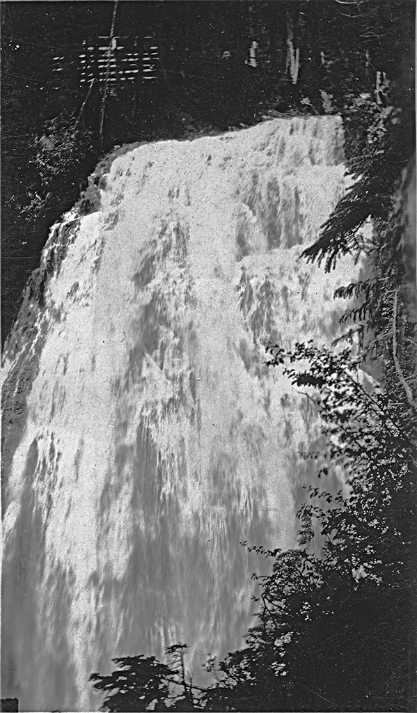
July 29, 1924 - Mt. Rainier
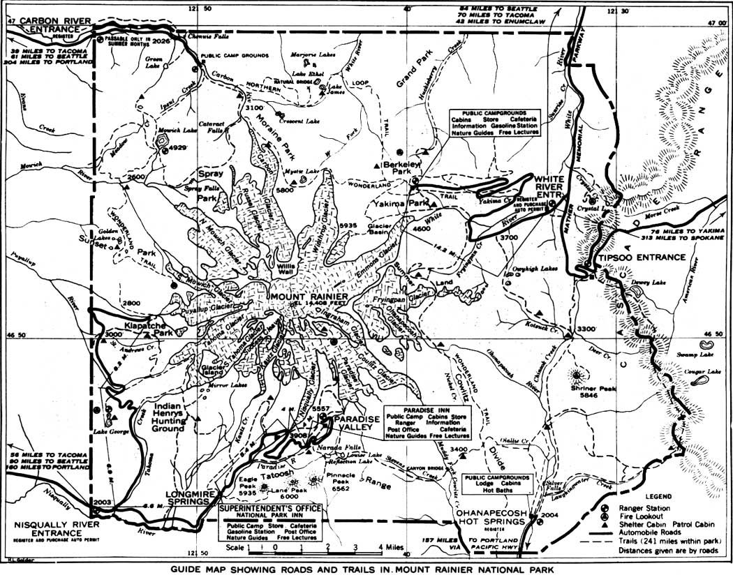
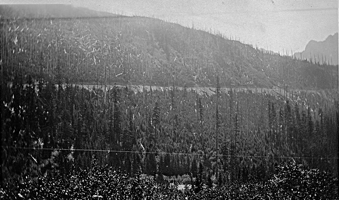
A 1915 map of Mt. Rainier N.P. John's party followed the same route Suzanna took in 2012.
"Paradise Falls Mt. Rainier Nat. Park. Height 147 ft."
"Another view of Paradise Falls"
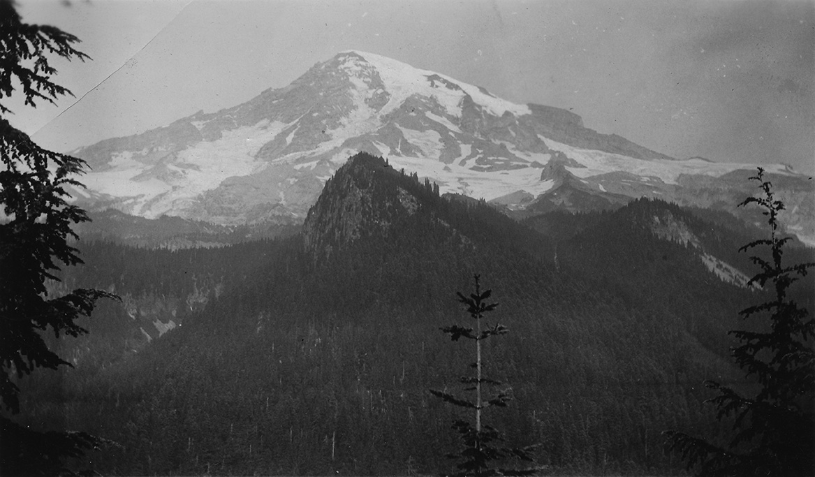
"Mt. Rainier"
"Mt. Rainier from the road"
"The road to Paradise Inn."
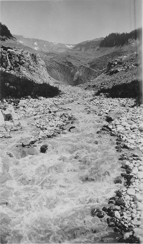
"Shows Mesqualy (sp. Nisqually) Glacier and stream flowing from it going to Paradise Inn."
July 29-30, 1924 - Climbing Mt. Rainier
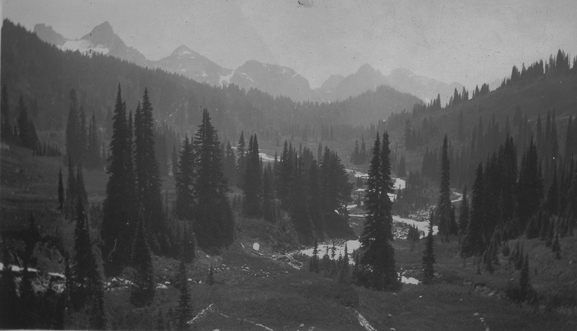

"On the road to Paradise Inn showing the valley below."
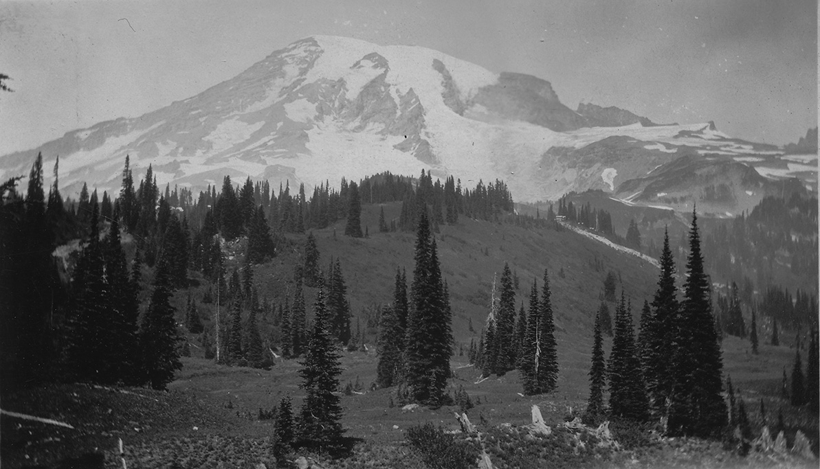
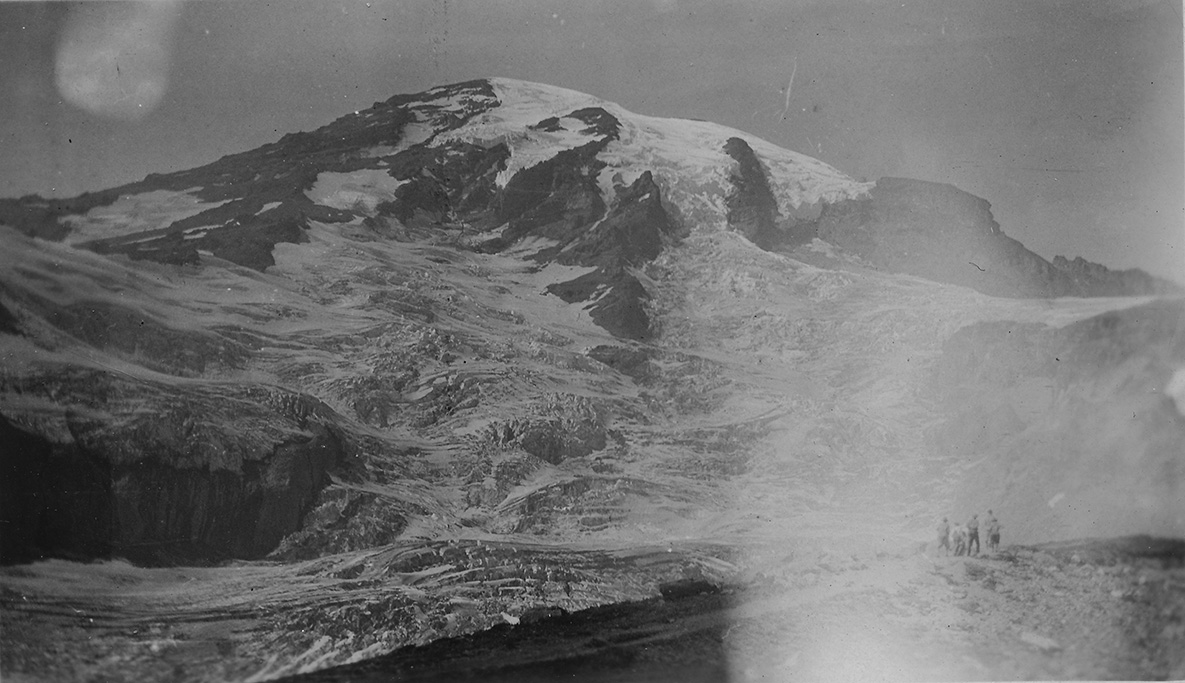
"Mt. Rainier taken from Paradise Inn."
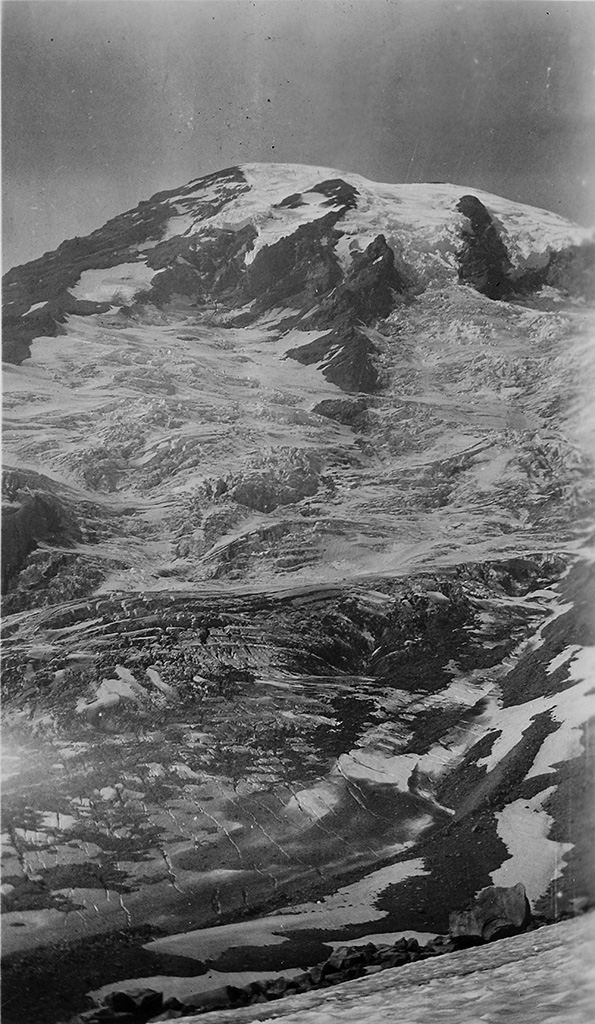
"Shows the peak in the distance."
This view is from McClure Rock.
"Showing peak covered with glaciers and drifts of snow and ice.
It looks like a short distance to the top but in reality it is a day's climb."
Also from McClure Rock.
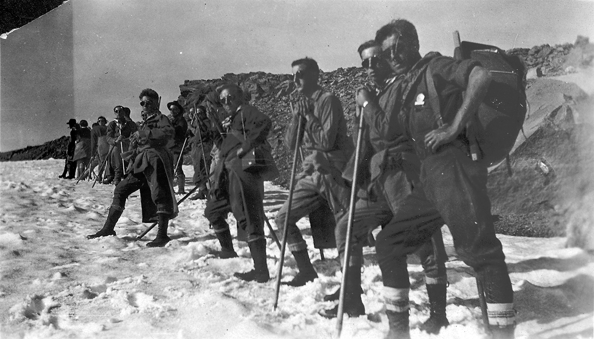
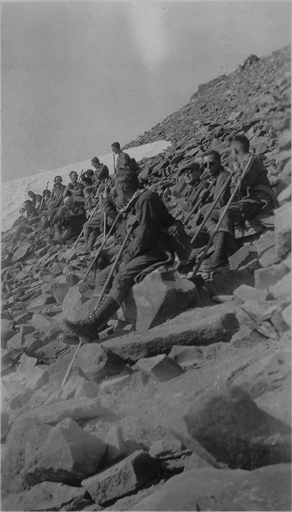
"Shows the group that started up the first day. Twenty-one in all."
This view is near Anvil Rock.
"On the way up the first day. Stopping for a rest."
Also near Anvil Rock.
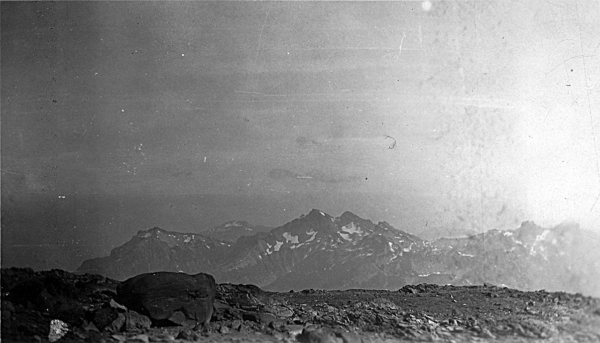
"Shows surrounding mountains on way up Mt. Rainier."
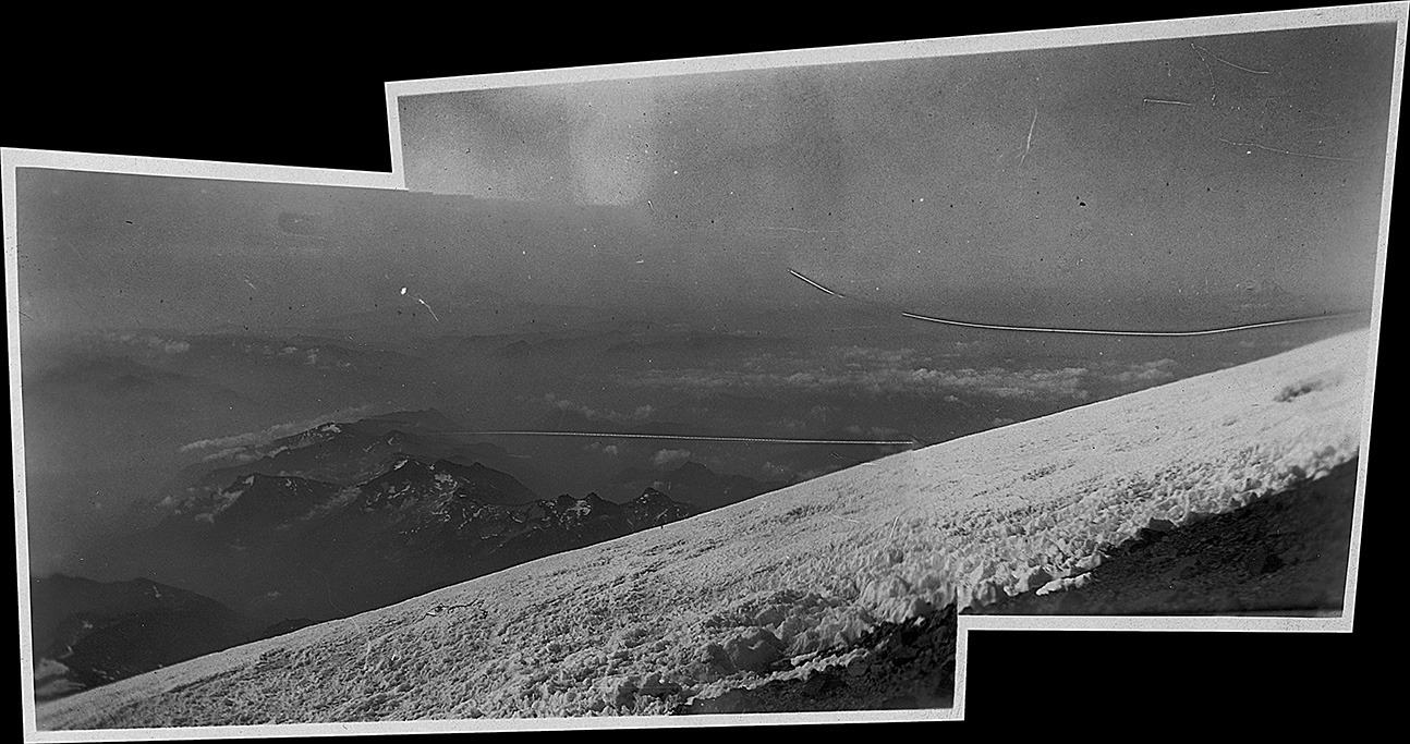
(a modern panorama from two photos)
"A" snow field on the side of Mt. Rainier."
"Another picture a little farther up."
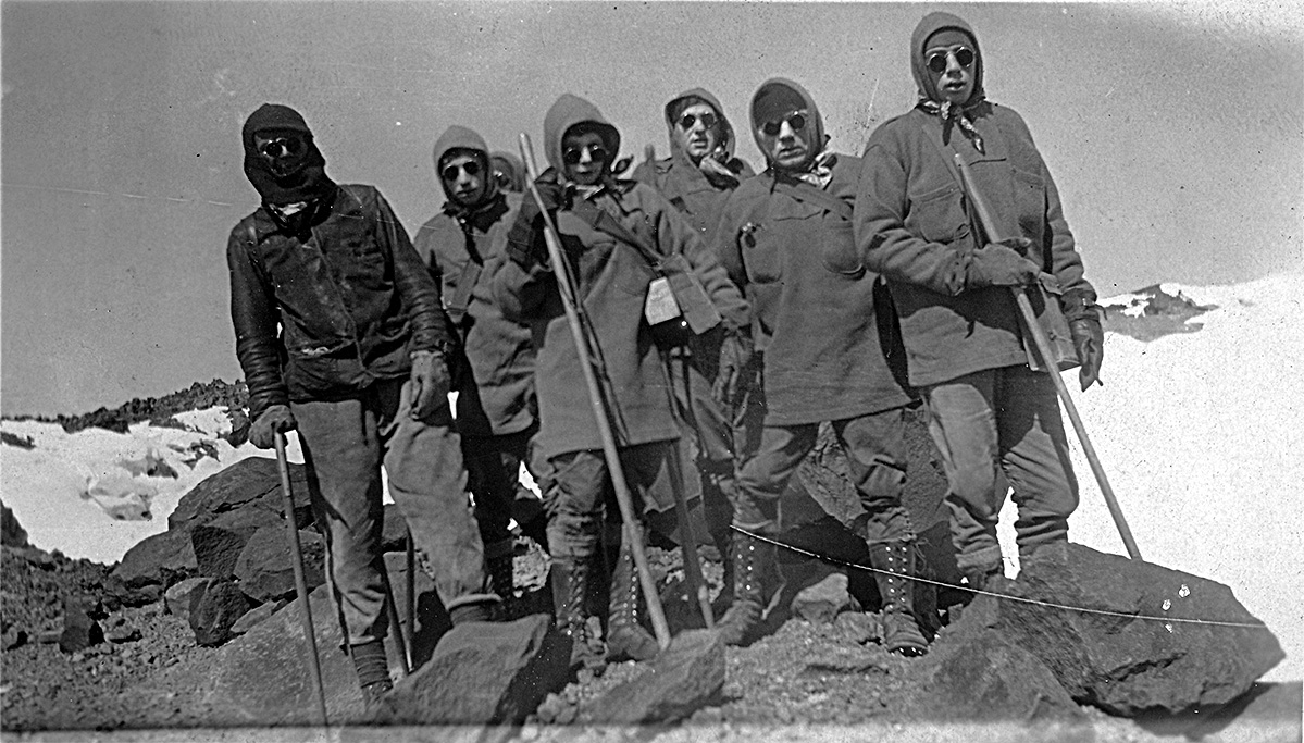
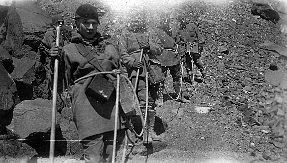
"On the top showing the party of eight that made the climb."
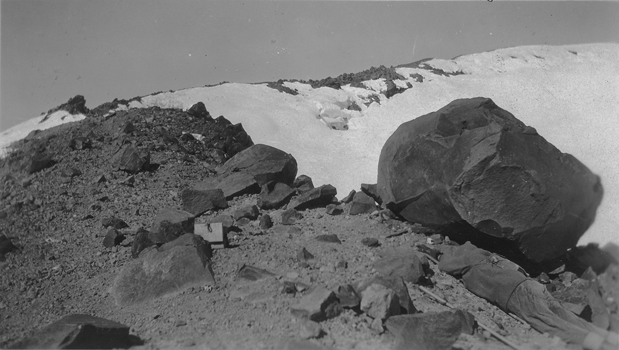
"On the summit, note one of the fellows so tired that he threw himself down for a rest. The box is filled with paper on which we signed our names that we reached the top."
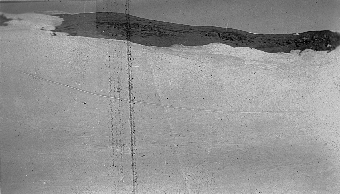
"At the top of the summit looking down into the crater which is filled with snow."
"Shows the party coming down. Bob Herbruch in the front, myself, Coach Marquardt, and Dutch Bosler."
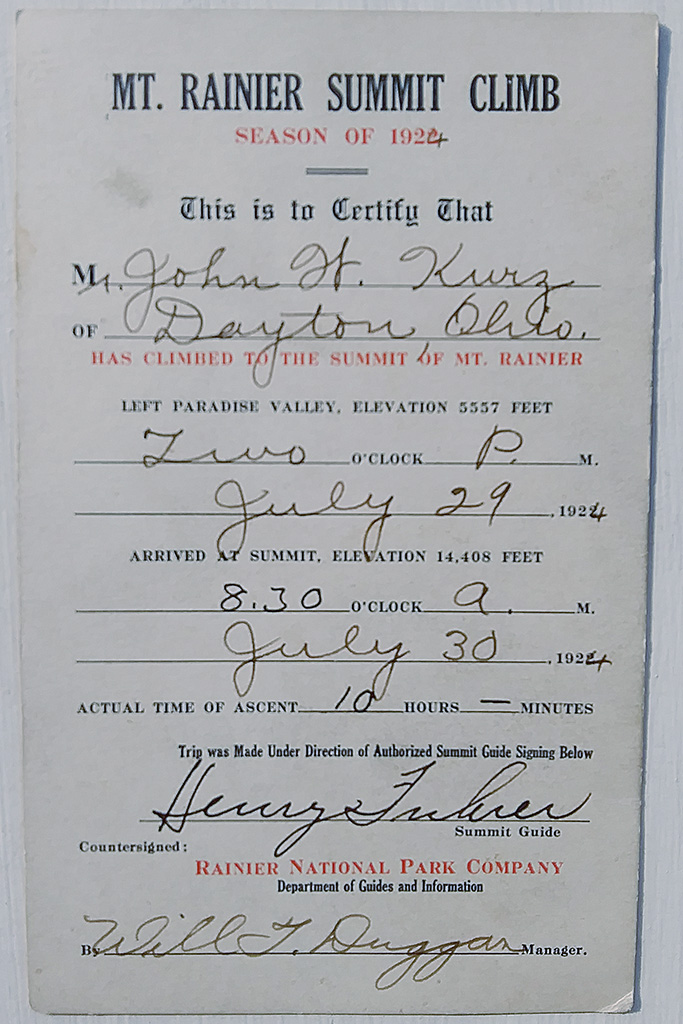
July 30, 1924 @ 8:30 A.M. - An official record of John's ascent, with real signatures!
August 3, 1924 - Washington Lumber Mill
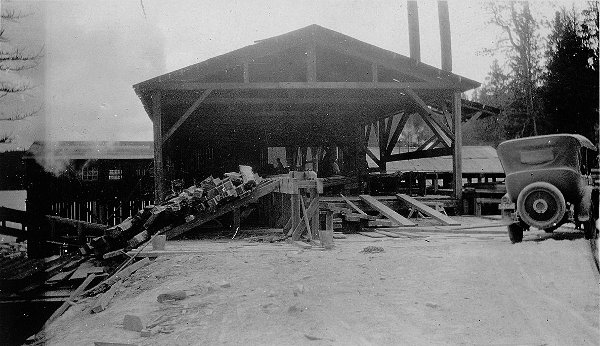
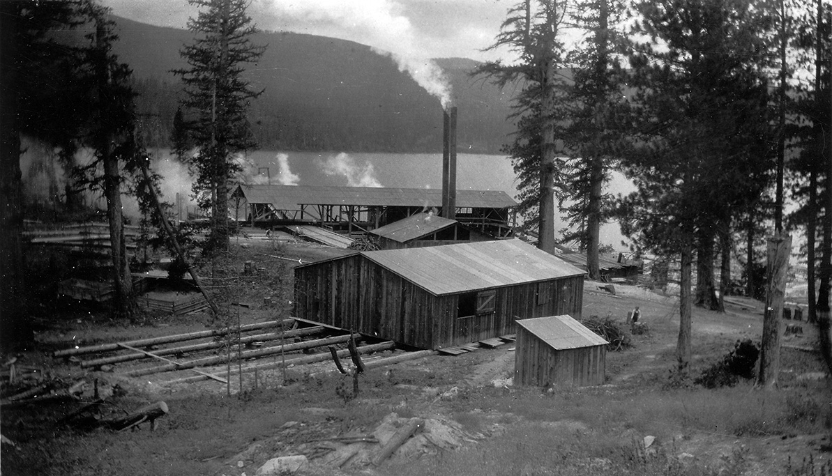
"Lumber mill in northern Washington."
"Another picture of the mill"
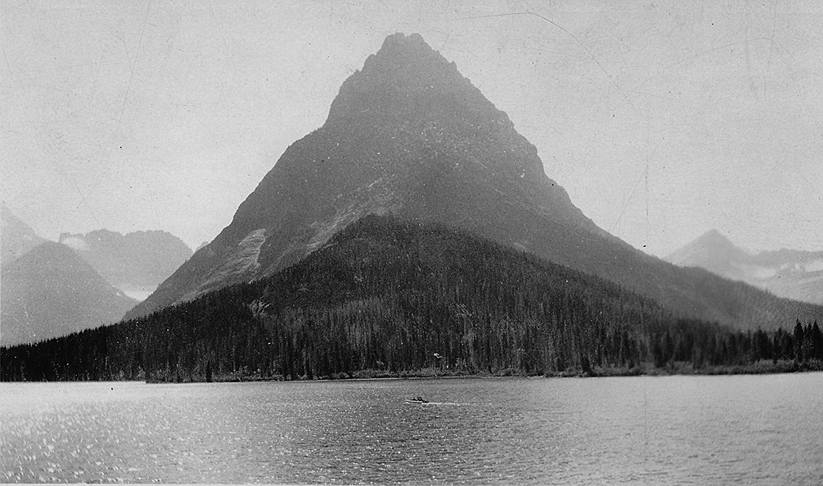
August 6, 1924 - Glacier National Park
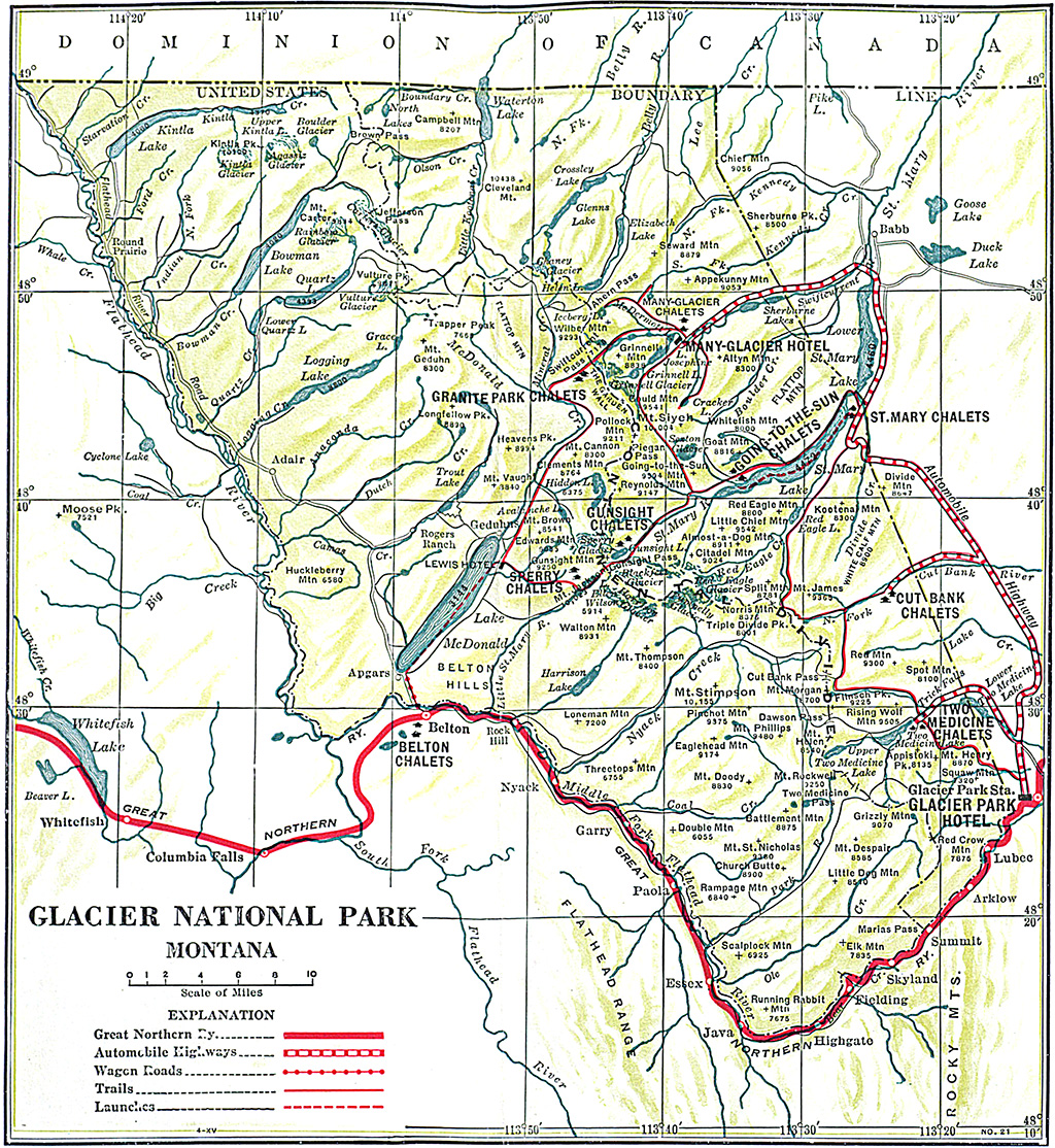
A map of Glacier N.P. from the early 1900s.
"What we saw as we entered the Park"
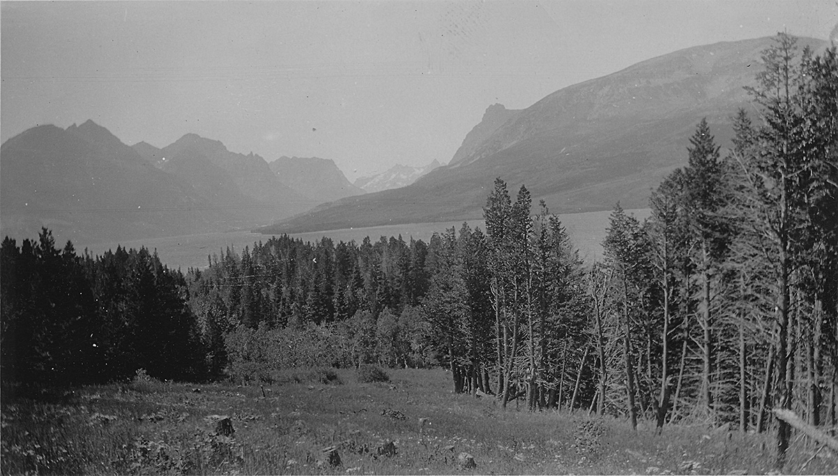
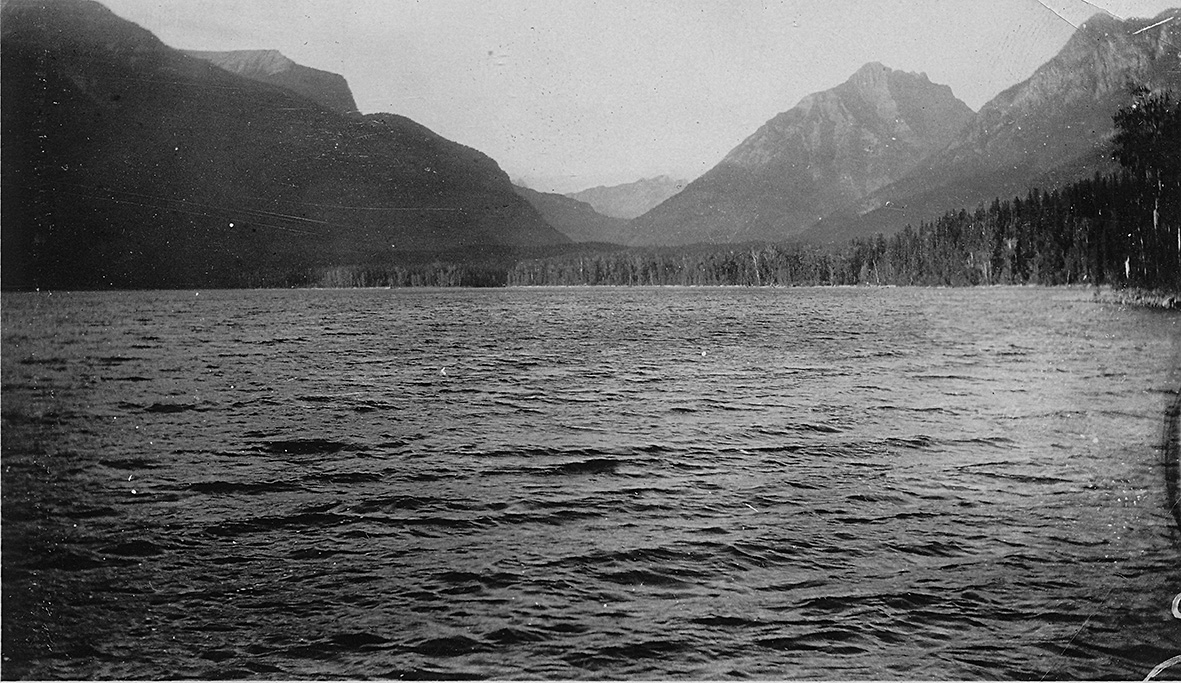
"Distant mountains in Glacier Park"
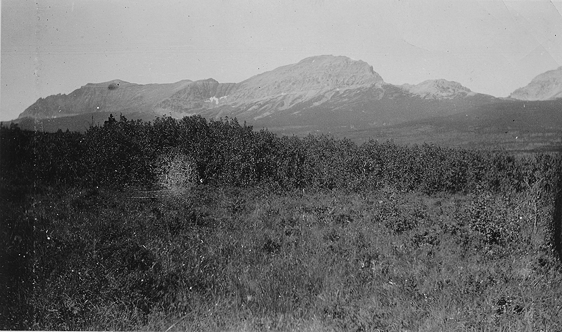
"Mountains in Glacier Park."
"Another view of mountains."
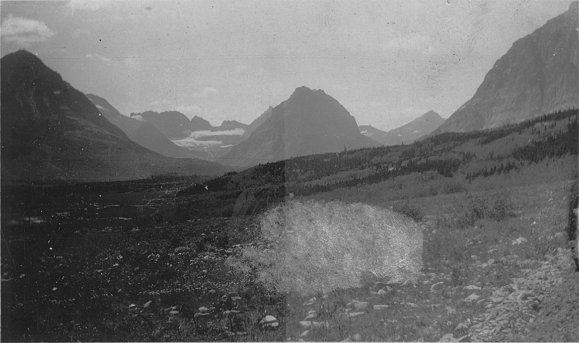
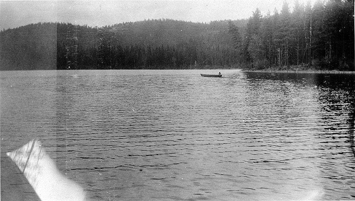
"One of the many lakes in Glacier Park."
"Another beautiful lake in Glacier Park"
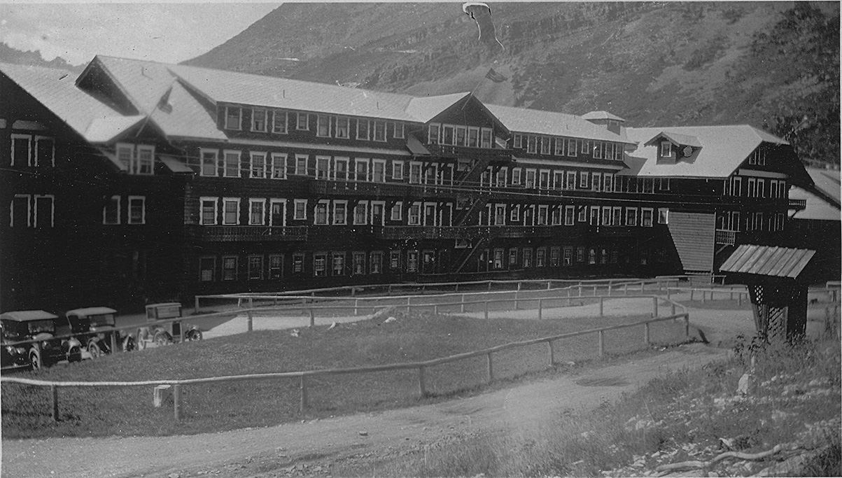
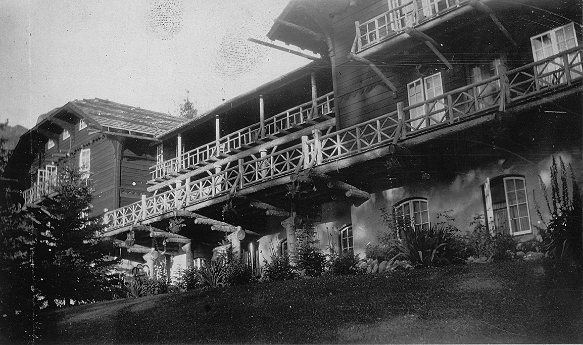
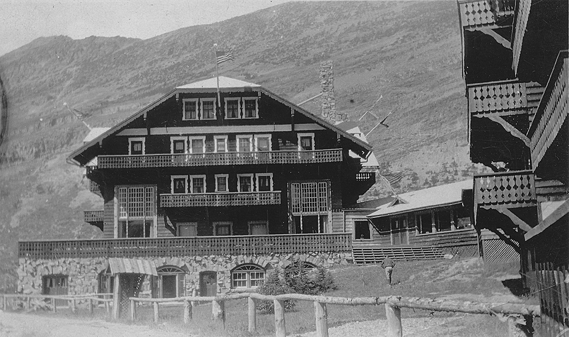
"Many Glacier Hotel in Glacier Park"
"Another fine hotel"
"Another view of the hotel."
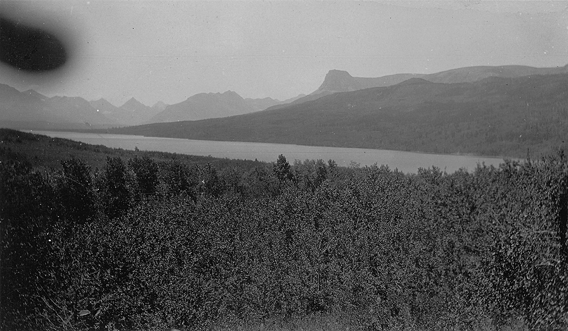
"A mountain across the lake from the hotel."
August 7, 1924 - Drive Across Rossevelt National Highway - Montana to Minnesota
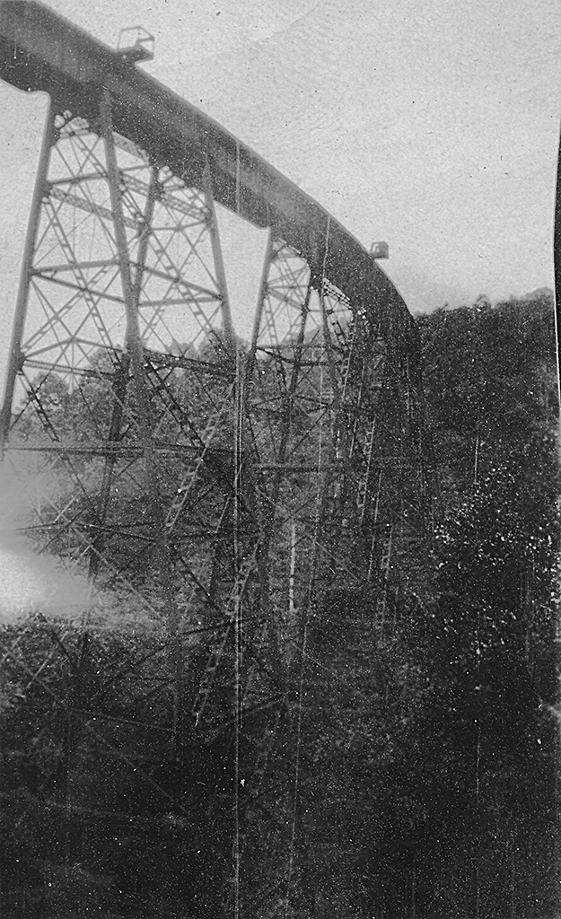
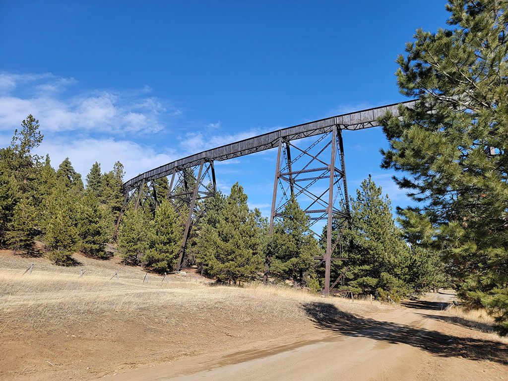
This photo was from a later trip out West. The Corbin Trestle is outside the mining town of Corbin, just west of Jackson, MT. It is 700 feet long.
Abandonned in 1971. As it appears today.
"Showing typical scenery on Roosevelt Highway in Montana."
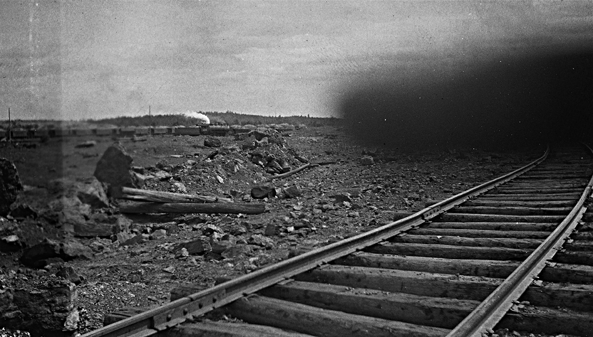
"Iron mining in Minn."
August 12-13, 1924 - Camp Wanaki & Duluth MN
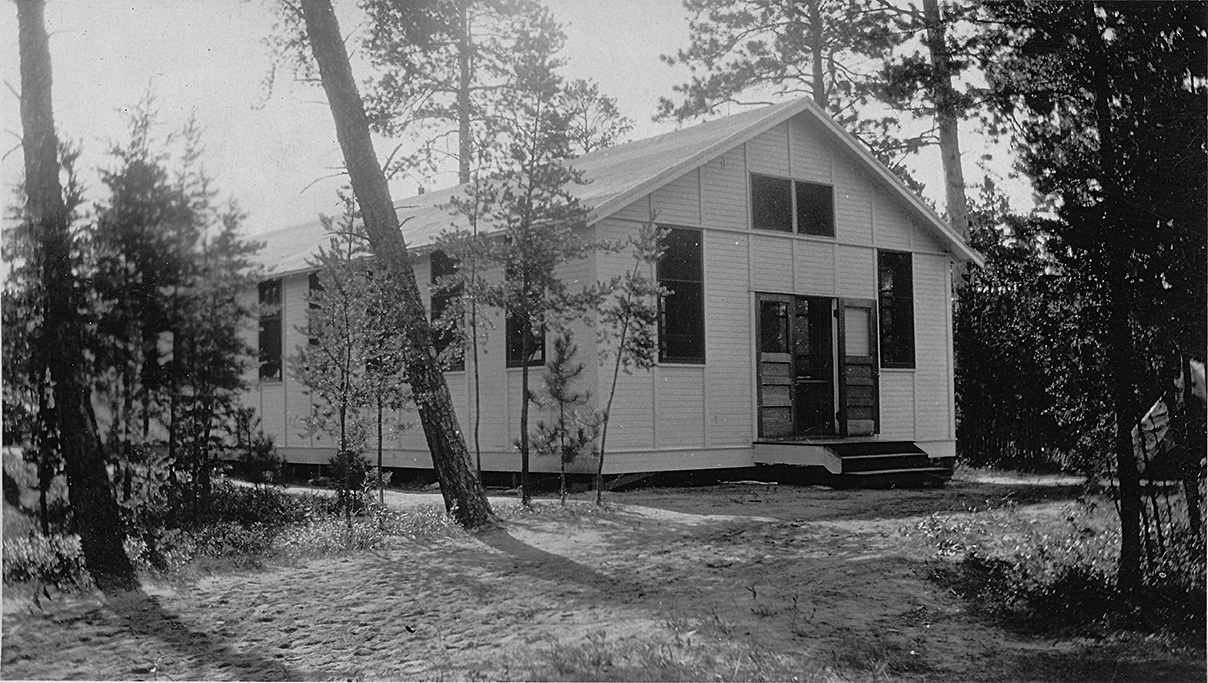
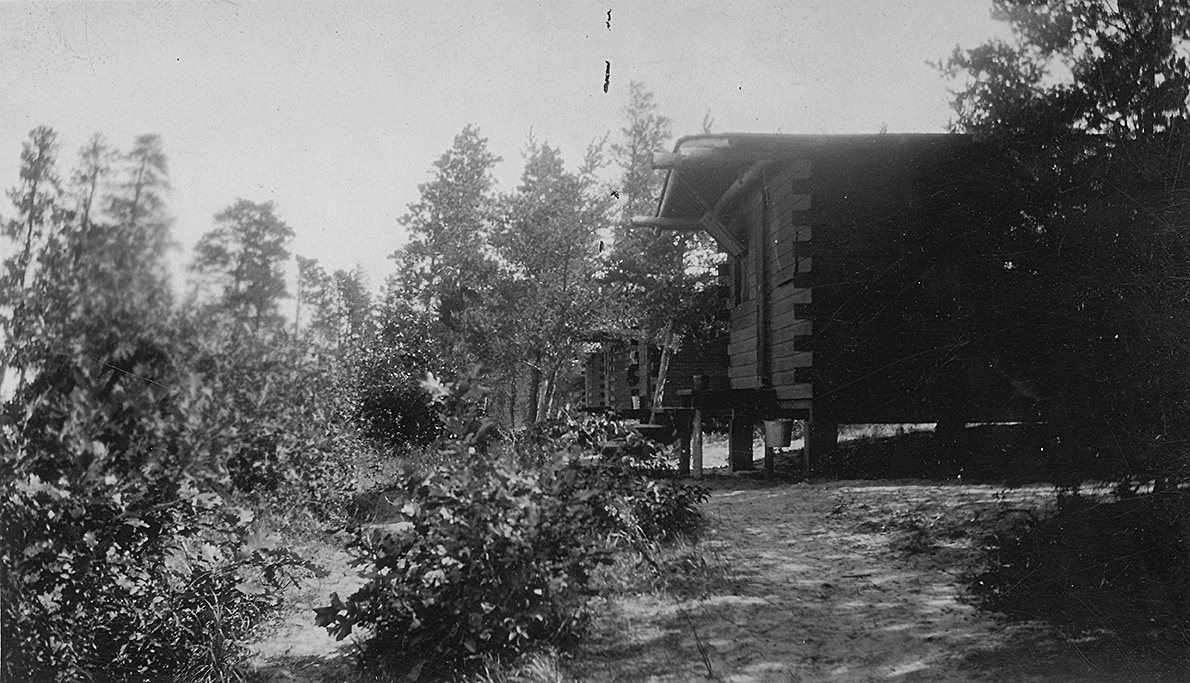
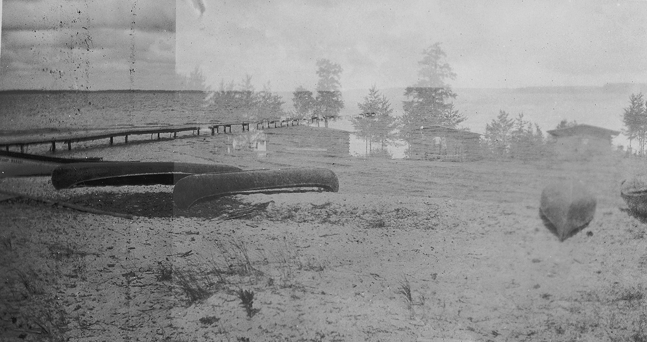
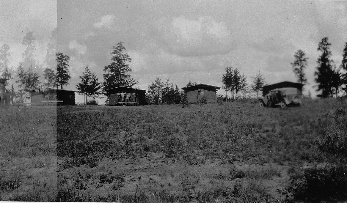
"A picture of Boys' Cabins at Camp Wanaki, Cass Lake Minn.
Fogged"
"Front view of cabins."
"A closeup of a cabin rear view."
"Mess Hall Camp Wanaki."
"8 - 12 - 24"
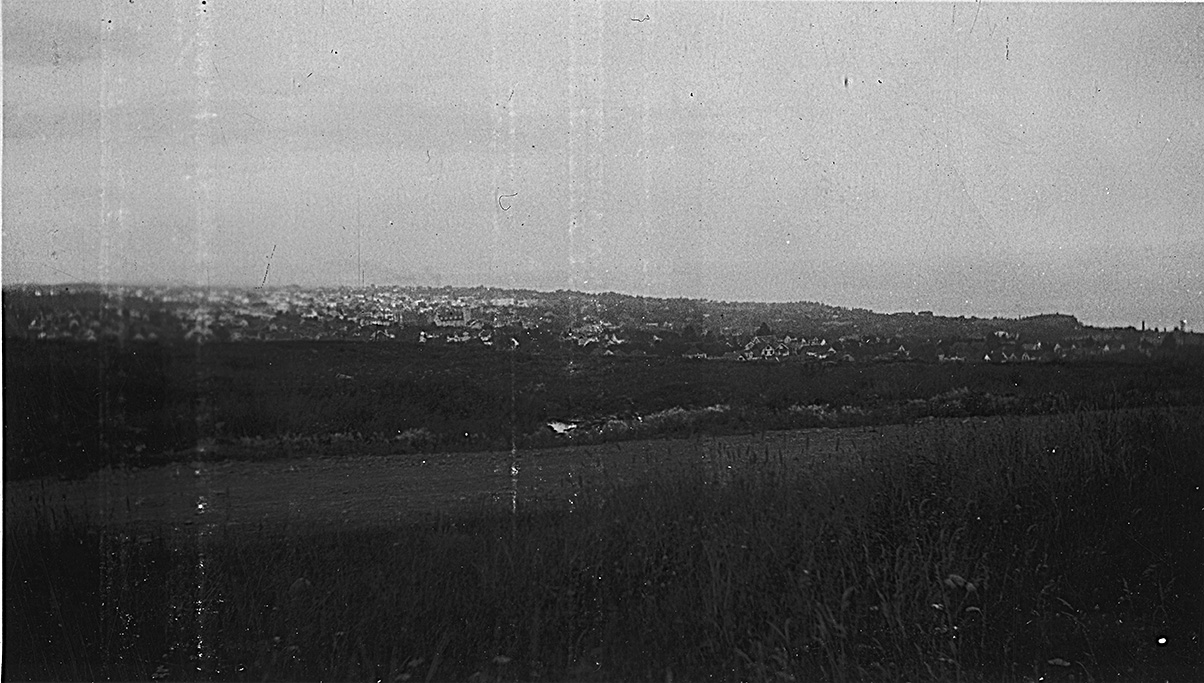
"A view of Duluth from road"
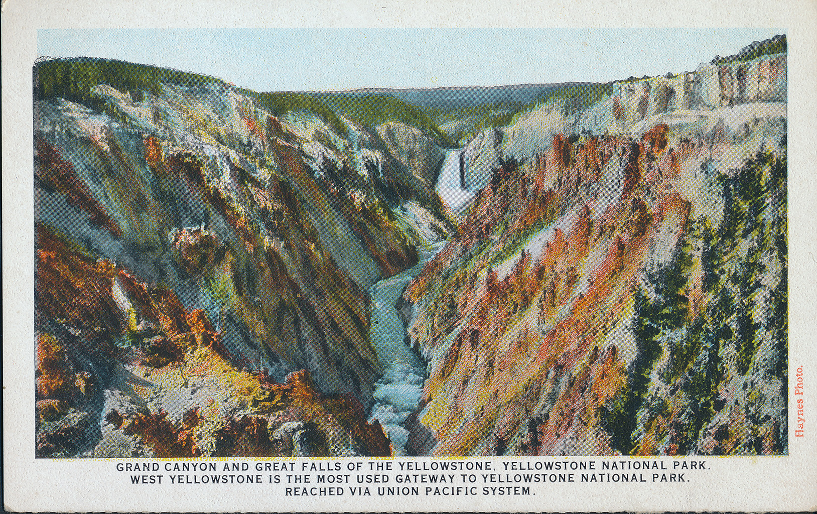
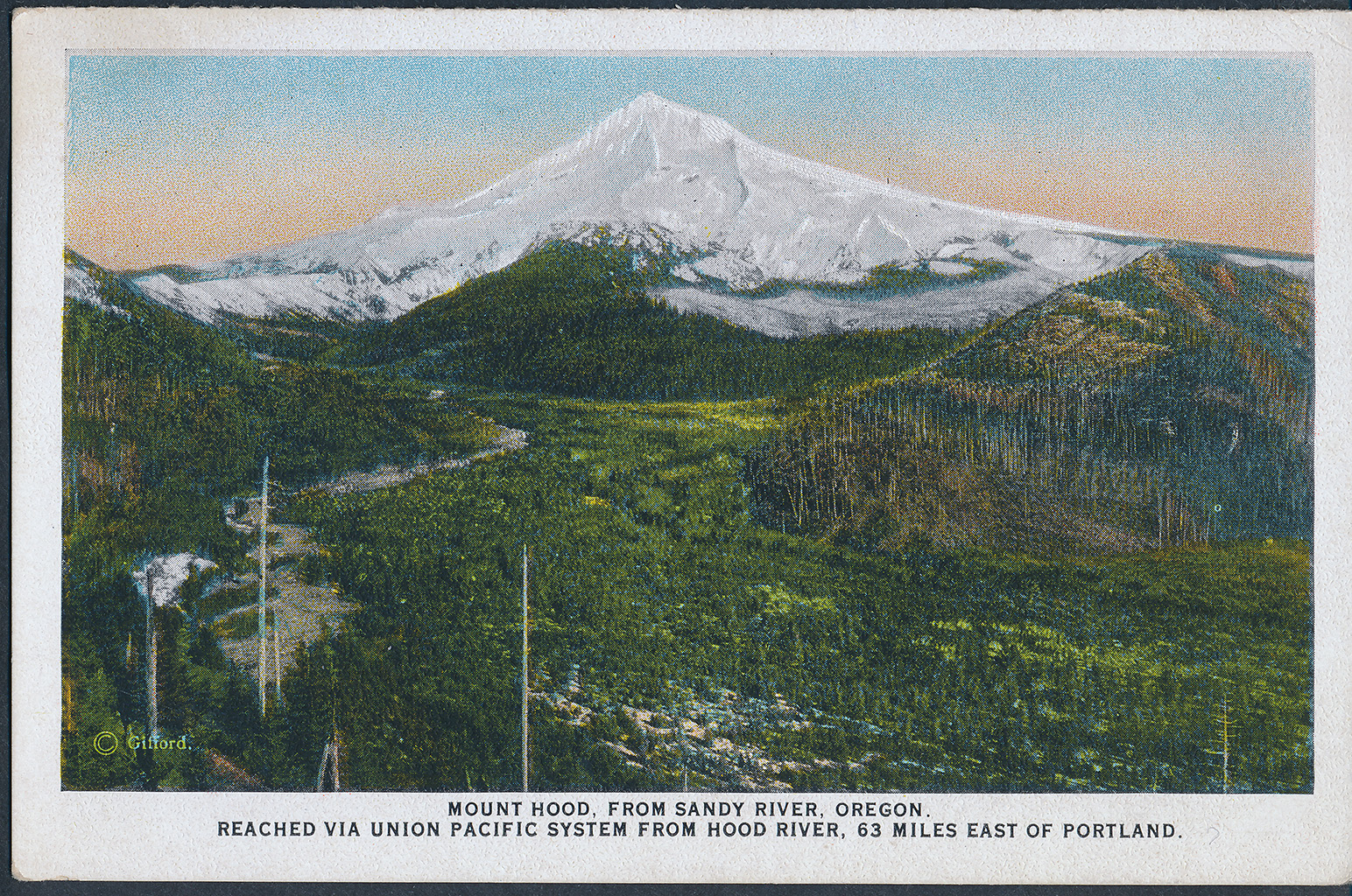
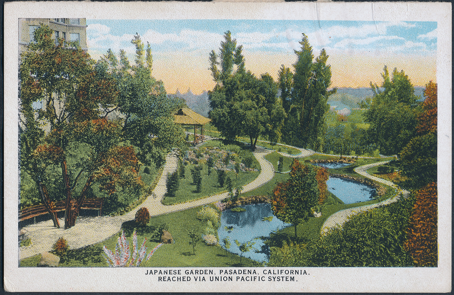
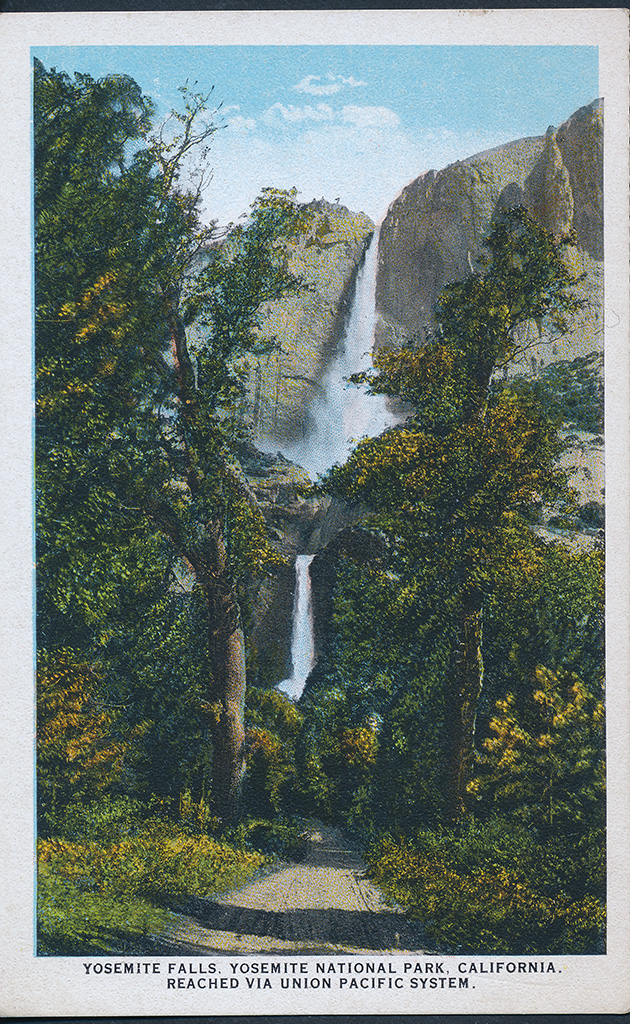
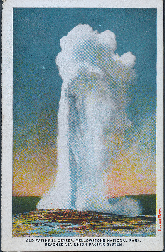
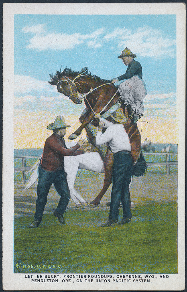
June July August, 1924 - Union Pacific Postcards
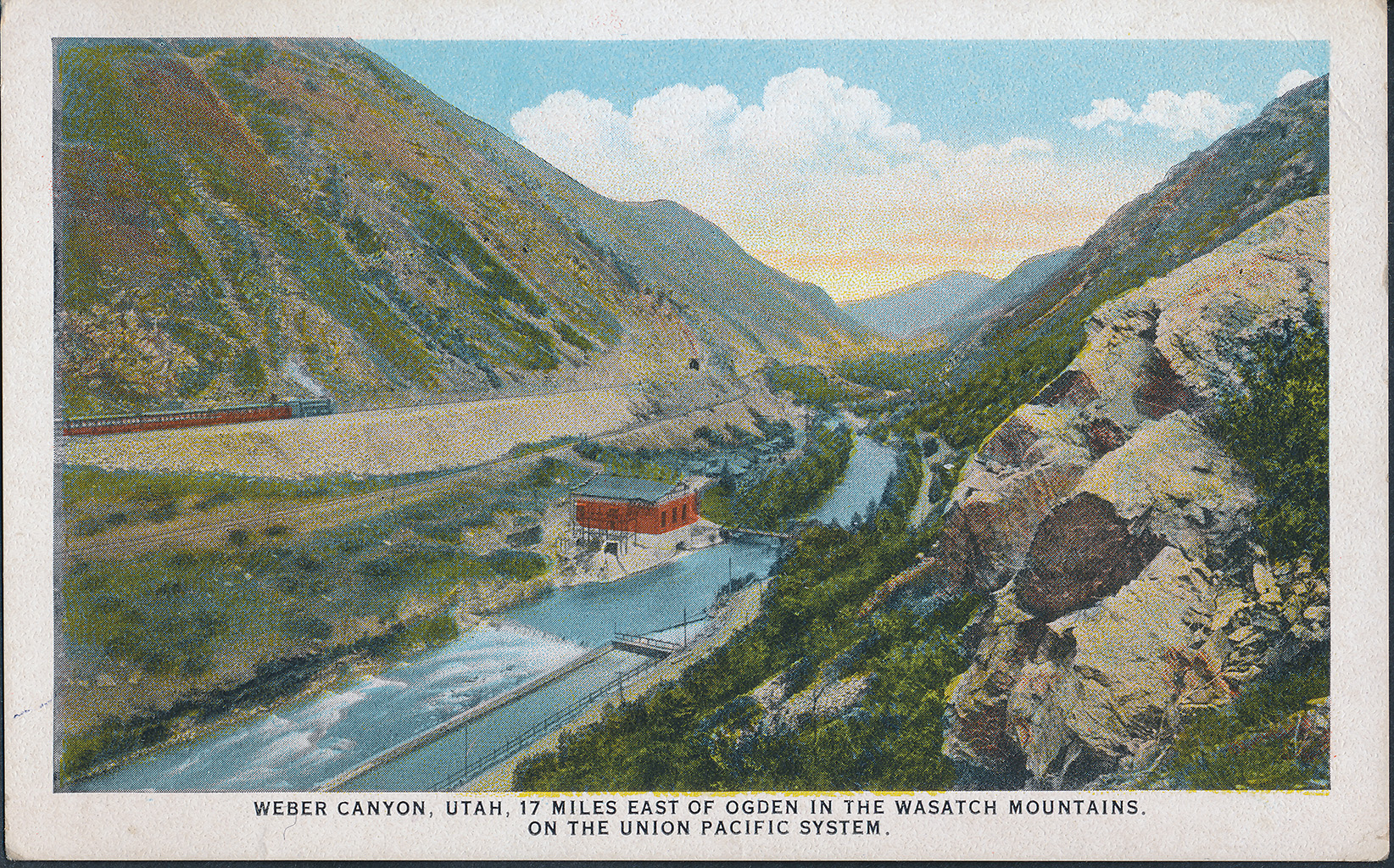
Weber Canyon, UT
Yellowstone Falls, WY
Mount Hood, OR
Japanses Water Garden
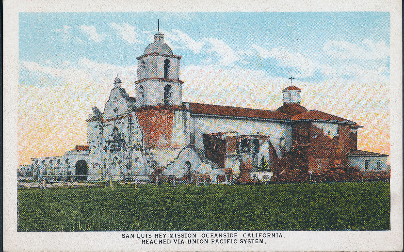
San Luis Rey Mission, Oceanside CA
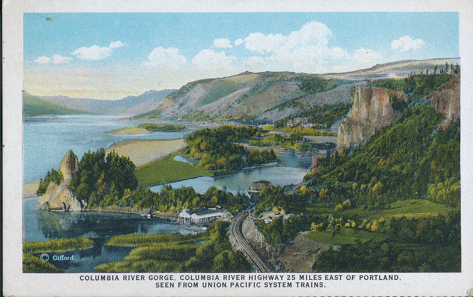
Columbia River, OR
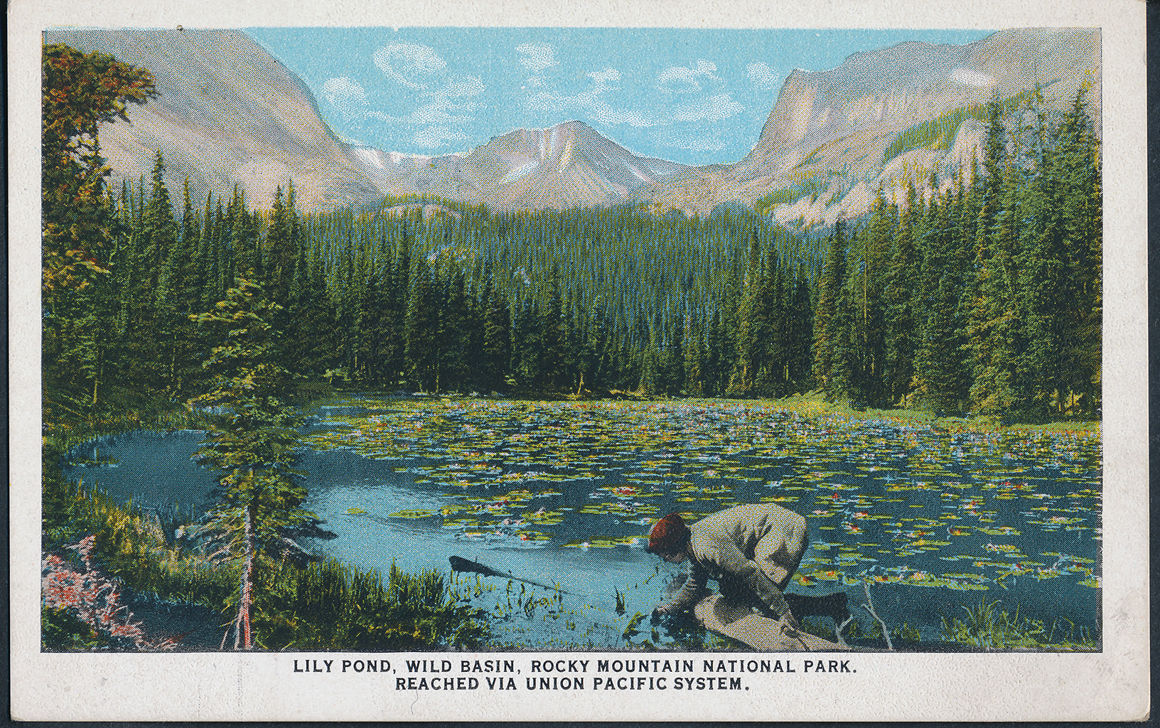
Wild Basin, RMNP CO
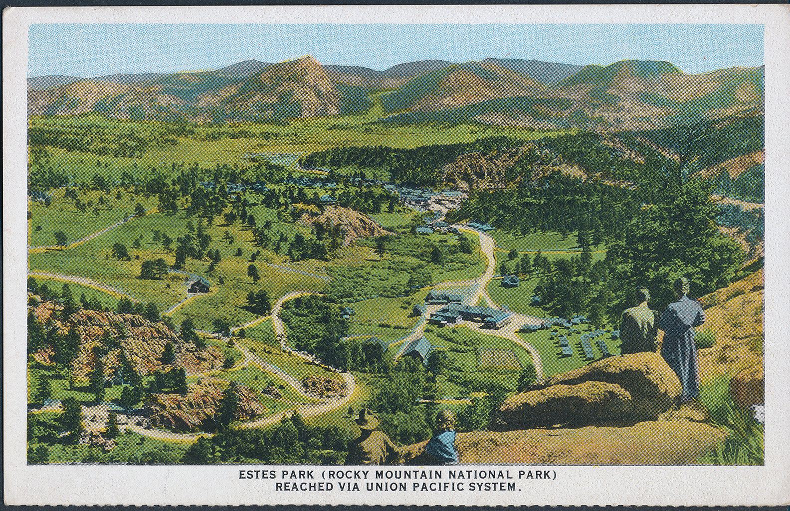
Estes Park, CO
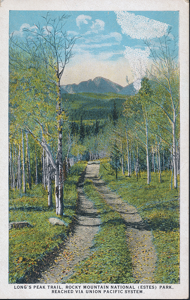
Estes Park, CO
Yosemite Falls, CA
Old Faithful, WY
Cheyenne, WY
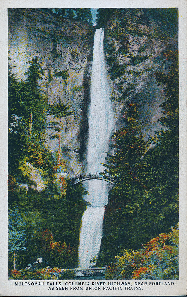
Multnomah Falls, OR
Back of post cards